

View Information About HSR Ratings
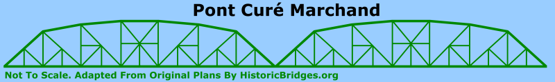
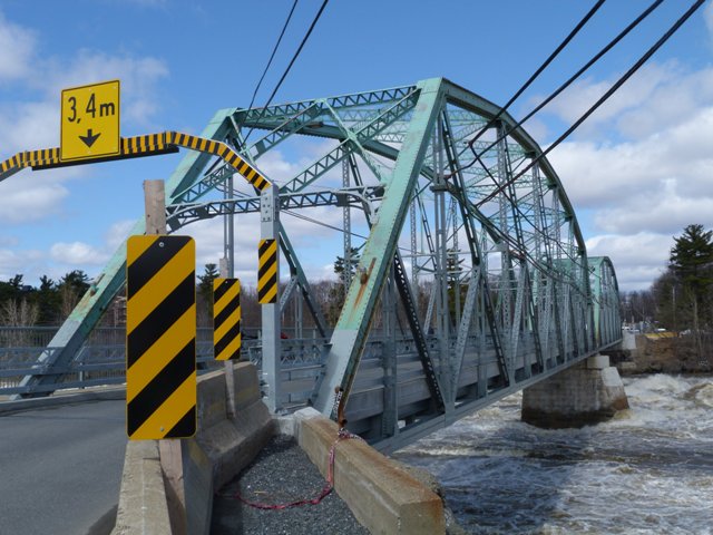
 This bridge is a rare example of a
truss bridge with a Pennsylvania truss configuration. It is also noteworthy for
its two-span configuration. It was built in 1922, and typical of bridges built
in this decade, has trusses and members that are more massive than those found
on metal truss bridges in earlier decades. This bridge's two spans are nearly identical. The only difference is that one span is 205 feet (62.5 meters) and the other is 210 feet (64 meters).
This bridge is a rare example of a
truss bridge with a Pennsylvania truss configuration. It is also noteworthy for
its two-span configuration. It was built in 1922, and typical of bridges built
in this decade, has trusses and members that are more massive than those found
on metal truss bridges in earlier decades. This bridge's two spans are nearly identical. The only difference is that one span is 205 feet (62.5 meters) and the other is 210 feet (64 meters).
The bridge was rehabilitated in 1981. In 2010 this bridge was again extensively rehabilitated. Québec has a program for designating bridges with historic significance, and it has a rating system. Depending on how high a historic bridge rates, the bridge might be restored or rehabilitated. This bridge appears to have been a rehabilitation because of the large number of members that were replaced, particularly most members on the lower half of the truss. These members were replaced in-kind with the built-up members being replicated including detail like v-lacing. The only shortcoming of the rehabilitation was the use of high strength bolts instead of rivets.
The first bridge at the location dated to 1860 and was a covered bridge built by Gordon and Nugent for $8807. This bridge was located where the nearby railway bridge is located today. The bridge apparently did not last long and was destroyed by floods in April 19, 1862. Construction of the second bridge was begun in 1883 and completed in 1885 by the Dominion Bridge Company of Montréal, Québec. It was financed through a company called Drummondville Bridge Company formed by Father Majorique Marchand and some other wealthy English individuals. The photo to the right is a historical photo of this previous bridge at the location. It was a single span metal Whipple truss bridge with pin connections. This bridge was operated as a toll bridge charging five cents per car, 10 cents per vehicle drawn by a horse or an ox, 15 cents per vehicle drawn by two horses or two oxen, or two cents for a pedestrian crossing. The 1885 bridge was destroyed in 1921 by an icepack hitting the bridge which caused the bridge to collapse.
The stone substructure for the 1885 bridge was reused for the 1922 bridge. However, the pier and abutments were modified with concrete to suit the new bridge. Of note, the substructure height was increased by four feet (1.2 meters) to better protect the 1922 bridge from high water and ice levels, a sensible move since the previous two bridges had both been destroyed by high water levels.
Thanks to Bruno Robert for providing a number of details about this bridge's history and technical specifications.
![]()
![]()
![]()

![]()
![]()
![]()
Coordinates (Latitude, Longitude):
Search For Additional Bridge Listings:
Additional Maps:
Google Streetview (If Available)
GeoHack (Additional Links and Coordinates)
Apple Maps (Via DuckDuckGo Search)
Apple Maps (Apple devices only)
Android: Open Location In Your Map or GPS App
Flickr Gallery (Find Nearby Photos)
Wikimedia Commons (Find Nearby Photos)
Directions Via Sygic For Android
Directions Via Sygic For iOS and Android Dolphin Browser

© Copyright 2003-2026, HistoricBridges.org. All Rights Reserved. Disclaimer: HistoricBridges.org is a volunteer group of private citizens. HistoricBridges.org is NOT a government agency, does not represent or work with any governmental agencies, nor is it in any way associated with any government agency or any non-profit organization. While we strive for accuracy in our factual content, HistoricBridges.org offers no guarantee of accuracy. Information is provided "as is" without warranty of any kind, either expressed or implied. Information could include technical inaccuracies or errors of omission. Opinions and commentary are the opinions of the respective HistoricBridges.org member who made them and do not necessarily represent the views of anyone else, including any outside photographers whose images may appear on the page in which the commentary appears. HistoricBridges.org does not bear any responsibility for any consequences resulting from the use of this or any other HistoricBridges.org information. Owners and users of bridges have the responsibility of correctly following all applicable laws, rules, and regulations, regardless of any HistoricBridges.org information.
![]()