

View Information About HSR Ratings
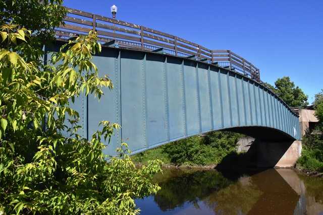
This is one of the oldest known plate girder bridges in Canada. As originally designed, it was a tubular girder structure designed to carry water pipes in between the girders and underneath a cover plate that was riveted on top of the girders. The bridge was built starting in 1883 and opened in January 1885. It remained in use as originally designed until 1944 when a project to bury the pipes underground took place. In 1945, the pipes were removed from the bridge. This project was due both to a long-standing concern that the above-ground pipes which were important to the city water supply were at risk from attack especially during World War II. After the project to bury the pipes was completed, the bridge was retained and turned into a pedestrian bridge. Presumably at this time, new floorbeams were added on top of the cover plate to facilitate the new use of the bridge. Thus, the through girder pipeline bridge transformed into a deck girder pedestrian bridge. Today, this bridge remains historically significant as a very old plate girder bridge. Its original design as a tubular girder is similar to large tubular girder bridges that were built in Montreal (Old Victoria Bridge) and in the United Kingdom. It also is unique for its arched shape of the girders. The span length is also very long for a simple plate girder span. The girders retain good historic integrity. The original stone abutments however have been replaced with concrete.
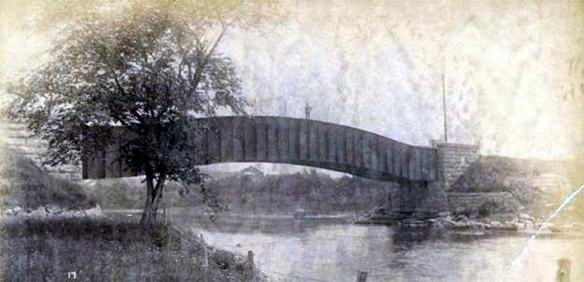
Above: Historical photo of bridge.

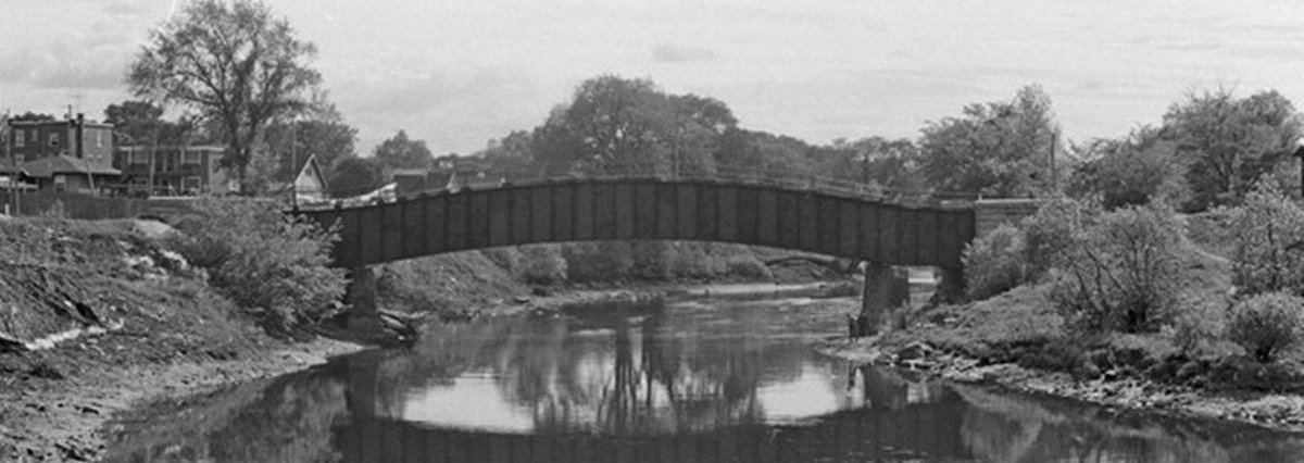
Above: Historical photo of bridge.
Above: Historical photo of bridge.
![]()
![]()
![]()
Coordinates (Latitude, Longitude):
Search For Additional Bridge Listings:
Bridgehunter.com: View listed bridges within 0.5 miles (0.8 kilometers) of this bridge.
Bridgehunter.com: View listed bridges within 10 miles (16 kilometers) of this bridge.
Additional Maps:
Google Streetview (If Available)
GeoHack (Additional Links and Coordinates)
Apple Maps (Via DuckDuckGo Search)
Apple Maps (Apple devices only)
Android: Open Location In Your Map or GPS App
Flickr Gallery (Find Nearby Photos)
Wikimedia Commons (Find Nearby Photos)
Directions Via Sygic For Android
Directions Via Sygic For iOS and Android Dolphin Browser
USGS National Map (United States Only)
Historical USGS Topo Maps (United States Only)
Historic Aerials (United States Only)
CalTopo Maps (United States Only)

© Copyright 2003-2026, HistoricBridges.org. All Rights Reserved. Disclaimer: HistoricBridges.org is a volunteer group of private citizens. HistoricBridges.org is NOT a government agency, does not represent or work with any governmental agencies, nor is it in any way associated with any government agency or any non-profit organization. While we strive for accuracy in our factual content, HistoricBridges.org offers no guarantee of accuracy. Information is provided "as is" without warranty of any kind, either expressed or implied. Information could include technical inaccuracies or errors of omission. Opinions and commentary are the opinions of the respective HistoricBridges.org member who made them and do not necessarily represent the views of anyone else, including any outside photographers whose images may appear on the page in which the commentary appears. HistoricBridges.org does not bear any responsibility for any consequences resulting from the use of this or any other HistoricBridges.org information. Owners and users of bridges have the responsibility of correctly following all applicable laws, rules, and regulations, regardless of any HistoricBridges.org information.
![]()