


View Information About HSR Ratings
This concrete arch bridge has been altered extensively, and one of these alterations has also attracted a colony of bats. In fact, the bridge doesn't even function as an arch anymore. The bridge was widened first in 1956. In 1980, the bridge was even more extensively reconstructed. The deck and the top portion of the columns were cut off and a new prestressed concrete box beam superstructrure was installed on top. Combined with alterations to the piers, the box beam structure is much wider than the concrete arch bridge. As such, hidden under the box beams, the original concrete arch and its columns are still visible, but it is decorative only. A gap is visible betwen the top of the columns and the box beams indicating that the arch plays no structural role whatsoever. This bridge is thus not the best example of historic bridge preservation, although what was done here was still better than full demolition and replacement.
The new prestressed concrete structure is composed of adjacent box beams. Although adjacent, there is an unusual gap between each box beam. These gaps turned out to be exactly the type of habitat that bats look for. Today, these gaps are home to a ton of bats. As a result, the bridge has become a significant local attraction on account of the bats, and is often known as the Bat Bridge.
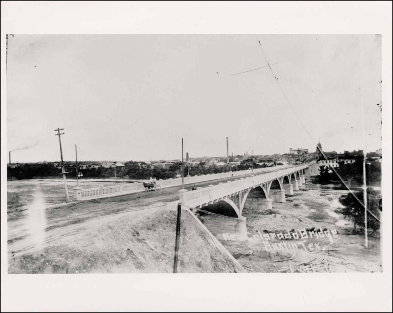
Above: Historical photo showing bridge as originally built.
![]()
![]()
![]()
Coordinates (Latitude, Longitude):
Search For Additional Bridge Listings:
Bridgehunter.com: View listed bridges within 0.5 miles (0.8 kilometers) of this bridge.
Bridgehunter.com: View listed bridges within 10 miles (16 kilometers) of this bridge.
Additional Maps:
Google Streetview (If Available)
GeoHack (Additional Links and Coordinates)
Apple Maps (Via DuckDuckGo Search)
Apple Maps (Apple devices only)
Android: Open Location In Your Map or GPS App
Flickr Gallery (Find Nearby Photos)
Wikimedia Commons (Find Nearby Photos)
Directions Via Sygic For Android
Directions Via Sygic For iOS and Android Dolphin Browser
USGS National Map (United States Only)
Historical USGS Topo Maps (United States Only)
Historic Aerials (United States Only)
CalTopo Maps (United States Only)

© Copyright 2003-2026, HistoricBridges.org. All Rights Reserved. Disclaimer: HistoricBridges.org is a volunteer group of private citizens. HistoricBridges.org is NOT a government agency, does not represent or work with any governmental agencies, nor is it in any way associated with any government agency or any non-profit organization. While we strive for accuracy in our factual content, HistoricBridges.org offers no guarantee of accuracy. Information is provided "as is" without warranty of any kind, either expressed or implied. Information could include technical inaccuracies or errors of omission. Opinions and commentary are the opinions of the respective HistoricBridges.org member who made them and do not necessarily represent the views of anyone else, including any outside photographers whose images may appear on the page in which the commentary appears. HistoricBridges.org does not bear any responsibility for any consequences resulting from the use of this or any other HistoricBridges.org information. Owners and users of bridges have the responsibility of correctly following all applicable laws, rules, and regulations, regardless of any HistoricBridges.org information.
![]()