

View Information About HSR Ratings
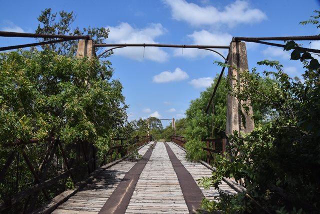
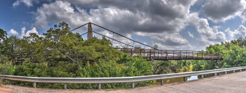
This is one of the few surviving unique small-scale suspension bridges in Texas and is also noted for its iron Howe truss approach spans. The bridge is one of the products of the Flinn-Moyer company which built these unique suspension bridges and Howe truss bridges. Originally, this bridge had iron pipe towers and the Howe trusses on the approach spans were also used for stiffening trusses on the main span. However, in 1926, the Austin Bridge Company of Dallas, Texas altered the bridge, adding new cable alongside each original cable, removing the stiffening truss, and encasing the towers in concrete.
The bridge is today bypassed and abandoned. It is among the most unique and significant bridges in Texas.
Please review this Historic American Engineering Record data pages for a very detailed and extensive history of this bridge.

Above: A view of the Howe truss for the approach spans.
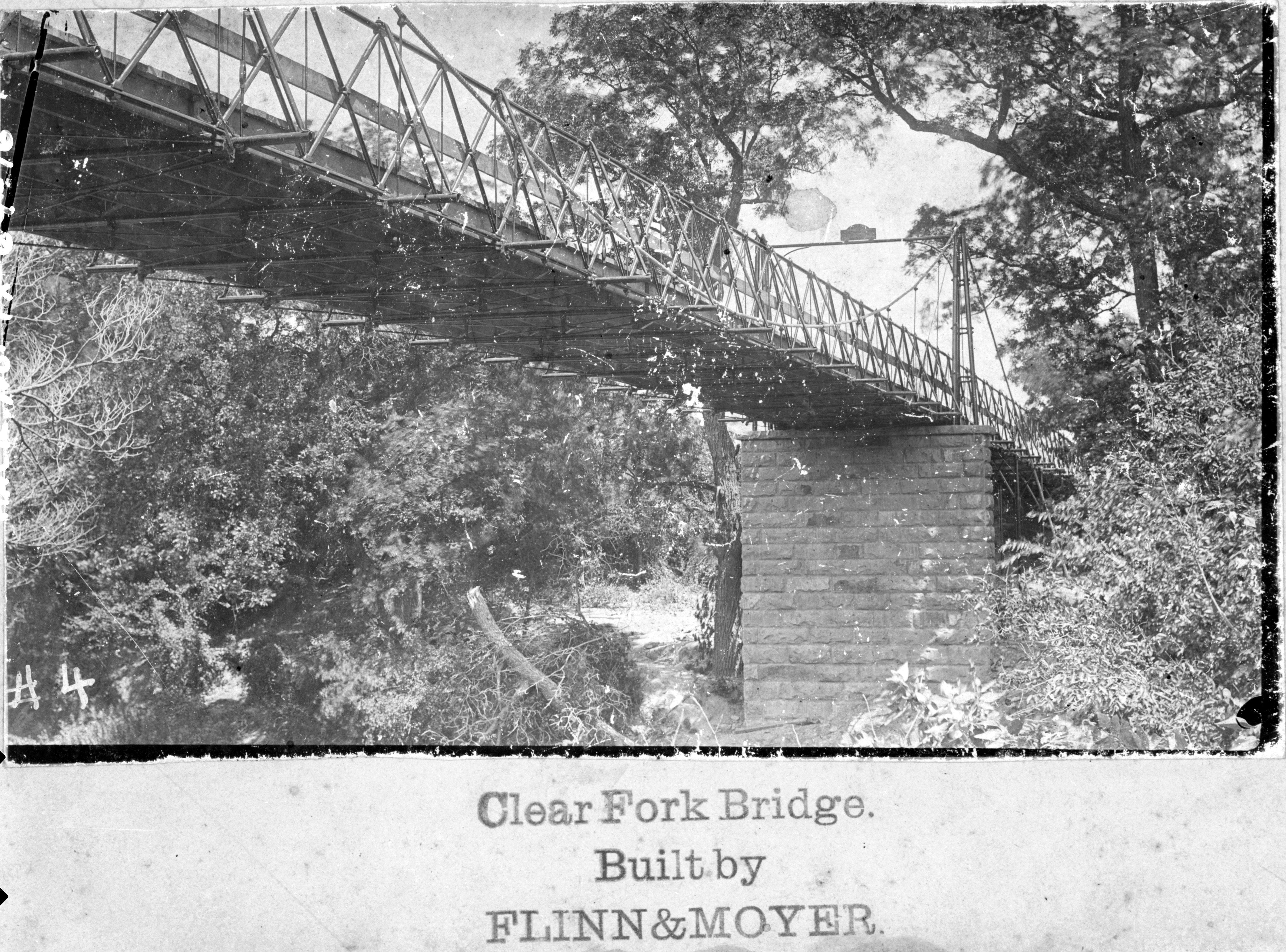
Above: Historical ca. 1896 photo of bridge showing design of bridge prior to 1926 alteration.

Above: Model from collection of Dr. Timothy L. Flinn, of Howe pipe truss bridge (no longer extant) spanning Deep Creek, Shackelford County, Texas, constructed by Flinn-Moyer Company in 1896. Photo Credit: Historic American Engineering Record.
![]()
![]()
![]()
Coordinates (Latitude, Longitude):
Search For Additional Bridge Listings:
Bridgehunter.com: View listed bridges within 0.5 miles (0.8 kilometers) of this bridge.
Bridgehunter.com: View listed bridges within 10 miles (16 kilometers) of this bridge.
Additional Maps:
Google Streetview (If Available)
GeoHack (Additional Links and Coordinates)
Apple Maps (Via DuckDuckGo Search)
Apple Maps (Apple devices only)
Android: Open Location In Your Map or GPS App
Flickr Gallery (Find Nearby Photos)
Wikimedia Commons (Find Nearby Photos)
Directions Via Sygic For Android
Directions Via Sygic For iOS and Android Dolphin Browser
USGS National Map (United States Only)
Historical USGS Topo Maps (United States Only)
Historic Aerials (United States Only)
CalTopo Maps (United States Only)

© Copyright 2003-2025, HistoricBridges.org. All Rights Reserved. Disclaimer: HistoricBridges.org is a volunteer group of private citizens. HistoricBridges.org is NOT a government agency, does not represent or work with any governmental agencies, nor is it in any way associated with any government agency or any non-profit organization. While we strive for accuracy in our factual content, HistoricBridges.org offers no guarantee of accuracy. Information is provided "as is" without warranty of any kind, either expressed or implied. Information could include technical inaccuracies or errors of omission. Opinions and commentary are the opinions of the respective HistoricBridges.org member who made them and do not necessarily represent the views of anyone else, including any outside photographers whose images may appear on the page in which the commentary appears. HistoricBridges.org does not bear any responsibility for any consequences resulting from the use of this or any other HistoricBridges.org information. Owners and users of bridges have the responsibility of correctly following all applicable laws, rules, and regulations, regardless of any HistoricBridges.org information.
![]()