We Recommend:
Bach Steel - Experts at historic truss bridge restoration.
BridgeHunter.com Phase 1 is released to the public! - Visit Now
Third Welland Canal CN Railway Bridge

Primary Photographer(s): Nathan Holth
Bridge Documented: 2005
Rural: Niagara Region, Ontario: Canada
By Builder/Contractor: Unknown
Not Available or Not Applicable
180.0 Feet (54.9 Meters)
180.0 Feet (54.9 Meters)
Not Available
1 Main Span(s)
Not Applicable

View Information About HSR Ratings
Bridge Documentation
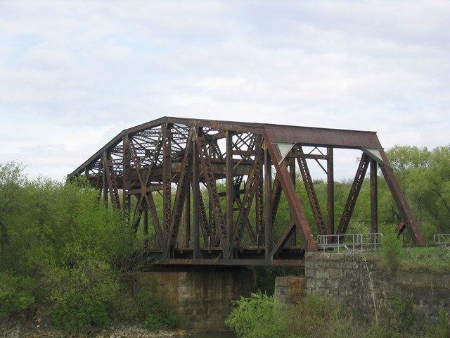
This bridge is an impressive swing bridge. It no longer opens for boats since it crosses an abandoned section of the Welland Canal. The bridge tender and machinery building has been removed, as has most of the operating machinery, although some of the gearing remains around the swing pier.
The configuration of this bridge is a camelback warren through truss. V-lacing and lattice are present on many members of the bridge. Swing pier and abutments for the bridge are stone. Connections on the bridge are riveted. The bridge carries two tracks on it, both well used.
Old locks are visible to the south of this bridge.
Thanks to Fred Herriot, who provided the following additional information regarding the bridge:
The bridge itself carries two tracks of the
Canadian National Railway and VIA Rail between Saint Catharines [and from beyond
to Hamilton and Toronto] and Niagara Falls [and from beyond to Buffalo and New
York City]). These tracks were originally part of the Grand Trunk Railway
system.
The section of the Welland Canal this bridge crosses is known historically as
the "Third Welland Canal," operating from the 1880s to the 1930s. This version
of the canal was shut down in 1932 when the "Fourth Canal" went into operation.
The bridge itself was built to take the place of a cut-stone tunnel, the Grand
Trunk Railroad Tunnel, which is located about two hundred metres (600 feet) to
the south-west of the bridge. The tunnel does leak, but it is still (I believe)
passable.
Above: Aerial drone view of bridge. Click for enlargement. Photo Credit: Ed Blasinski
Above: Aerial drone view of bridge. Click for enlargement. Photo Credit: Ed Blasinski
Above: Aerial drone view of bridge. Click for enlargement. Photo Credit: Ed Blasinski
Above: Aerial drone view of bridge. Click for enlargement. Photo Credit: Ed Blasinski
![]()
Photo Galleries and Videos: Third Welland Canal CN Railway Bridge
Bridge Photo-Documentation
Original / Full Size PhotosA collection of overview and detail photos. This gallery offers photos in the highest available resolution and file size in a touch-friendly popup viewer.
Alternatively, Browse Without Using Viewer
![]()
Bridge Photo-Documentation
Mobile Optimized PhotosA collection of overview and detail photos. This gallery features data-friendly, fast-loading photos in a touch-friendly popup viewer.
Alternatively, Browse Without Using Viewer
![]()
Maps and Links: Third Welland Canal CN Railway Bridge
Coordinates (Latitude, Longitude):
Search For Additional Bridge Listings:
Additional Maps:
Google Streetview (If Available)
GeoHack (Additional Links and Coordinates)
Apple Maps (Via DuckDuckGo Search)
Apple Maps (Apple devices only)
Android: Open Location In Your Map or GPS App
Flickr Gallery (Find Nearby Photos)
Wikimedia Commons (Find Nearby Photos)
Directions Via Sygic For Android
Directions Via Sygic For iOS and Android Dolphin Browser


