We Recommend:
Bach Steel - Experts at historic truss bridge restoration.
BridgeHunter.com Phase 1 is released to the public! - Visit Now
DeWitt Road Bridge

Primary Photographer(s): Nathan Holth and Rick McOmber
Bridge Documented: March 7, 2006 and November 6, 2011
Merle Beach (Rural): Clinton County, Michigan: United States
Not Available or Not Applicable
40.0 Feet (12.2 Meters)
40.0 Feet (12.2 Meters)
16 Feet (4.88 Meters)
1 Main Span(s)
Not Applicable

View Information About HSR Ratings
Bridge Documentation
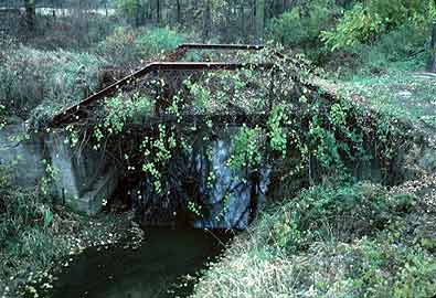
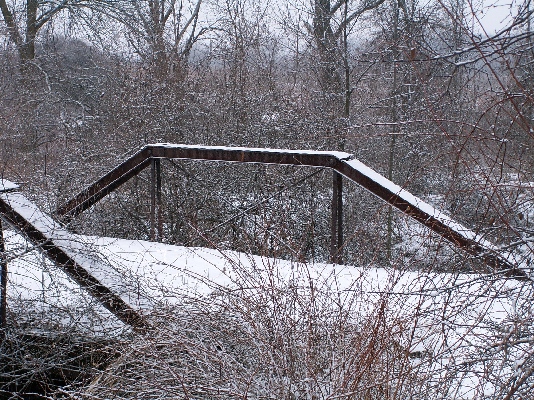
This bridge is one of the oldest bridges in Michigan, with a construction date of 1880. This is also the last known remaining pin-connected queenpost truss bridge in Michigan, and is forty feet in length. Clearly, this is a small bridge with great importance. Unfortunately, the bridge sits severely rusted with so much growth on it that it is not difficult to imagine the vines eventually collapsing the bridge. Although the bridge is a privately owned structure today, the bridge however appears to be in its original location, as an old alignment for DeWitt Road. Regardless of who owns the bridge, funding from a government level should be made available to preserve this last vestige of early metal truss bridge construction in Michigan.
Information and Findings From Michigan Historic Bridge InventoryNarrative Description
This single-span wrought iron bridge crosses Stoney Creek on an abandoned
road segment in rural Olive Township. Spanning about 40 feet, the Stoney
Creek Bridge is a pin-connected Queenpost pony truss. Information and Findings From Michigan Historic Sites OnlineNarrative Description This single-span wrought iron bridge crosses Stoney Creek on an abandoned road segment in rural Olive Township. Spanning about 40 feet, the Stoney Creek Bridge is a pin-connected Queenpost pony truss, with web members comprised as follows: upper chord and inclined end post - two channels with cover and batten plates; lower chord and vertical - two punched rectangular eyebars; and diagonal - two round eyerods with turnbuckles. I-beam floor beams are hung from the lower chord pins by U-bolts and support steel stringers, which carry a timber deck. The truss is supported by concrete abutments with stone masonry wingwalls. The bridge has been superseded by a concrete culvert and now stands abandoned and in deteriorating condition. main span number: 1 main span length: 40.0 structure length: 42.0 roadway width: 16.0 structure width: 18.0 |
This bridge is tagged with the following special condition(s): Unorganized Photos
![]()
Photo Galleries and Videos: DeWitt Road Bridge
Bridge Photo-Documentation
A collection of overview and detail photos. This photo gallery contains a combination of Original Size photos and Mobile Optimized photos in a touch-friendly popup viewer.Alternatively, Browse Without Using Viewer
![]()
Additional Unorganized Photos
Original / Full Size PhotosA supplemental collection of photos that are from additional visit(s) to the bridge and have not been organized or captioned. This gallery offers photos in the highest available resolution and file size in a touch-friendly popup viewer.
Alternatively, Browse Without Using Viewer
![]()
Additional Unorganized Photos
Mobile Optimized PhotosA supplemental collection of photos that are from additional visit(s) to the bridge and have not been organized or captioned. This gallery features data-friendly, fast-loading photos in a touch-friendly popup viewer.
Alternatively, Browse Without Using Viewer
![]()
Maps and Links: DeWitt Road Bridge
Coordinates (Latitude, Longitude):
Search For Additional Bridge Listings:
Bridgehunter.com: View listed bridges within 0.5 miles (0.8 kilometers) of this bridge.
Bridgehunter.com: View listed bridges within 10 miles (16 kilometers) of this bridge.
Additional Maps:
Google Streetview (If Available)
GeoHack (Additional Links and Coordinates)
Apple Maps (Via DuckDuckGo Search)
Apple Maps (Apple devices only)
Android: Open Location In Your Map or GPS App
Flickr Gallery (Find Nearby Photos)
Wikimedia Commons (Find Nearby Photos)
Directions Via Sygic For Android
Directions Via Sygic For iOS and Android Dolphin Browser
USGS National Map (United States Only)
Historical USGS Topo Maps (United States Only)
Historic Aerials (United States Only)
CalTopo Maps (United States Only)


