

View Information About HSR Ratings
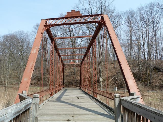
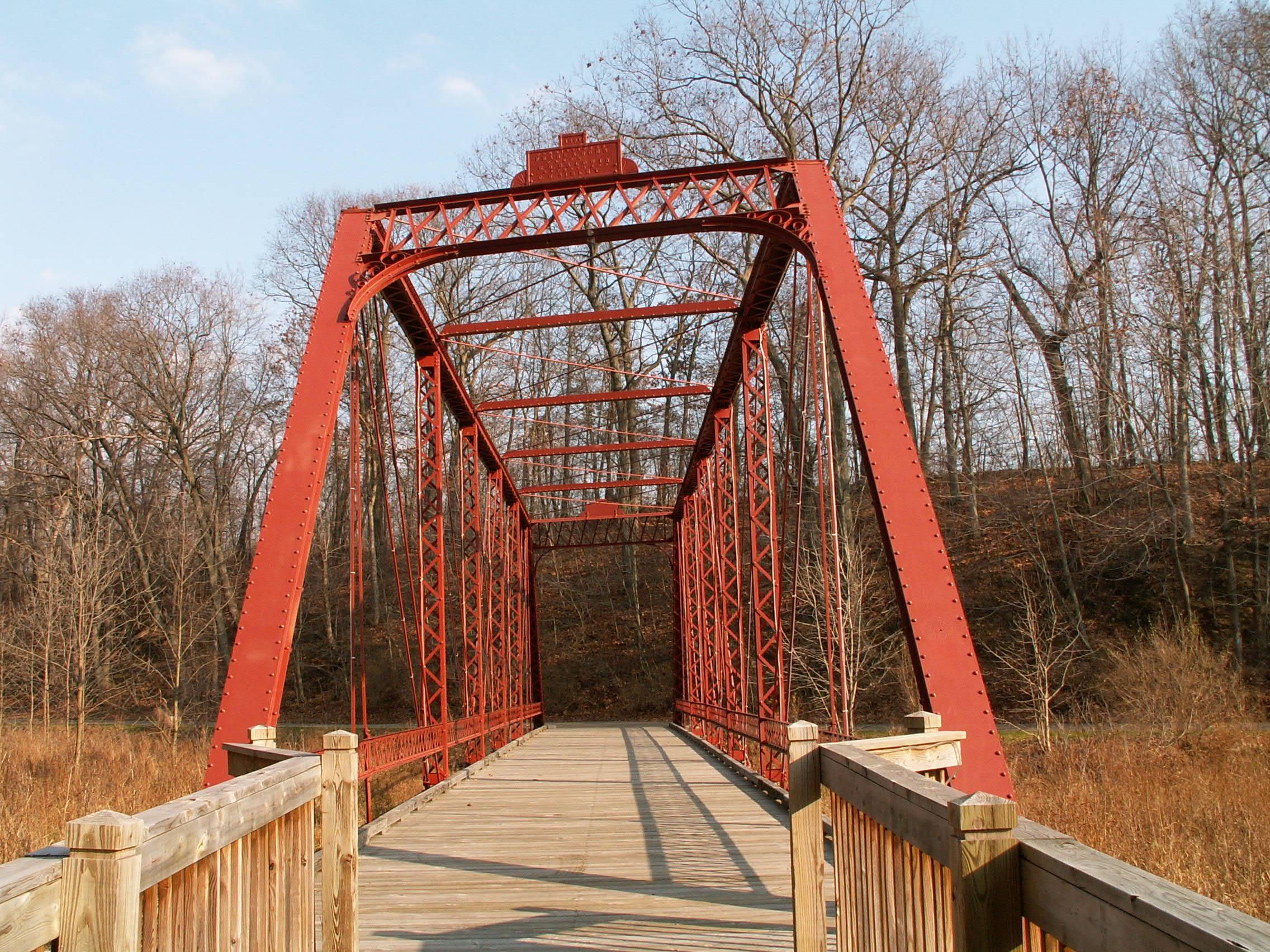
This bridge is the last known remaining highway Pratt through truss in Michigan that is skewed. HABS HAER documented the Sheridan Road Bridge in Saginaw County prior to its demolition, which also was skewed. They mentioned that it was the last skewed Pratt through truss in Michigan. The Gale Road Bridge must have been disassembled and in storage when they made that assessment. Now that Gale Road Bridge stands restored as the third bridge erected in the park, it takes the honor. Although the Gale Road Bridge is not heavily skewed, it does have that unique crooked appearance that makes a skewed bridge interesting to look at. The bridge was built in 1897 by the Lafayette Bridge Company. The bridge is a seven panel bridge and has pinned connections. V-lacing is present on verticals and under the top chord. The bridge also has an unusual and plain sway bracing design. A county commissioner plaque remains atop the portal, however the end post builder plaque is missing, as indicated by the oval-shaped rust scar on the end post.
The portal bracing on this bridge was completely rebuilt as part of the restoration, due to poor condition of the original. The new bracing was designed to have the same appearance as the original bracing, although steel angles were used instead of flat bars resulting in an unusual appearance that would not have been present on the original structure.
This bridge is tagged with the following special condition(s): Reused
![]()
![]()
![]()
![]()
The above map shows the current location of the bridge. The bridge originally crossed the Grand River on Gale Road, Ingham County, Michigan
Coordinates (Latitude, Longitude):
Search For Additional Bridge Listings:
Bridgehunter.com: View listed bridges within 0.5 miles (0.8 kilometers) of this bridge.
Bridgehunter.com: View listed bridges within 10 miles (16 kilometers) of this bridge.
Additional Maps:
Google Streetview (If Available)
GeoHack (Additional Links and Coordinates)
Apple Maps (Via DuckDuckGo Search)
Apple Maps (Apple devices only)
Android: Open Location In Your Map or GPS App
Flickr Gallery (Find Nearby Photos)
Wikimedia Commons (Find Nearby Photos)
Directions Via Sygic For Android
Directions Via Sygic For iOS and Android Dolphin Browser
USGS National Map (United States Only)
Historical USGS Topo Maps (United States Only)
Historic Aerials (United States Only)
CalTopo Maps (United States Only)

© Copyright 2003-2026, HistoricBridges.org. All Rights Reserved. Disclaimer: HistoricBridges.org is a volunteer group of private citizens. HistoricBridges.org is NOT a government agency, does not represent or work with any governmental agencies, nor is it in any way associated with any government agency or any non-profit organization. While we strive for accuracy in our factual content, HistoricBridges.org offers no guarantee of accuracy. Information is provided "as is" without warranty of any kind, either expressed or implied. Information could include technical inaccuracies or errors of omission. Opinions and commentary are the opinions of the respective HistoricBridges.org member who made them and do not necessarily represent the views of anyone else, including any outside photographers whose images may appear on the page in which the commentary appears. HistoricBridges.org does not bear any responsibility for any consequences resulting from the use of this or any other HistoricBridges.org information. Owners and users of bridges have the responsibility of correctly following all applicable laws, rules, and regulations, regardless of any HistoricBridges.org information.
![]()