We Recommend:
Bach Steel - Experts at historic truss bridge restoration.
BridgeHunter.com Phase 1 is released to the public! - Visit Now
Half Road Bridge

Primary Photographer(s): Nathan Holth and Luke Gordon
Bridge Documented: August 1, 2005, November 26, 2005, and May 2011
Rural: Monroe County, Michigan: United States
Not Available or Not Applicable
36.7 Feet (11.2 Meters)
41.0 Feet (12.5 Meters)
14 Feet (4.27 Meters)
1 Main Span(s)
58304A00022B010

View Information About HSR Ratings
Bridge Documentation
This bridge is in storage!
View Archived National Bridge Inventory Report - Has Additional Details and Evaluation
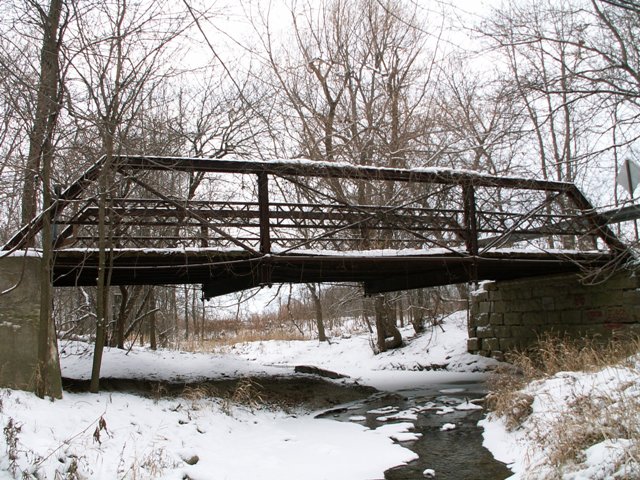
This bridge is one of several small pony truss bridges that were abandoned in place in Monroe County. This bridge was built in 1910, according to the national bridge inventory, and retains original lattice guardrails. V-lacing is on vertical members. The deck is wooden. This bridge was very overgrown. The southwest endpost of the bridge had a small tree growing through it! The tree started on the ground outside the bridge, passed up inside the endposts, through a part of the lattice railings, and up toward the light above bridge! The bridge sat on stone abutments, although the southern abutment had been significantly reconstructed in concrete to the point where the southern abutment was essentially a concrete abutment, although the stone appeared to remain behind the concrete. This bridge had not been maintained for a long time, and as a result this bridge was in danger of collapse.
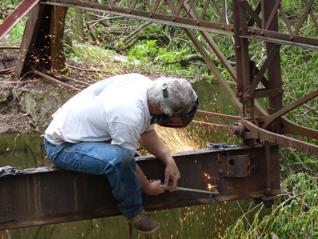
In order to save this bridge from continuing deterioration which would inevitably lead to collapse, HistoricBridges.org and Bach Ornamental and Structural Steel, got together and with the support of the Monroe County Road Commission, worked together to develop and execute a project to remove this and four other similar abandoned and deteriorated truss bridges in the county and place them into storage, ready for future restoration and reuse. The project was done without cost to the county, and HistoricBridges.org and Bach Ornamental and Structural Steel intend to recoup costs by restoring the truss bridges and selling them as like-new historic bridges to new owners.
Prior to being rescued and placed into storage for future restoration, the Half Road Bridge was in extreme danger of collapse due to severe section loss on the vertical members. Some vertical members were completely severed by section loss at the bottom chord connections.
This bridge is tagged with the following special condition(s): Available
![]()
Photo Galleries and Videos: Half Road Bridge
Bridge Photo-Documentation
Original / Full Size PhotosA collection of overview and detail photos. This gallery offers photos in the highest available resolution and file size in a touch-friendly popup viewer.
Alternatively, Browse Without Using Viewer
![]()
Removal For Restoration
Original / Full Size PhotosA collection of photos documenting the removal of this bridge from its original location to be placed in storage for future restoration and reuse. This gallery offers photos in the highest available resolution and file size in a touch-friendly popup viewer.
Alternatively, Browse Without Using Viewer
![]()
Bridge Photo-Documentation
Mobile Optimized PhotosA collection of overview and detail photos. This gallery features data-friendly, fast-loading photos in a touch-friendly popup viewer.
Alternatively, Browse Without Using Viewer
![]()
Removal For Restoration
Mobile Optimized PhotosA collection of photos documenting the removal of this bridge from its original location to be placed in storage for future restoration and reuse. This gallery features data-friendly, fast-loading photos in a touch-friendly popup viewer.
Alternatively, Browse Without Using Viewer
![]()
Maps and Links: Half Road Bridge
Coordinates (Latitude, Longitude):
Search For Additional Bridge Listings:
Bridgehunter.com: View listed bridges within 0.5 miles (0.8 kilometers) of this bridge.
Bridgehunter.com: View listed bridges within 10 miles (16 kilometers) of this bridge.
Additional Maps:
Google Streetview (If Available)
GeoHack (Additional Links and Coordinates)
Apple Maps (Via DuckDuckGo Search)
Apple Maps (Apple devices only)
Android: Open Location In Your Map or GPS App
Flickr Gallery (Find Nearby Photos)
Wikimedia Commons (Find Nearby Photos)
Directions Via Sygic For Android
Directions Via Sygic For iOS and Android Dolphin Browser
USGS National Map (United States Only)
Historical USGS Topo Maps (United States Only)
Historic Aerials (United States Only)
CalTopo Maps (United States Only)


