We Recommend:
Bach Steel - Experts at historic truss bridge restoration.
BridgeHunter.com Phase 1 is released to the public! - Visit Now
Well's Bridge
1/2 Mile Road Bridge / Marl Lake Road Bridge

Primary Photographer(s): Nathan Holth and Rick McOmber
Bridge Documented: 2006, September 7, 2014, and February 22, 2020
Marl Lake Road (1/2 Mile Road) Over Nottawa Creek (Nottawassepee River)
Rural: Branch County, Michigan and Calhoun County, Michigan: United States
Not Available or Not Applicable
80.0 Feet (24.4 Meters)
80.0 Feet (24.4 Meters)
15 Feet (4.57 Meters)
1 Main Span(s)
13315H00014B010

View Information About HSR Ratings
Bridge Documentation
This bridge is listed in the inventories as being in Calhoun County, although the two counties have long disputed who actually owns this county line bridge. Either way, recent developments have resulted in plans to relocate the bridge to Historic Bridge Park.
The water this bridge crosses goes by two names. It is called Nottawassepee River or Nottawa Creek The root meaning of the "ssepee" is Algonquin for "creek" or "river", and so Nottawassepee River could be considered redundant. Thanks to Dave Lemberg for providing this information.
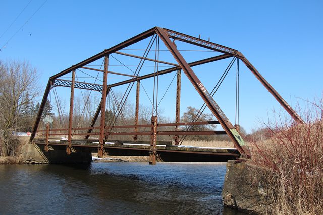
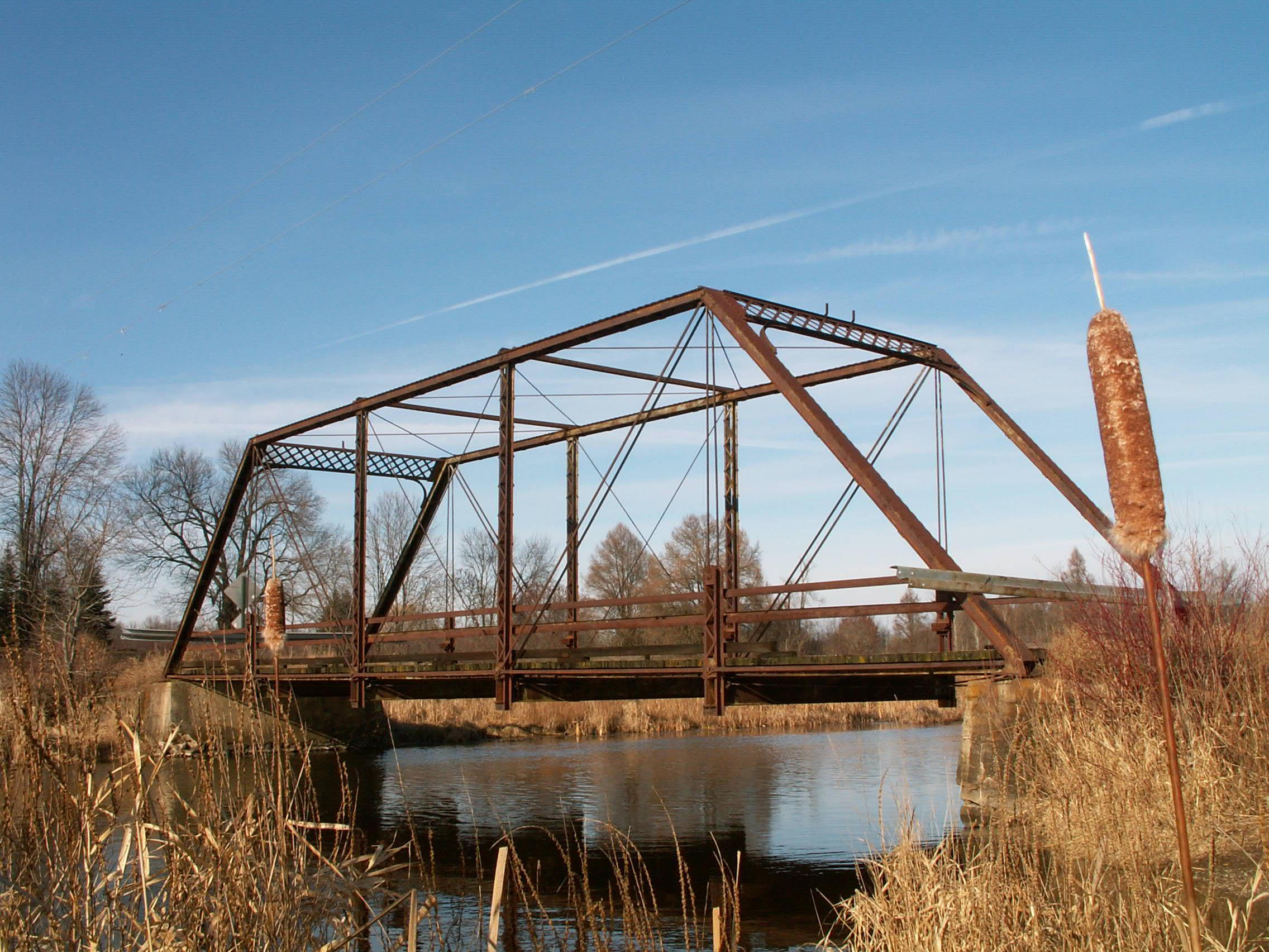
This bridge is a pin connected Pratt through truss, and is composed of five panels. It is seated on concrete abutments. These abutments, particularly the southern one, are failing, as they are tipping inward to the river. This can be seen by the crooked appearance of the feet of this bridge, which are no longer flat on the abutment. There is v-lacing present on the vertical members, which is on the "side" of the vertical members, which is the less common configuration. Simple channel steel provides a railing for the bridge. The portal bracing is a lattice design. The plaques for this bridge are lost, but the brackets for the portal-mounted plaques remain.
Although the inventories list a 1914 date for the construction of this bridge, this is likely a data entry error. 1904 seems a more reasonable date of construction for this bridge.
Calhoun County at one time planned to relocate this bridge to Historic Bridge Park, however the county no longer is planning to add bridges to the park, and so the bridge's future is uncertain, particularly considering that the bridge has abutment problems. Left as it is for too many years, the abutments would eventually begin to twist the superstructure of the bridge, which would go on until it caused the bridge to collapse. A good example of this is the Maple Rapids Road Bridge, which is also a short through truss bridge. The relocation of this bridge would ensure that this treasure remains around for people to enjoy.
View Archived National Bridge Inventory Report - Has Additional Details and Evaluation
This bridge is tagged with the following special condition(s): Available and Unorganized Photos
![]()
Photo Galleries and Videos: Well's Bridge
Bridge Photo-Documentation
A collection of overview and detail photos. This photo gallery contains a combination of Original Size photos and Mobile Optimized photos in a touch-friendly popup viewer.Alternatively, Browse Without Using Viewer
![]()
Additional Unorganized Photos
Original / Full Size PhotosA supplemental collection of photos that are from additional visit(s) to the bridge and have not been organized or captioned. This gallery offers photos in the highest available resolution and file size in a touch-friendly popup viewer.
Alternatively, Browse Without Using Viewer
![]()
Additional Unorganized Photos
Mobile Optimized PhotosA supplemental collection of photos that are from additional visit(s) to the bridge and have not been organized or captioned. This gallery features data-friendly, fast-loading photos in a touch-friendly popup viewer.
Alternatively, Browse Without Using Viewer
![]()
Maps and Links: Well's Bridge
Coordinates (Latitude, Longitude):
Search For Additional Bridge Listings:
Bridgehunter.com: View listed bridges within 0.5 miles (0.8 kilometers) of this bridge.
Bridgehunter.com: View listed bridges within 10 miles (16 kilometers) of this bridge.
Additional Maps:
Google Streetview (If Available)
GeoHack (Additional Links and Coordinates)
Apple Maps (Via DuckDuckGo Search)
Apple Maps (Apple devices only)
Android: Open Location In Your Map or GPS App
Flickr Gallery (Find Nearby Photos)
Wikimedia Commons (Find Nearby Photos)
Directions Via Sygic For Android
Directions Via Sygic For iOS and Android Dolphin Browser
USGS National Map (United States Only)
Historical USGS Topo Maps (United States Only)
Historic Aerials (United States Only)
CalTopo Maps (United States Only)


