We Recommend:
Bach Steel - Experts at historic truss bridge restoration.
BridgeHunter.com Phase 1 is released to the public! - Visit Now
Lowell Road Bridge

Primary Photographer(s): Nathan Holth and Rick McOmber
Bridge Documented: April 17, 2006
Rural: Clinton County, Michigan: United States
Not Available or Not Applicable
91.0 Feet (27.7 Meters)
91.0 Feet (27.7 Meters)
13.8 Feet (4.21 Meters)
1 Main Span(s)
19315H00014B010

View Information About HSR Ratings
Bridge Documentation
This bridge no longer exists!
Bridge Status: Demolished and replaced. Bridge was in storage in Calhoun County with use on trail planned, but its parts were destroyed by a careless equipment operator.View Archived National Bridge Inventory Report - Has Additional Details and Evaluation
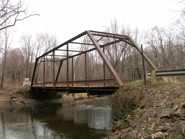
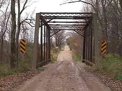
This six-panel truss bridge with a 16 foot (4.88 meters) vertical clearance bears a number of similarities to Wrought Iron Bridge Company structures, such as the East Delhi Road Bridge. The lack of v-lacing on verticals and sway bracing is one similarity, as well as the bracing rod that runs parallel to the top chord at the center of the bridge overhead. In addition, the unusual four-pronged connection detail on the hip vertical is similar to that seen on Wrought Iron Bridge Company bridges like the Dewey Road Bridge. It is unclear whether this is enough evidence to link this bridge to the Wrought Iron Bridge Company, however, these are undeniably defining characteristics of the Lowell Road Bridge.
There was damage to the western half of the northern portal bracing, possibly due to the clearance restrictions not being observed by drivers.
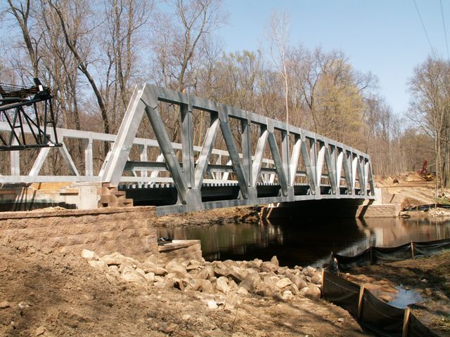
Clinton County Road Commission has dismantled this bridge and is giving it to Historic Bridge Park, so this bridge has not been lost forever. However Lowell Road will no longer be a trip back in time. The modern bridge built in its place is a welded truss bridge placed on modern concrete abutments with stone-shaped stamps on them. This was done as a "context-sensitive" replacement as mitigation for removing the historic bridge. While the replacement bridge may be an impressive and unusual example of a modern bridge that actually offers something in the way of aesthetics, it does not fill the shoes of its predecessor in any manner. As a welded, warren pony truss, the only similarities the two bridges share is that they are truss bridges. The historic bridge is a pin-connected Pratt through truss. In modern engineering, to see a new bridge with even the smallest element of beauty is something that is noteworthy and should be applauded. It is important not only to preserve historic bridges, but to ensure that any modern bridges that are constructed are also an attractive feature on the roadway. However, the construction of an attractive modern bridge does not justify the demolition of a historic bridge. In the case of Lowell Road, where the historic bridge will have a new life at Historic Bridge Park, this may have been an acceptable compromise. However, in other cases where the historic bridge is demolished, any decorations added to a modern bridge do not excuse the loss of heritage and superior beauty that a historic bridge offers over any aesthetic modern bridge. In some cases, these so-called context sensitive solutions do nothing more than mock the beauty and heritage that historic bridge enthusiasts have been deprived of through the demolition.
The photos of the historic bridge available in the photo gallery were taken shortly before the bridge was removed. A fair amount of the natural forest around the bridge was severely disturbed and destroyed. In addition, Rick McOmber provided a photo showing the bridge prior to the removal of the trees. Also available in the photo gallery are a few photos of the modern bridge, for comparison purposes.
|
|
This bridge is tagged with the following special condition(s): Available
![]()
Photo Galleries and Videos: Lowell Road Bridge
Bridge Photo-Documentation
Original / Full Size PhotosA collection of overview and detail photos. This gallery offers photos in the highest available resolution and file size in a touch-friendly popup viewer.
Alternatively, Browse Without Using Viewer
![]()
Replacement Bridge
Original / Full Size PhotosA collection of overview and detail photos showing the replacement bridge. This gallery offers photos in the highest available resolution and file size in a touch-friendly popup viewer.
Alternatively, Browse Without Using Viewer
![]()
2011 Parts Inventory
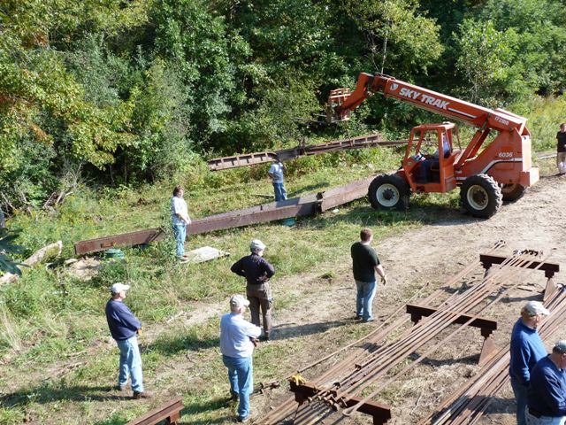
Original / Full Size PhotosPhotos taken during an effort to inventory and make ready the bridge parts for eventual restoration with assistance from North Country Trail Chief Noonday Chapter members. Photos showing both the event itself as well as physical condition of bridge parts needing repair. This gallery offers photos in the highest available resolution and file size in a touch-friendly popup viewer.
Alternatively, Browse Without Using Viewer
![]()
Bridge Photo-Documentation
Mobile Optimized PhotosA collection of overview and detail photos. This gallery features data-friendly, fast-loading photos in a touch-friendly popup viewer.
Alternatively, Browse Without Using Viewer
![]()
Replacement Bridge
Mobile Optimized PhotosA collection of overview and detail photos showing the replacement bridge. This gallery features data-friendly, fast-loading photos in a touch-friendly popup viewer.
Alternatively, Browse Without Using Viewer
![]()
2011 Parts Inventory
Mobile Optimized PhotosPhotos taken during a volunteer effort to inventory and make ready the bridge parts for eventual restoration. Photos showing both the event itself as well as physical condition of bridge parts needing repair. This gallery features data-friendly, fast-loading photos in a touch-friendly popup viewer.
Alternatively, Browse Without Using Viewer
![]()
Maps and Links: Lowell Road Bridge
This historic bridge has been demolished. This map is shown for reference purposes only.
Coordinates (Latitude, Longitude):
Search For Additional Bridge Listings:
Bridgehunter.com: View listed bridges within 0.5 miles (0.8 kilometers) of this bridge.
Bridgehunter.com: View listed bridges within 10 miles (16 kilometers) of this bridge.
Additional Maps:
Google Streetview (If Available)
GeoHack (Additional Links and Coordinates)
Apple Maps (Via DuckDuckGo Search)
Apple Maps (Apple devices only)
Android: Open Location In Your Map or GPS App
Flickr Gallery (Find Nearby Photos)
Wikimedia Commons (Find Nearby Photos)
Directions Via Sygic For Android
Directions Via Sygic For iOS and Android Dolphin Browser
USGS National Map (United States Only)
Historical USGS Topo Maps (United States Only)
Historic Aerials (United States Only)
CalTopo Maps (United States Only)


