We Recommend:
Bach Steel - Experts at historic truss bridge restoration.
BridgeHunter.com Phase 1 is released to the public! - Visit Now
Michigan Avenue Bridge
DuSable Bridge
Primary Photographer(s): Nathan Holth
Bridge Documented: August 12, 2006 - October 18, 2021
Chicago: Cook County, Illinois: United States
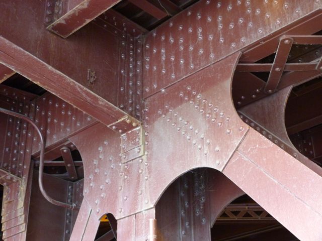
Metal Rivet-Connected Pratt Deck Truss, Movable: Double Leaf Bascule (Fixed Trunnion) and Approach Spans: Metal Stringer (Multi-Beam), Fixed
1920 By Builder/Contractor: Great Lakes Dredge and Dock Company of Chicago, Illinois and Engineer/Design: City of Chicago
2009
256.0 Feet (78 Meters)
400.0 Feet (121.9 Meters)
64 Feet (19.51 Meters)
1 Main Span(s) and 2 Approach Span(s)
16603527325

View Information About HSR Ratings
Bridge Documentation
This bridge's song is:
View Archived National Bridge Inventory Report - Has Additional Details and Evaluation
View Historic American Engineering Record (HAER) Documentation For This Bridge
HAER Data Pages, PDF
View The Michigan-Wacker Historic District Nomination Form
About This Bridge

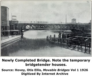
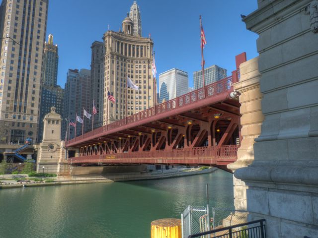
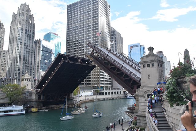
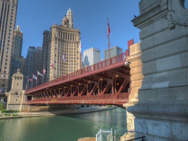
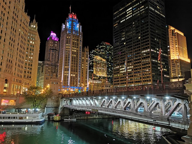
This bridge is commonly known as the Michigan Avenue Bridge, but officially renamed the DuSable Bridge in October 2010, to honor Jean Baptiste Pointe DuSable. DuSable was the first non-native settler in Chicago.
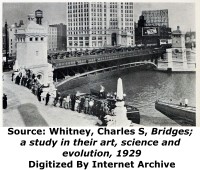
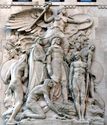
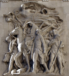
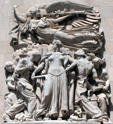
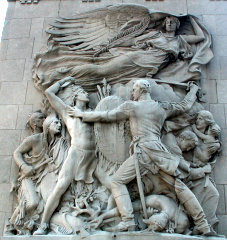
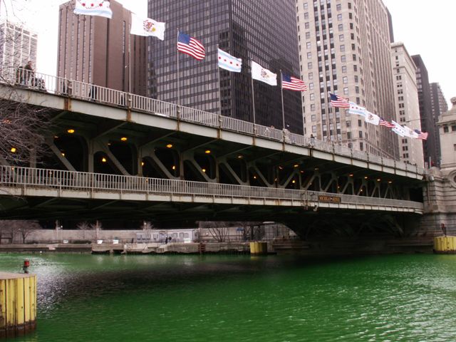
Connecting the downtown Loop to the Magnificent Mile, this is essentially the "Main Street Bridge" of Chicago, since it carries a busy roadway including as many as 30,000 pedestrians daily, and has been decorated to give it the feel of a gateway bridge. It is the most well-known of the Chicago bascule bridges. The composition of the trusses are comparable to other bridges in the city, except that this bridge is one of the uncommon common double-deck bridges in the city. The decorations such as the bridge-tender towers on this bridge, and the plaques on the bridge also set this aside from other Chicago bridges. The city has furthered this bridge's unique appearance by flying various flags on the bridge as well.
Most recently, the city of Chicago demonstrated not only their commitment to maintain this landmark historic bridge, but to restore and increase the historic integrity and beauty of the bridge in a unique restoration project executed in 2009. This project actually removed the modern and relatively mundane pedestrian railings on the bridge and placed replicas of the original ornate railings that were present when the bridge was built and had been replaced some years ago. The project has dramatically increased the historic appearance and beauty of the bridge. The project is significant because often railings are ignored during bridge preservation projects. However, the truth is railings are often play a significant role in the aesthetic quality of a historic bridge. Chicago has recognized this and set an example of other owners of historic bridges to follow.
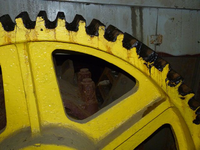
The southwest bridgetender house of this bridge contains the McCormick Bridgehouse & Chicago River Museum. With an entry fee of only four dollars, this small museum offers a history of the bridge and the Chicago River, but perhaps one of the most exciting parts of the museum is that they have opened up a viewing area to the public where you can view the motors, breaks, trunnion, and other mechanical parts of the movable bridge that are normally hidden and restricted from the view of the public. Some of the original electrical equipment that was saved from a previous renovation project is on display here as well.
From a distance this bridge looks square like the Wells Street Bridge, but if you walk on the lower sidewalk, you will note the bottom chord is arched a bit, and rises above the sidewalk at the middle of the span. Its truss design is more like Ohio Street.
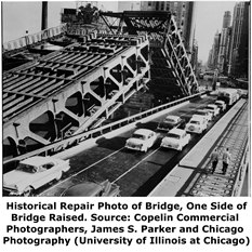
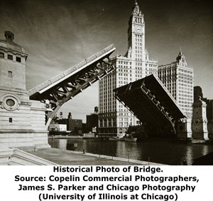
The Michigan Avenue Bridge was constructed as two parallel bridges, and could actually be lifted independently of each other. If you are on the lower level or on the Chicago Riverwalk which runs under the bridge, you can see how there are two trusses at the center of the bridge, and can thus visualize how the bridge is really two bridges side by side.
An unusual random trivia for this bridge is that in the 1920s, the city installed rubber tile pavement as an experimental surface type.
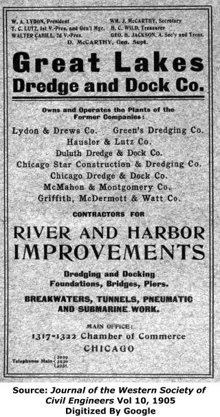
Both the substructure and superstructure for this bridge was built by the Great Lakes Dredge and Dock Company. This is somewhat unusual, since a lot of Chicago's bascule bridges had separate contractors for superstructure, substructure, and electrical work. Great Lakes Dredge and Dock was a frequent contractor for the substructures of bascule bridges in Chicago. This is an unusual case where the company also erected the superstructure. Formed in 1890 as Lydon and Drews Company, the company changed its name to Great Lakes Dredge and Dock Company in 1905. A local advertisement from that period shows that by that time the company had acquired several other companies. The company survives today and does work around the world according to the company's website.
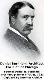
Information and Findings From Chicago Landmarks DesignationGeneral Information Address: Chicago River, between Michigan and Wabash Architect Information Raised and educated in Chicago, Daniel Hudson
Burnham (1846-1912) gained his early architectural experience with
William Le Baron Jenney, the so-called "father of the skyscraper." In
1873, Burnham formed a partnership with John Wellborn Root (1850-1891)
that produced such commissions as the Kent House, Masonic Temple
(demolished), Monadnock Building, Reliance, Rookery, St. Gabriel's
Church, and the Union Stock Yard Gate. This Bridge Is A Designated Chicago Landmark |
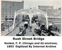
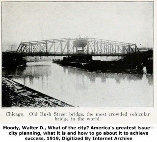
Above: The infamous Rush Street Bridge, the predecessor to the Michigan Avenue Bridge. Located a short distance west of Michigan Avenue, Rush Street and its bridge were an extremely busy bottleneck for Chicago. The extent of this bottleneck can be seen in two of the above photos, where what could only be described as a horse and buggy traffic jam is visible. Although the statements validity cannot be verified, one photo caption describes the bridge as "the most crowded vehicular bridge in the world." What was certainly true however, was the need for the Michigan Avenue Bridge.
Above: This photo shows an earlier Rush Street swing bridge that preceded the final Rush Street swing bridge. This earlier bridge, the first at this crossing noted in the Annual Reports of the Department of Public Works, was built in 1856, and was described as an "all iron bridge." As such, this bridge would have been among the earliest iron bridges built in the United States. The bridge was 211 feet in length. The hand-turned swing bridge was built by contractors Harper and Tweedale for $54, 000. An Annual Report of the Department of Public Works described the bridge as the "First iron bridge of the West." This was the first bridge to move beyond the simple wooden bridges built previously in Chicago. From this point forward, bridges tended to be built of either metal or a combination of metal and wood. However, for the next several decades, the bridges built, while an improvement over earlier bridges, still lacked a detailed structural and traffic analysis and tended to have a relatively limited service life. The 1856 Rush Street Bridge was rebuilt in 1864 by Fox and Howard, destroyed in the fire of 1871, and replaced in 1872 by another iron swing bridge, built by the Detroit Bridge Company. The bridge was 211 feet in length and 33 feet wide. This bridge was destroyed in a collision with the Schooner Granger on November 22, 1883. In 1884, a third iron swing bridge was built, this time by Rust and Coolidge, and the bridge was 240 feet long with a width of 59 feet.
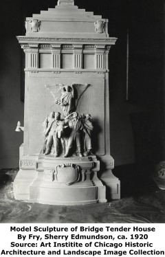
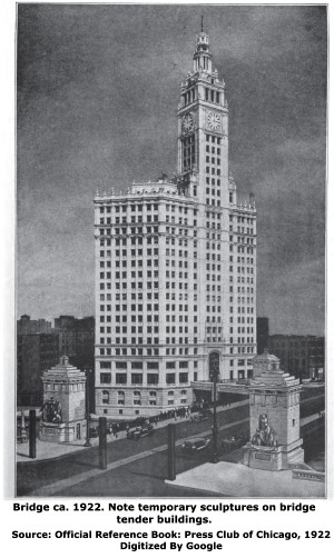
Above: Scale models of the bridge tender houses were created during the design of this bridge. As is clear from the photos of two models created, the final design of the sculptures ended up being different than those seen on the models.
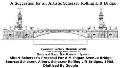
Above: In 1908, Albert Scherzer proposed the below "artistic" design for a Michigan Avenue Bridge. He got inspiration for the design from Pont Alexandre III in Paris, France, which had been completed in 1900.
Above: Joseph Strauss proposed the below extravagant design for a Michigan Avenue Bridge in 1913. The appearance of the bridge appears to be somewhat inspired by the Tower Bridge in London, England. The bridge was described in The American City as follows:
"The design illustrated herewith shows a form of movable bridge which has been proposed by the Strauss Bascule Bridge Company for the span to be built across the Chicago River at Michigan Avenue, Chicago, connecting the North and South Side Boulevards. It is of the vertical lift form, having neither cables nor chains, the counterbalancing being effected through levers which form a part of the suspension trusses from which the span and the load it carries are hung."
Historical Articles
View Detailed Articles About This Bridge's Substructure and Superstructure From Engineering News-Record
View A Selection of Additional Historical Articles Discussing This Bridge
![]()
Historic Bridges of Chicago and Cook County


Chicago and Cook County are home to one of the largest collections of historic bridges in the country, and no other city in the world has more movable bridges. HistoricBridges.org is proud to offer the most extensive coverage of historic Chicago bridges on the Internet.
General Chicago / Cook County Bridge Resources
Chicago's Bridges - By Nathan Holth, author of HistoricBridges.org, this book provides a discussion of the history of Chicago's movable bridges, and includes a virtual tour discussing all movable bridges remaining in Chicago today. Despite this broad coverage, the book is presented in a compact format that is easy to take with you and carry around for reference on a visit to Chicago. The book includes dozens of full color photos. Only $9.95 U.S! ($11.95 Canadian). Order on Amazon.
Chicago River Bridges - By Patrick T. McBriarty, this is a great companion to Holth's book shown above. This much larger book offers an extremely in-depth exploration of Chicago's movable highway bridges, including many crossings that have not existed for many years. Order Now Direct From The Publisher! or order on Amazon.
View Historic American Engineering Record (HAER) Overview of Chicago Bascule Bridges (HAER Data Pages, PDF)
Chicago Loop Bridges - Chicago Loop Bridges is another website on the Internet that is a great companion to the HistoricBridges.org coverage of the 18 movable bridges within the Chicago Loop. This website includes additional information such as connections to popular culture, overview discussions and essays about Chicago's movable bridges, additional videos, and current news and events relating to the bridges.
Additional Online Articles and Resources - This page is a large gathering of interesting articles and resources that HistoricBridges.org has uncovered during research, but which were not specific to a particular bridge listing.
This bridge is tagged with the following special condition(s): Double-Deck and Unorganized Photos
![]()
Photo Galleries and Videos: Michigan Avenue Bridge
Structure Overview
Original / Full Size PhotosA collection of overview photos that show the bridge as a whole and general areas of the bridge. This gallery offers photos in the highest available resolution and file size in a touch-friendly popup viewer.
Alternatively, Browse Without Using Viewer
![]()
Additional Overviews
Original / Full Size PhotosAdditional overview photos including from before the 2009 restoration was completed, views during St. Patricks Day with the green river, night views, and other special events. This gallery offers photos in the highest available resolution and file size in a touch-friendly popup viewer.
Alternatively, Browse Without Using Viewer
![]()
Structure Details
Original / Full Size PhotosA collection of detail photos that document the parts, construction, and condition of the bridge. This gallery offers photos in the highest available resolution and file size in a touch-friendly popup viewer.
Alternatively, Browse Without Using Viewer
![]()
Buildings and Plaques
Original / Full Size PhotosPhotos of the plaques and bridgetender buildings including the bas relief sculptures. This gallery offers photos in the highest available resolution and file size in a touch-friendly popup viewer.
Alternatively, Browse Without Using Viewer
![]()
Interior
Original / Full Size PhotosPhotos taken in the McCormick Bridgehouse & Chicago River Museum. Photos showing the structural interior of the bridgetender building, as well as the interior electrical mechanical equipment for the bridge including gears, drive system, and trunnion. Also includes views looking out from the top level of the bridgetender building. This gallery offers photos in the highest available resolution and file size in a touch-friendly popup viewer.
Alternatively, Browse Without Using Viewer
![]()
Structure Overview
Mobile Optimized PhotosA collection of overview photos that show the bridge as a whole and general areas of the bridge. This gallery features data-friendly, fast-loading photos in a touch-friendly popup viewer.
Alternatively, Browse Without Using Viewer
![]()
Additional Overviews
Mobile Optimized PhotosAdditional overview photos including from before the 2009 restoration was completed, views during St. Patricks Day with the green river, night views, and other special events. This gallery features data-friendly, fast-loading photos in a touch-friendly popup viewer.
Alternatively, Browse Without Using Viewer
![]()
Structure Details
Mobile Optimized PhotosA collection of detail photos that document the parts, construction, and condition of the bridge. This gallery features data-friendly, fast-loading photos in a touch-friendly popup viewer.
Alternatively, Browse Without Using Viewer
![]()
Buildings and Plaques
Mobile Optimized PhotosPhotos of the plaques and bridgetender buildings including the bas relief sculptures. This gallery features data-friendly, fast-loading photos in a touch-friendly popup viewer.
Alternatively, Browse Without Using Viewer
![]()
Interior
Mobile Optimized PhotosPhotos taken in the McCormick Bridgehouse & Chicago River Museum. Photos showing the structural interior of the bridgetender building, as well as the interior electrical mechanical equipment for the bridge including gears, drive system, and trunnion. Also includes views looking out from the top level of the bridgetender building. This gallery features data-friendly, fast-loading photos in a touch-friendly popup viewer.
Alternatively, Browse Without Using Viewer
![]()
Additional Unorganized Photos
Original / Full Size PhotosA supplemental collection of photos that are from additional visit(s) to the bridge and have not been organized or captioned. This gallery offers photos in the highest available resolution and file size in a touch-friendly popup viewer.
Alternatively, Browse Without Using Viewer
![]()
Additional Unorganized Photos
Mobile Optimized PhotosA supplemental collection of photos that are from additional visit(s) to the bridge and have not been organized or captioned. This gallery features data-friendly, fast-loading photos in a touch-friendly popup viewer.
Alternatively, Browse Without Using Viewer
![]()
Leaf Being Raised
Full Motion VideoNote: The downloadable high quality version of this video (available on the video page) is well worth the download since it offers excellent 1080 HD detail and is vastly more impressive than the compressed streaming video. Streaming video of the bridge. Also includes a higher quality downloadable video for greater clarity or offline viewing.
![]()
Leaf Being Raised
Full Motion VideoStreaming video of the bridge. Also includes a higher quality downloadable video for greater clarity or offline viewing.
![]()
Maps and Links: Michigan Avenue Bridge
Coordinates (Latitude, Longitude):
Search For Additional Bridge Listings:
Bridgehunter.com: View listed bridges within 0.5 miles (0.8 kilometers) of this bridge.
Bridgehunter.com: View listed bridges within 10 miles (16 kilometers) of this bridge.
Additional Maps:
Google Streetview (If Available)
GeoHack (Additional Links and Coordinates)
Apple Maps (Via DuckDuckGo Search)
Apple Maps (Apple devices only)
Android: Open Location In Your Map or GPS App
Flickr Gallery (Find Nearby Photos)
Wikimedia Commons (Find Nearby Photos)
Directions Via Sygic For Android
Directions Via Sygic For iOS and Android Dolphin Browser
USGS National Map (United States Only)
Historical USGS Topo Maps (United States Only)
Historic Aerials (United States Only)
CalTopo Maps (United States Only)


