We Recommend:
Bach Steel - Experts at historic truss bridge restoration.
BridgeHunter.com Phase 1 is released to the public! - Visit Now
Rockford Railroad Bridge

Primary Photographer(s): Nathan Holth
Bridge Documented: March 6, 2006
Rockford: Kent County, Michigan: United States
1898 By Builder/Contractor: Detroit Bridge and Iron Works of Detroit, Michigan
Not Available or Not Applicable
134.0 Feet (40.8 Meters)
134.0 Feet (40.8 Meters)
Not Available
1 Main Span(s)
Not Applicable

View Information About HSR Ratings
Bridge Documentation
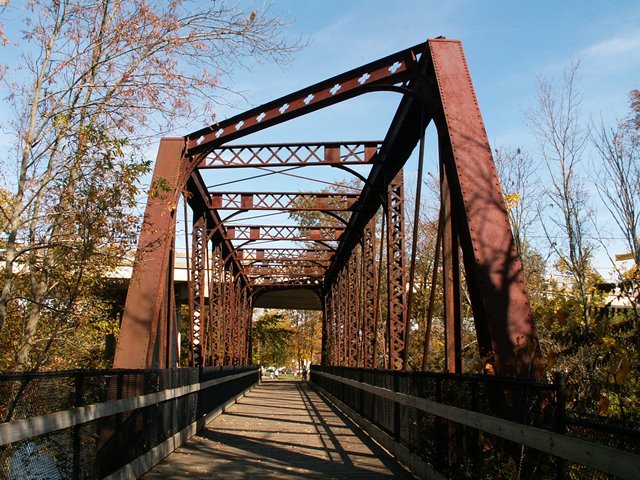
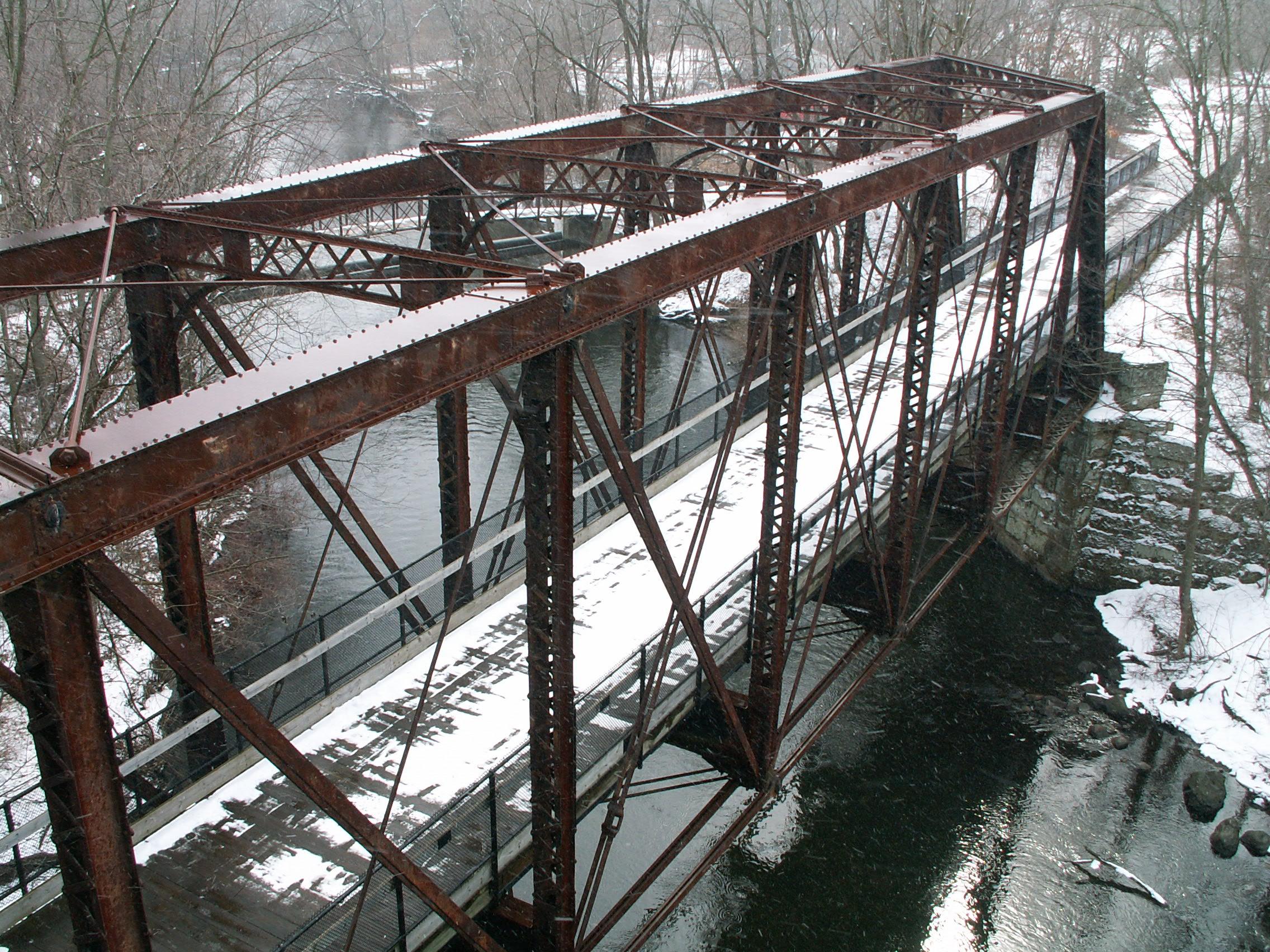
This is a beautiful example of a railroad bridge. It is noted for its skew which appears be about forty-five degrees. This gives the bridge a distinctive appearance. The bridge is an eight panel through truss with pinned connections. The bridge sits on stone abutments. Both types of v-lacing are present on this bridge. The vertical members feature the normal v-lacing that is almost always the type seen on highway truss bridges where each piece of the lacing is a bar with rounded ends, and each end has a single rivet holding it in place on top of the adjacent lacing bar. Under the top chord is the more unusual style usually found on railroad bridges. In this type, each piece of v-lacing is a bar with no rounded ends and has its own two rivets connecting it to the beam, rather than sharing the rivet with another piece of the v-lacing. Lattice is present on the sway bracing. For a railroad bridge, the portal bracing is rather ornate. It has cloverleaf type designs on the main part of the bracing, with a cloverleaf and two teardrop shapes on the corners of the bracing. This certainly is an unusual railroad bridge, and it has a lot of beauty as well. The clover leaves on the portal bracing are something shared with some other truss bridges that were associated with Grand Rapids and Indiana Railroad, which is who apparently designed this bridge. That said, few examples of these uniquely decorated railroad truss bridges remain nationwide today, and so this is a significant historic bridge.
More recently, this bridge was previously part of the Michigan Northern Railway, which stopped running trains on the line in 1984. Thanks to Les Hale for providing this historical tidbit. The bridge is today converted for pedestrian use. Conversion was limited to removing the tracks and putting a new deck in, as well as adding somewhat unsightly cyclone fencing for railing on the bridge. No structural work of note appears to have been done to the truss itself, which is unaltered and retains good historic integrity.
![]()
Photo Galleries and Videos: Rockford Railroad Bridge
Sunny Autumn Photo-Documentation
Original / Full Size PhotosA collection of overview and detail photos. This gallery offers photos in the highest available resolution and file size in a touch-friendly popup viewer.
Alternatively, Browse Without Using Viewer
![]()
Sunny Autumn Photo-Documentation
Mobile Optimized PhotosA collection of overview and detail photos. This gallery features data-friendly, fast-loading photos in a touch-friendly popup viewer.
Alternatively, Browse Without Using Viewer
![]()
Snowy Winter Bridge Photo-Documentation
A collection of overview and detail photos. This photo gallery contains a combination of Original Size photos and Mobile Optimized photos in a touch-friendly popup viewer.Alternatively, Browse Without Using Viewer
![]()
Maps and Links: Rockford Railroad Bridge
Coordinates (Latitude, Longitude):
Search For Additional Bridge Listings:
Bridgehunter.com: View listed bridges within 0.5 miles (0.8 kilometers) of this bridge.
Bridgehunter.com: View listed bridges within 10 miles (16 kilometers) of this bridge.
Additional Maps:
Google Streetview (If Available)
GeoHack (Additional Links and Coordinates)
Apple Maps (Via DuckDuckGo Search)
Apple Maps (Apple devices only)
Android: Open Location In Your Map or GPS App
Flickr Gallery (Find Nearby Photos)
Wikimedia Commons (Find Nearby Photos)
Directions Via Sygic For Android
Directions Via Sygic For iOS and Android Dolphin Browser
USGS National Map (United States Only)
Historical USGS Topo Maps (United States Only)
Historic Aerials (United States Only)
CalTopo Maps (United States Only)


