

View Information About HSR Ratings
Additional Information: An engineering periodical reported the letting of this bridge's contract as follows: "Portland, Mich. -- the Wynkoop & McGormley Co., Toledo, Ohio has been awarded contract for the construction of a single span steel bridge across the Grand River at Turner's Ford, in Danby Township at $9,444"
This bridge was formally found historic by the Michigan Historic Bridge Inventory, although the now-defunct MDOT Historic Bridge website didn't have a lot to say about it... their only comment was "Year Built: 1910. This is one of only three Parker through trusses identified in the Historic Bridge Inventory. Wynkoop & McGorley of Toledo, Ohio, the builder, was an important metal truss bridge company in the midwest."
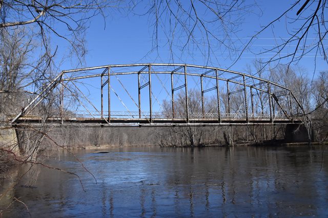
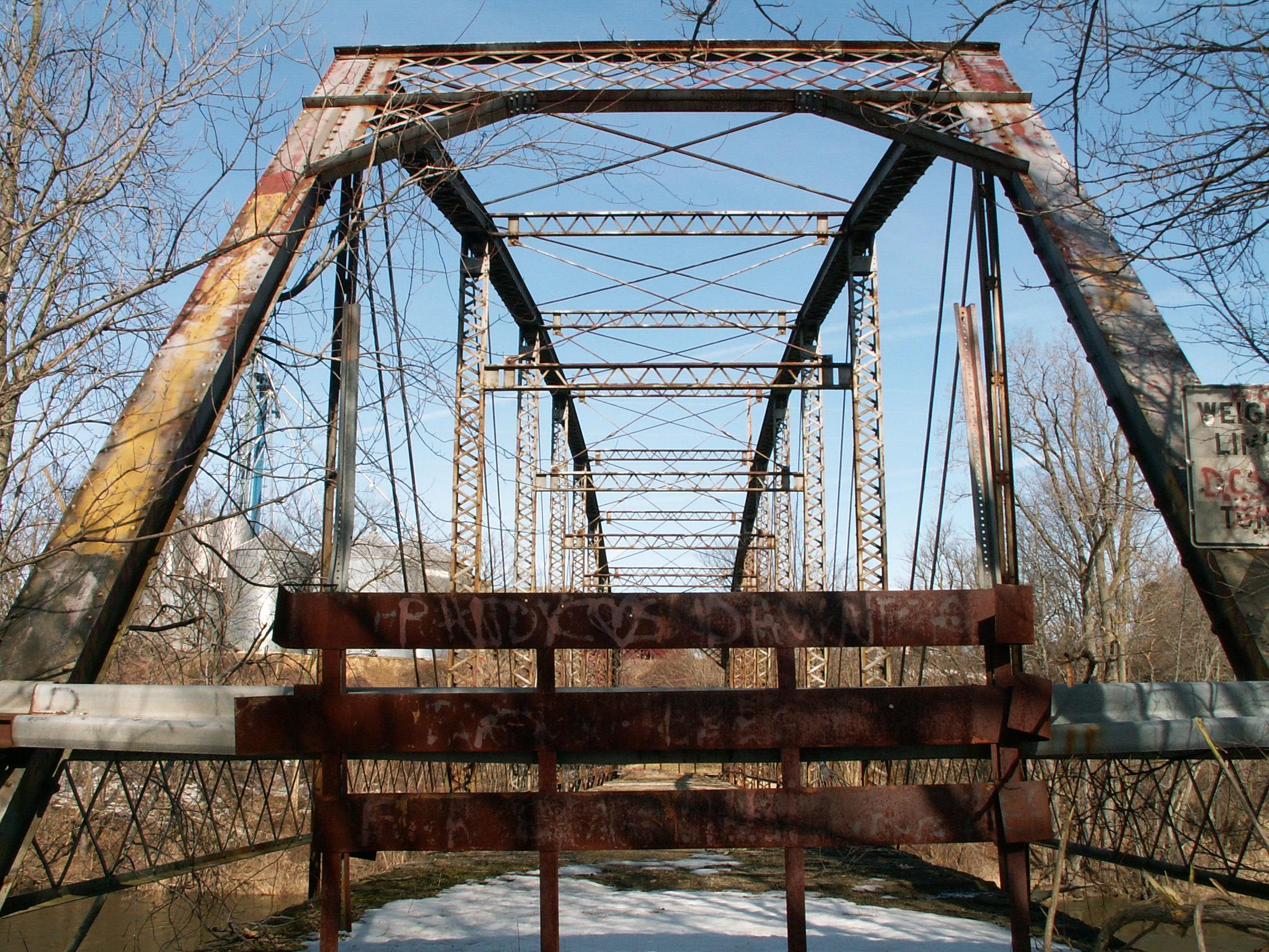
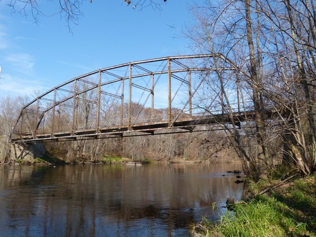
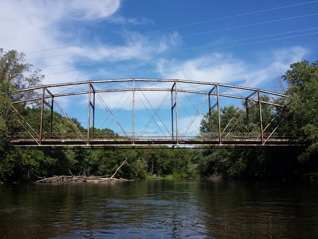
There are only three through Parker truss bridges remaining in Michigan, and this is one. The other two are the Kent Street Bridge and the Upton Road Bridge. The Parker truss is a modification of the Pratt design, where the top chord was polygonal instead of constantly parallel to the bottom chord. This Turner Road bridge is similar, although not the same, as the somewhat nearby Kent Street Bridge. Turner Road retains a higher degree of integrity and aesthetic beauty than Kent Street. The Turner Road Bridge was built by Wynkoop & McGormley of Toledo, Ohio the same firm that built the Kent Street Bridge three years earlier. They were agents of the Toledo-Massillon Bridge Company. The portal bracing is perhaps the most obvious difference in construction between Kent Street and Turner Street. They are the same design, but the Turner Road portal bracing is a bit smaller.
The Turner Road Bridge is pin connected, and has a concrete deck, which is deteriorating. The bridge sits on concrete abutments. Original lattice guardrails are present on the bridge. The bridge is comprised of nine panels. V-lacing on the bridge is extensive: on the vertical members, under the top chord, and on the sway bracing.
This bridge looks to be in decent structural condition, and it should be restored. However, after seeing what happened with the Kent Street Bridge, it is important to stipulate that the original railings be retained, and also that the bridge be restored here in its original, scenic location. Its location in a state game area makes it a great candidate for restoration, since it is already in a public park-like setting. Since it is one of only three remaining through Parker trusses, their statewide rarity is comparable to the overrated wooden covered bridges.
This bridge is tagged with the following special condition(s): Unorganized Photos
![]()
![]()
![]()
![]()
![]()
![]()
Coordinates (Latitude, Longitude):
Search For Additional Bridge Listings:
Bridgehunter.com: View listed bridges within 0.5 miles (0.8 kilometers) of this bridge.
Bridgehunter.com: View listed bridges within 10 miles (16 kilometers) of this bridge.
Additional Maps:
Google Streetview (If Available)
GeoHack (Additional Links and Coordinates)
Apple Maps (Via DuckDuckGo Search)
Apple Maps (Apple devices only)
Android: Open Location In Your Map or GPS App
Flickr Gallery (Find Nearby Photos)
Wikimedia Commons (Find Nearby Photos)
Directions Via Sygic For Android
Directions Via Sygic For iOS and Android Dolphin Browser
USGS National Map (United States Only)
Historical USGS Topo Maps (United States Only)
Historic Aerials (United States Only)
CalTopo Maps (United States Only)

© Copyright 2003-2026, HistoricBridges.org. All Rights Reserved. Disclaimer: HistoricBridges.org is a volunteer group of private citizens. HistoricBridges.org is NOT a government agency, does not represent or work with any governmental agencies, nor is it in any way associated with any government agency or any non-profit organization. While we strive for accuracy in our factual content, HistoricBridges.org offers no guarantee of accuracy. Information is provided "as is" without warranty of any kind, either expressed or implied. Information could include technical inaccuracies or errors of omission. Opinions and commentary are the opinions of the respective HistoricBridges.org member who made them and do not necessarily represent the views of anyone else, including any outside photographers whose images may appear on the page in which the commentary appears. HistoricBridges.org does not bear any responsibility for any consequences resulting from the use of this or any other HistoricBridges.org information. Owners and users of bridges have the responsibility of correctly following all applicable laws, rules, and regulations, regardless of any HistoricBridges.org information.
![]()