

View Information About HSR Ratings
This bridge is technically a relic from US-112, although for the sake of clarity, it is usually considered the Old US-12 Bridge. US-12 was during the time this bridge was built, right through 1933 when the Michigan State Highway Department realigned the highway south of the truss bridge, actually US-112. At that time, US-12 followed the current route of I-94. Remnants of this highway, which passed through cities like Kalamazoo, Battle Creek, Albion, Jackson, and Paw Paw, are commonly named Michigan Avenue today. Only in 1962 when I-94 was completed did US-112 become US-12 and the Michigan Avenue US-12 was decommissioned.
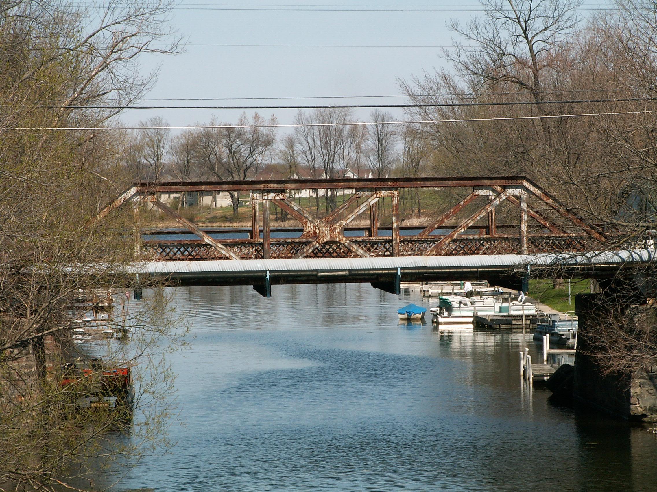
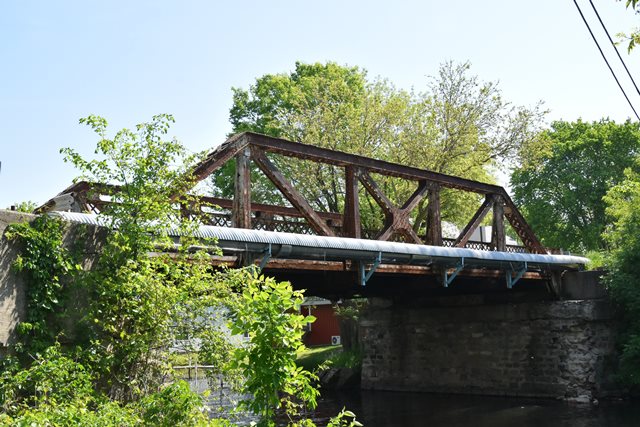
This bridge is unusual because it is a Michigan State Highway Department standard plan structure and bears much similarity to Michigan's standard Parker pony truss plan as seen in bridges like M-86. This is a relatively short bridge, and as such a Parker truss was most likely unnecessary here.
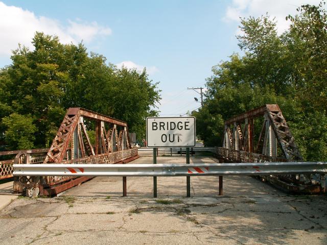
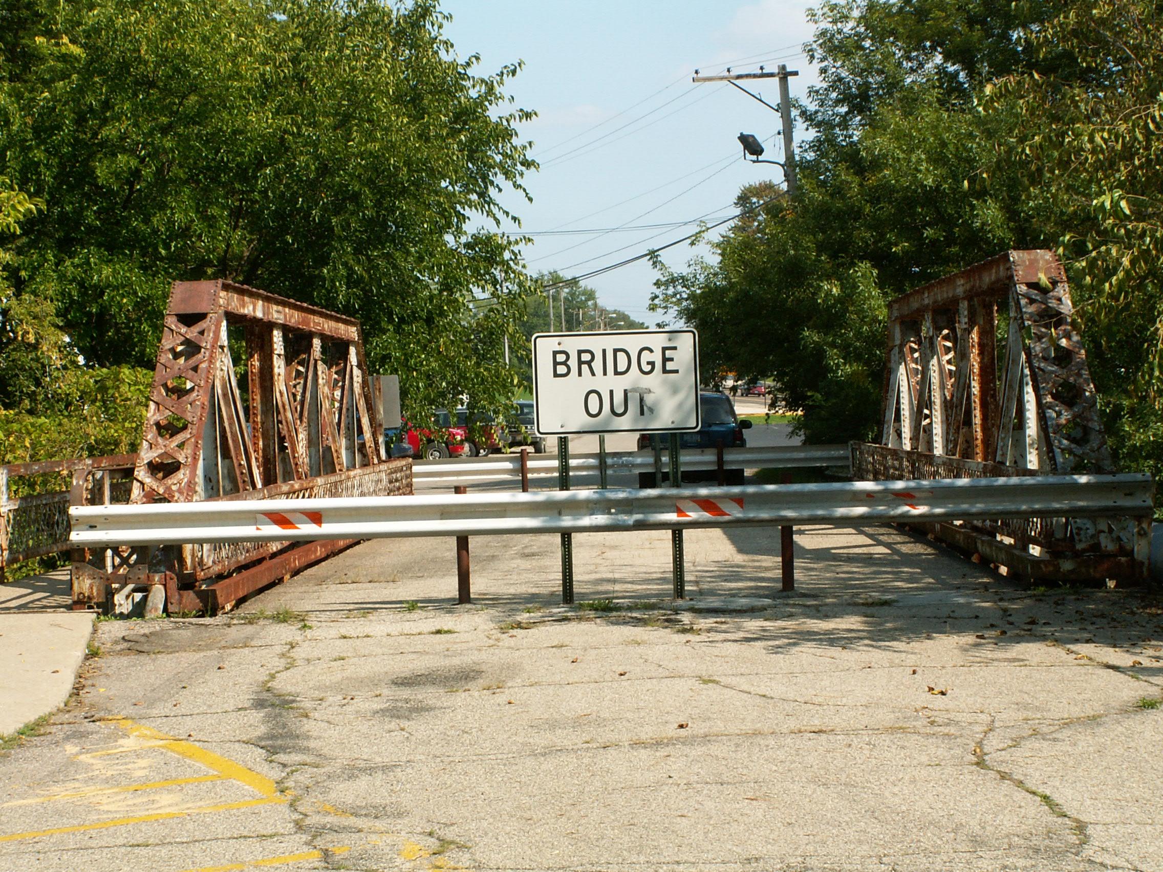
In a county where ancient pin-connected truss bridges like the Gower Road Bridge, plus Stancer Road Bridge, remain open to traffic, finding this 1920s truss bridge with riveted connections closed to traffic might come as a shock. The shock might be amplified by the fact that the M-86 Bridge, one of those similar Parker truss bridges, is open to trunk line traffic with no weight limit at all. The Old US-12 Bridge has severe rust deterioration on the bottom chord, floor beams, and deck stringers. It is likely due to salt damage. The older pin-connected bridges are both on dirt roads, where salt is not applied in the winter, accounting for why a newer and originally stronger bridge is today in worse condition. This bridge underscores the need to explore and utilize alternative forms of de-icing that do not deteriorate bridges, and for that matter cars as well.
Up until 1997, the 1933 bridge that was built just a little bit south of this bridge to carry the realigned US-112 was still standing, displaying two generations of bridge design. Unfortunately, that bridge was demolished in 1997.
This bridge is tagged with the following special condition(s): Unorganized Photos
![]()
![]()
![]()

![]()
![]()
![]()
This historic bridge has been demolished. This map is shown for reference purposes only.
Coordinates (Latitude, Longitude):
Search For Additional Bridge Listings:
Bridgehunter.com: View listed bridges within 0.5 miles (0.8 kilometers) of this bridge.
Bridgehunter.com: View listed bridges within 10 miles (16 kilometers) of this bridge.
Additional Maps:
Google Streetview (If Available)
GeoHack (Additional Links and Coordinates)
Apple Maps (Via DuckDuckGo Search)
Apple Maps (Apple devices only)
Android: Open Location In Your Map or GPS App
Flickr Gallery (Find Nearby Photos)
Wikimedia Commons (Find Nearby Photos)
Directions Via Sygic For Android
Directions Via Sygic For iOS and Android Dolphin Browser
USGS National Map (United States Only)
Historical USGS Topo Maps (United States Only)
Historic Aerials (United States Only)
CalTopo Maps (United States Only)

© Copyright 2003-2026, HistoricBridges.org. All Rights Reserved. Disclaimer: HistoricBridges.org is a volunteer group of private citizens. HistoricBridges.org is NOT a government agency, does not represent or work with any governmental agencies, nor is it in any way associated with any government agency or any non-profit organization. While we strive for accuracy in our factual content, HistoricBridges.org offers no guarantee of accuracy. Information is provided "as is" without warranty of any kind, either expressed or implied. Information could include technical inaccuracies or errors of omission. Opinions and commentary are the opinions of the respective HistoricBridges.org member who made them and do not necessarily represent the views of anyone else, including any outside photographers whose images may appear on the page in which the commentary appears. HistoricBridges.org does not bear any responsibility for any consequences resulting from the use of this or any other HistoricBridges.org information. Owners and users of bridges have the responsibility of correctly following all applicable laws, rules, and regulations, regardless of any HistoricBridges.org information.
![]()