

View Information About HSR Ratings
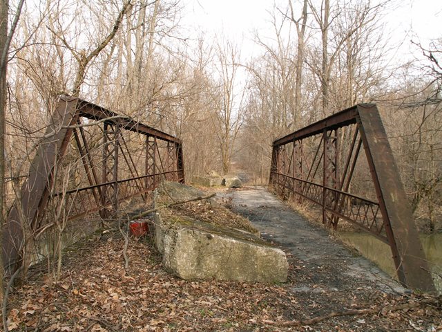
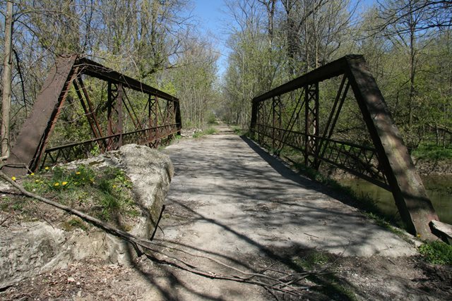
This is a four-panel half-hip pony truss. It features a jack-arch deck design. This bridge has a listed construction date of 1910 which may be a guess date and inaccurate. However, because of the jack-arch deck the bridge does appear to be a 1900-1910 bridge since that deck type was popular in Michigan during this time. This bridge is an interesting comparison to the Card Road Bridge in Macomb County, which is a Warren pony truss with riveted connections. At 77 feet in length, it is a bit longer, but guardrails, deck and general feel of the bridge are similar. Card Road was also listed as having been built in 1910. As such, it is a pretty straightforward pinned versus riveted comparison in regards to connection type. The 1900-1910 period was one of transition from pin connections to riveted connections. Thus, the Bruce Highway Bridge would represent the old method, while the Card Road Bridge would have been more cutting edge for the time.
Technical issues aside, this is a nice looking bridge hidden away in a very secluded natural area. The road leading up to it is seasonal at best. It would be nice to see this bridge restored in place for pedestrian use and a nature trail made here. Instead this bridge sits, slowly rusting away forgotten by all. The bridge would also be a good candidate to relocate, restore, and reuse as a trail bridge in a different location.
This bridge is tagged with the following special condition(s): Available and Unorganized Photos
![]()
![]()
![]()
![]()
Coordinates (Latitude, Longitude):
Search For Additional Bridge Listings:
Bridgehunter.com: View listed bridges within 0.5 miles (0.8 kilometers) of this bridge.
Bridgehunter.com: View listed bridges within 10 miles (16 kilometers) of this bridge.
Additional Maps:
Google Streetview (If Available)
GeoHack (Additional Links and Coordinates)
Apple Maps (Via DuckDuckGo Search)
Apple Maps (Apple devices only)
Android: Open Location In Your Map or GPS App
Flickr Gallery (Find Nearby Photos)
Wikimedia Commons (Find Nearby Photos)
Directions Via Sygic For Android
Directions Via Sygic For iOS and Android Dolphin Browser
USGS National Map (United States Only)
Historical USGS Topo Maps (United States Only)
Historic Aerials (United States Only)
CalTopo Maps (United States Only)

© Copyright 2003-2025, HistoricBridges.org. All Rights Reserved. Disclaimer: HistoricBridges.org is a volunteer group of private citizens. HistoricBridges.org is NOT a government agency, does not represent or work with any governmental agencies, nor is it in any way associated with any government agency or any non-profit organization. While we strive for accuracy in our factual content, HistoricBridges.org offers no guarantee of accuracy. Information is provided "as is" without warranty of any kind, either expressed or implied. Information could include technical inaccuracies or errors of omission. Opinions and commentary are the opinions of the respective HistoricBridges.org member who made them and do not necessarily represent the views of anyone else, including any outside photographers whose images may appear on the page in which the commentary appears. HistoricBridges.org does not bear any responsibility for any consequences resulting from the use of this or any other HistoricBridges.org information. Owners and users of bridges have the responsibility of correctly following all applicable laws, rules, and regulations, regardless of any HistoricBridges.org information.
![]()