We Recommend:
Bach Steel - Experts at historic truss bridge restoration.
BridgeHunter.com Phase 1 is released to the public! - Visit Now
State Street Bridge
Bataan-Corregidor Memorial Bridge
Primary Photographer(s): Nathan Holth
Bridge Documented: August 12, 2006 - October 7, 2017
Chicago: Cook County, Illinois: United States
Metal Rivet-Connected Pratt Railing Height Truss, Movable: Double Leaf Bascule (Fixed Trunnion) and Approach Spans: Metal Stringer (Multi-Beam), Fixed
1949 By Builder/Contractor: Overland Construction Company of Chicago, Illinois and Engineer/Design: City of Chicago
1994
245.0 Feet (74.7 Meters)
307.0 Feet (93.6 Meters)
72 Feet (21.95 Meters)
1 Main Span(s) and 5 Approach Span(s)
16604827322

View Information About HSR Ratings
Bridge Documentation
View Archived National Bridge Inventory Report - Has Additional Details and Evaluation
View Historic American Engineering Record (HAER) Documentation For This Bridge
HAER Data Pages, PDF
About This Bridge
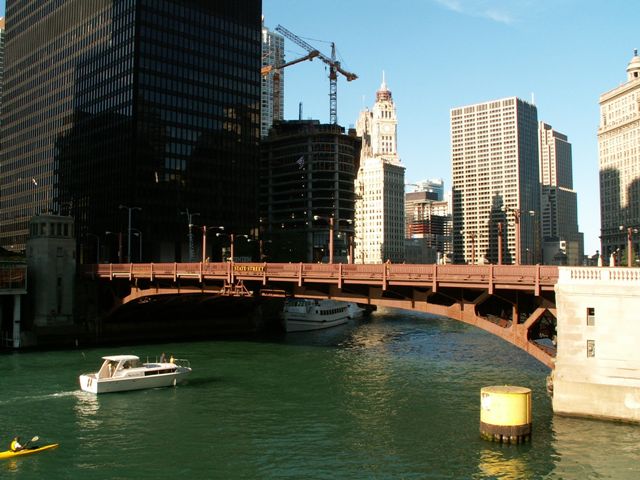
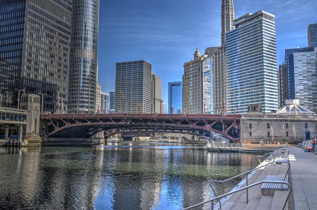
This bridge is among the newer of Chicago's deck truss bascule bridges with a 1949 construction date. Historic American Engineering Record mentions a 1942 construction date, but the bridge was not actually completed until 1949 due to steel shortages from World War II and also issues with the Red Line subway construction that was in progress at the time as well in this area of State Street. The bridge is an example of the unique Chicago design which raised the position of the deck truss up just far enough so that the top chord is above the deck like a pony truss, where it can act as a guardrail and also increase both the clearance under the bridge and the streamlined aesthetics of the bridge. This design is known as the railing height truss.

Today, there are a number of bridges in Chicago that display the railing height truss design, and they are all attractive structures, however the newer examples display less ornate bridge tender houses. Constructed in 1949, this bridge is one of the last bridges built in Chicago that has bridge tender houses that display significant aesthetic enhancements. Although not as ornate as earlier bridges from the 1920s-1930s, this bridge's bridge tender houses do display some noteworthy architectural details.
This bridge is one of the widest Chicago bascule bridges and serves an impressive eight lanes of traffic. To accommodate and support this width, the bridge is designed with three truss lines. There are three railing height trusses, including State Street Bridge, that are located one right after another on this section of the river. Of those three, this is the widest, the only one with three truss lines.
65th Anniversary In 2014
This bridge was completed and opened on May 28, 1949. It celebrates its 65th Anniversary in 2014. Click here to view a commemoration article by ChicagoLoopBridges.com.
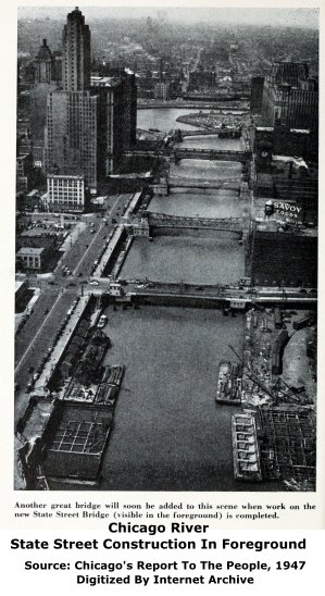
Above: This aerial view of the bridge during the earlier stages of construction shows the abutments under construction. The trusses of this bridge were assembled in sections off-site, and brought to the construction site on a barge. In the above photo, one of the northern truss sections can be seen off to the side on a barge. One of the southern truss sections can be seen held by cranes on a barge, which is floating right in between the abutments.
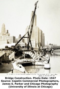
Above: This photo shows the bridge construction site. In this photo, the trunnion girders are visible. These unusually shaped girders are a design used on a number of Chicago bascule bridges. Trunnion girders are where the trunnion (and thus the entirety of a leaf) are supported. They address the issues that arise from having a large tail pit for the counterweight in the same location where the trunnion and bascule leaf need to rest and be supported.
Above: At left, a conceptual drawing provided to give an idea of what the bridge would look like when completed. At right, a photo showing abutment construction.
Above: This photo shows the dedication and ribbon cutting for the existing State Street Bridge.
Above: While it did not actually win an official award, the State Street Bridge did get recognized in 1949 by the American Institute of Steel Construction for its beauty. It did get honorable mention however, receiving the certificate seen here.
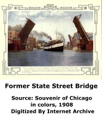
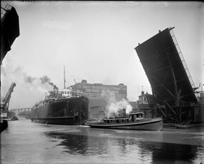
The above photos show the bridge that preceded the existing bridge. This bridge was a Scherzer rolling lift bascule pony truss bridge. It was built in 1903 with American Bridge Company as the superstructure contractor.
Above: Views of the Chicago River in general, showing the previous bridge at this location built in 1903.
Above: Two additional photos of the previous Scherzer rolling lift bascule bridge. Source: Library of Congress.
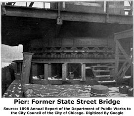
Above: Photos of the bridge that preceded the Scherzer rolling lift bridge. It was a 184 foot long metal through truss swing bridge with substantial ornamental details on the portal bracing. The bridge was completed in 1872 following the Chicago Fire. The superstructure contractor was the Keystone Bridge Company. This bridge was rebuilt in 1887 by A. Gottlieb and Company. The center pier of the swing bridge was reconstructed in 1898. Only five years after this reconstruction, the entire bridge was replaced with the Scherzer rolling lift bascule bridge.
Above: A photo of an early State Street Bridge, presumed to be the 184 foot wooden swing bridge built in 1864 by contractors Fox and Howard. This bridge was destroyed in the 1871 fire.
|
Main Plaque BATAAN-CORREGIDORMEMORIAL BRIDGE -- 1949 -- CITY OF CHICAGO MARTIN H. KENNELLY Mayor OSCAR E. HEWITT Commissioner of Public Works W. W. DE BERARD City Engineer STEPHEN J. MICHUDA City Bridge & Viad. Engineer
CONTRACTORS Fitz Simons & Connell Dredge and Dock Co. The Overland Construction Co. Fries-Walters Co. |
|
Dedication Plaque BATAAN-CORREGIDORMEMORIAL BRIDGE DEDICATED TO THE MEMORY OF THOSE GALLANT HEROES FROM THE CHICAGO AREA WHO WERE MEMBERS OF THE BESIEGED GARRISON ON THE BATAAN PENINSULA AND AT CORREGIDOR, PHILIPPINE ISLANDS, IN WORLD WAR II. MAY THE COURAGE AND FORTITUDE DISPLAYED BY THIS GROUP IN THE FACE OF ADVERSITY BE A CONSTANT INSPIRATION TO OUR CITIZENS 1949 |
Rededication Plaque In commemoration of the 100th Anniversary of thePhilippine Independence, and on the occasion of Bataan Day APRIL 9, 1998, this bridge has been re- dedicated by Mayor Richard M. Daley in honor of all the Filipino and American Veterans who fought side-by-side during the Heroic Fall of Bataan and Corregidor Island, Philippines in 1942.
Donated by the Philippine Department of Tourism |
![]()
Historic Bridges of Chicago and Cook County


Chicago and Cook County are home to one of the largest collections of historic bridges in the country, and no other city in the world has more movable bridges. HistoricBridges.org is proud to offer the most extensive coverage of historic Chicago bridges on the Internet.
General Chicago / Cook County Bridge Resources
Chicago's Bridges - By Nathan Holth, author of HistoricBridges.org, this book provides a discussion of the history of Chicago's movable bridges, and includes a virtual tour discussing all movable bridges remaining in Chicago today. Despite this broad coverage, the book is presented in a compact format that is easy to take with you and carry around for reference on a visit to Chicago. The book includes dozens of full color photos. Only $9.95 U.S! ($11.95 Canadian). Order Now Direct From The Publisher! or order on Amazon.
Chicago River Bridges - By Patrick T. McBriarty, this is a great companion to Holth's book shown above. This much larger book offers an extremely in-depth exploration of Chicago's movable highway bridges, including many crossings that have not existed for many years. Order Now Direct From The Publisher! or order on Amazon.
View Historic American Engineering Record (HAER) Overview of Chicago Bascule Bridges (HAER Data Pages, PDF)
Chicago Loop Bridges - Chicago Loop Bridges is another website on the Internet that is a great companion to the HistoricBridges.org coverage of the 18 movable bridges within the Chicago Loop. This website includes additional information such as connections to popular culture, overview discussions and essays about Chicago's movable bridges, additional videos, and current news and events relating to the bridges.
Additional Online Articles and Resources - This page is a large gathering of interesting articles and resources that HistoricBridges.org has uncovered during research, but which were not specific to a particular bridge listing.
This bridge is tagged with the following special condition(s): Unorganized Photos
![]()
Photo Galleries and Videos: State Street Bridge
Structure Overview
Original / Full Size PhotosA collection of overview photos that show the bridge as a whole and general areas of the bridge. This gallery offers photos in the highest available resolution and file size in a touch-friendly popup viewer.
Alternatively, Browse Without Using Viewer
![]()
Structure Details
Original / Full Size PhotosA collection of detail photos that document the parts, construction, and condition of the bridge. This gallery offers photos in the highest available resolution and file size in a touch-friendly popup viewer.
Alternatively, Browse Without Using Viewer
![]()
Structure Overview
Mobile Optimized PhotosA collection of overview photos that show the bridge as a whole and general areas of the bridge. This gallery features data-friendly, fast-loading photos in a touch-friendly popup viewer.
Alternatively, Browse Without Using Viewer
![]()
Structure Details
Mobile Optimized PhotosA collection of detail photos that document the parts, construction, and condition of the bridge. This gallery features data-friendly, fast-loading photos in a touch-friendly popup viewer.
Alternatively, Browse Without Using Viewer
![]()
Additional Unorganized Photos
Original / Full Size PhotosA supplemental collection of photos that are from additional visit(s) to the bridge and have not been organized or captioned. This gallery offers photos in the highest available resolution and file size in a touch-friendly popup viewer.
Alternatively, Browse Without Using Viewer
![]()
Additional Unorganized Photos
Mobile Optimized PhotosA supplemental collection of photos that are from additional visit(s) to the bridge and have not been organized or captioned. This gallery features data-friendly, fast-loading photos in a touch-friendly popup viewer.
Alternatively, Browse Without Using Viewer
![]()
Raising The Bridge
Full Motion VideoOblique view. Note: The downloadable high quality version of this video (available on the video page) is well worth the download since it offers excellent 1080 HD detail and is vastly more impressive than the compressed streaming video. Streaming video of the bridge. Also includes a higher quality downloadable video for greater clarity or offline viewing.
![]()
Raising The Bridge
Full Motion VideoElevation from southeast quadrant. Streaming video of the bridge. Also includes a higher quality downloadable video for greater clarity or offline viewing.
![]()
Raising The Bridge
Full Motion VideoView beside bridge from southeast quadrant. Streaming video of the bridge. Also includes a higher quality downloadable video for greater clarity or offline viewing.
![]()
Warning Lights
Full Motion VideoA short video showing the unusual lights that spell out STOP and flash when a Chicago bridge is raised. Streaming video of the bridge. Also includes a higher quality downloadable video for greater clarity or offline viewing.
![]()
Hosing Down The Bridge
Full Motion VideoTaken June 2011. Chicago Fire Department trucks and boat hose down a bridge that was stuck and would not open. The cold water helps the metal contract, allowing the bridge to raise. Streaming video of the bridge. Also includes a higher quality downloadable video for greater clarity or offline viewing.
![]()
Maps and Links: State Street Bridge
Coordinates (Latitude, Longitude):
Search For Additional Bridge Listings:
Bridgehunter.com: View listed bridges within 0.5 miles (0.8 kilometers) of this bridge.
Bridgehunter.com: View listed bridges within 10 miles (16 kilometers) of this bridge.
Additional Maps:
Google Streetview (If Available)
GeoHack (Additional Links and Coordinates)
Apple Maps (Via DuckDuckGo Search)
Apple Maps (Apple devices only)
Android: Open Location In Your Map or GPS App
Flickr Gallery (Find Nearby Photos)
Wikimedia Commons (Find Nearby Photos)
Directions Via Sygic For Android
Directions Via Sygic For iOS and Android Dolphin Browser
USGS National Map (United States Only)
Historical USGS Topo Maps (United States Only)
Historic Aerials (United States Only)
CalTopo Maps (United States Only)


