

View Information About HSR Ratings
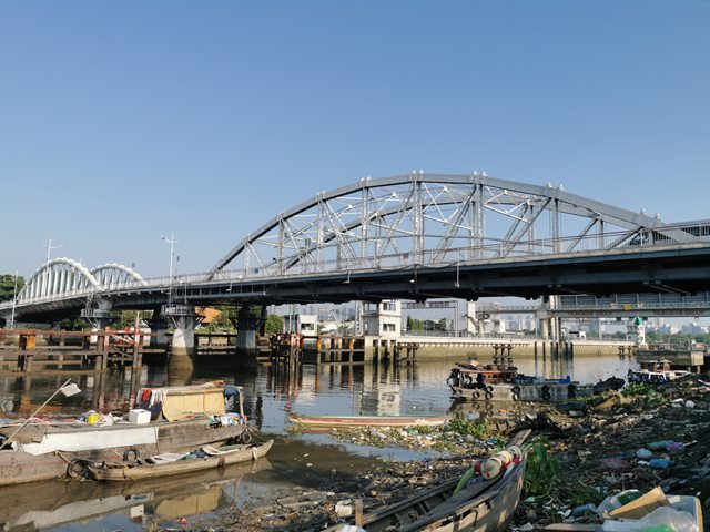
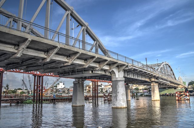
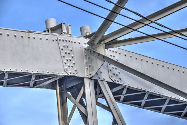
Cầu Tân Thuận is a bridge located in Ho Chi Minh City between District 7 and 4 and today carries one-way traffic alongside a modern bridge which handles the other direction of traffic. Cầu Tân Thuận was a French-built bridge completed in 1905. The bridge is a bit of a mystery because it appears the short central span of the bridge was originally designed as a very small, simple (perhaps even manually operated) bascule span. However not enough historical photos could be found to confirm this. The “mystery span” consists of a riveted deck plate girder, with welded plate added at the center of the span to eliminate the original variable-depth design of the girder. The girders extend beyond the piers under the adjacent spans, which could have accommodated a counterweight system for a bascule. A historical photo taken during the Vietnam War in 1968-9 shows this span having been supplemented with a temporary Bailey truss structure. The original girders in this photo can be seen without the welded plate added, showing the original cantilevered design which strongly resemble bascule leaves. While some catwalks are visible under the bridge, no machinery is visible to confirm the bascule design. There is the possibility that this span was built as a fixed girder, but in such a way that it could have been converted to a bascule span at a later date if marine needs arose. The other spans of Cầu Tân Thuận are also of note, and include a rare concrete bowstring-like truss span, and a European style riveted bowstring through truss span.
Span length and bridge length is an estimate. From west two east, there is two concrete t-beam spans, one 150 foot concrete bowstring span, one 85 foot deck plate girder span, one 180 foot steel bowstring span, and one 135 foot concrete bowstring span.

Above: Historical postcard showing original design of bridge.
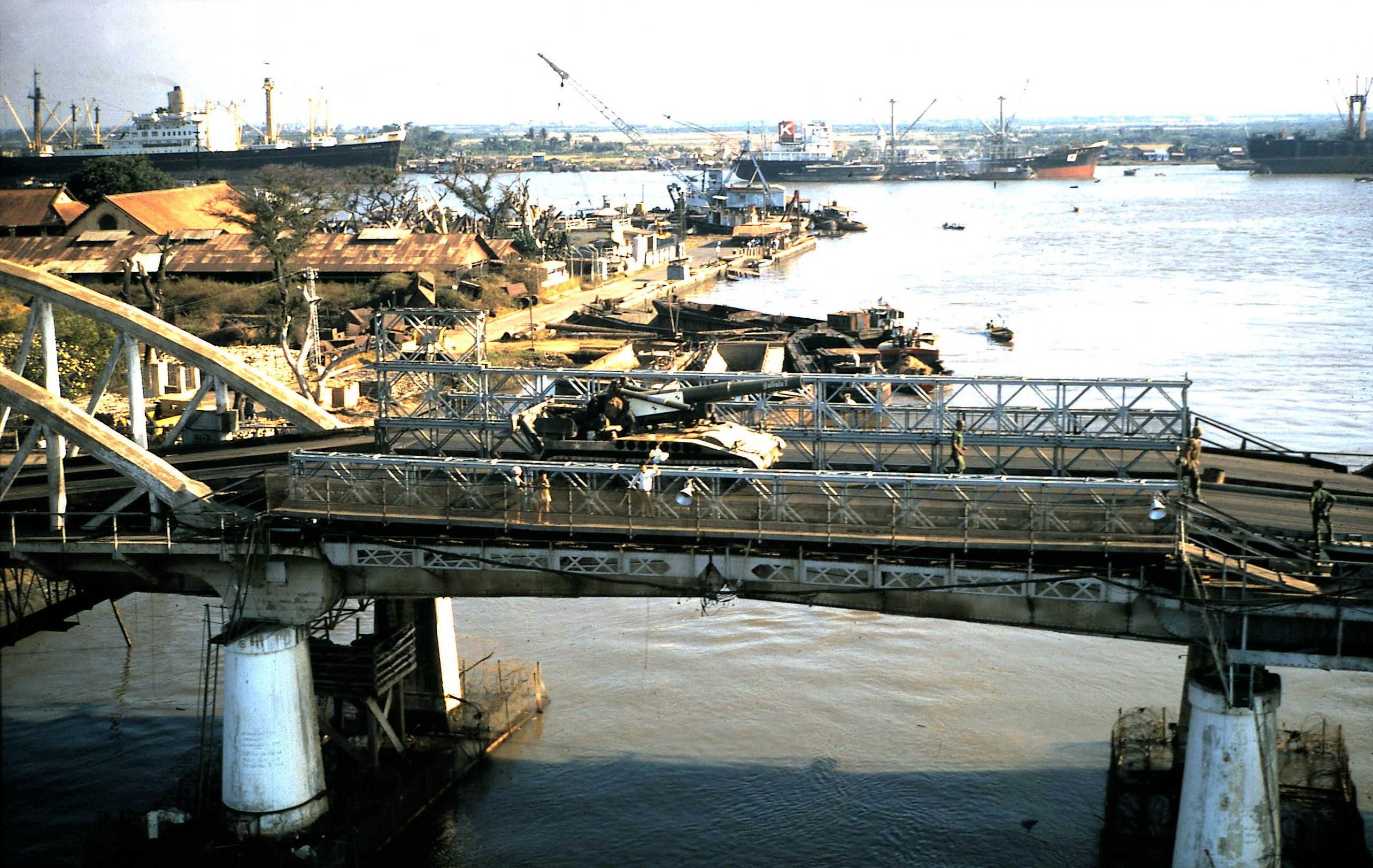
Above: Deck plate girder span as seen in 1967. The plate girder still retains its original design including lattice fascia beam and variable depth girder design. A load-bearing Bailey truss has been added to the top, potentially to handle the heavy loads of military vehicles such as the tank visible in the photo.
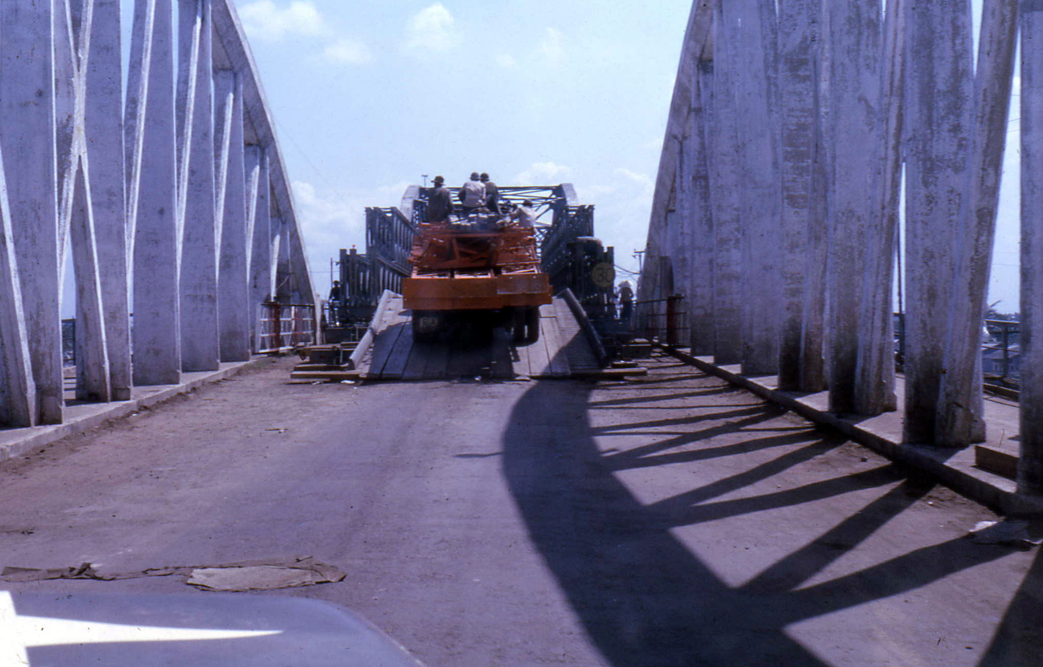
Above: Deck plate girder span as seen from on a concrete bowstring span in 1968-9. A load-bearing Bailey truss has been added to the top of the deck plate girder span, potentially to handle the heavy loads of military vehicles.
![]()
![]()
![]()
![]()
![]()
![]()
![]()

![]()
Coordinates (Latitude, Longitude):
Search For Additional Bridge Listings:
Additional Maps:
Google Streetview (If Available)
GeoHack (Additional Links and Coordinates)
Apple Maps (Via DuckDuckGo Search)
Apple Maps (Apple devices only)
Android: Open Location In Your Map or GPS App
Flickr Gallery (Find Nearby Photos)
Wikimedia Commons (Find Nearby Photos)
Directions Via Sygic For Android
Directions Via Sygic For iOS and Android Dolphin Browser

© Copyright 2003-2026, HistoricBridges.org. All Rights Reserved. Disclaimer: HistoricBridges.org is a volunteer group of private citizens. HistoricBridges.org is NOT a government agency, does not represent or work with any governmental agencies, nor is it in any way associated with any government agency or any non-profit organization. While we strive for accuracy in our factual content, HistoricBridges.org offers no guarantee of accuracy. Information is provided "as is" without warranty of any kind, either expressed or implied. Information could include technical inaccuracies or errors of omission. Opinions and commentary are the opinions of the respective HistoricBridges.org member who made them and do not necessarily represent the views of anyone else, including any outside photographers whose images may appear on the page in which the commentary appears. HistoricBridges.org does not bear any responsibility for any consequences resulting from the use of this or any other HistoricBridges.org information. Owners and users of bridges have the responsibility of correctly following all applicable laws, rules, and regulations, regardless of any HistoricBridges.org information.
![]()