

View Information About HSR Ratings
This bridge is listed in inventories with a 1930 construction date, which is obviously totally incorrect for a pin-connected truss bridge. It may be a default date indicating unknown construction date, or it may suggest the truss was moved here at this time, although the bridge sits on stone abutments in this location making it more likely this could be the original location of the truss. The bridge may date to the 1890s.
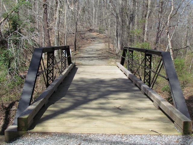
This rare Virginia example of the Groton Bridge Company was nicely restored following damage by a tree.
In 1995 the bridge was rehabilitated: floor beams, stringers, and deck planks were replaced; truss member was repaired; structural steel was painted.
The bridge, a rare federally owned truss bridge, was closed to vehicle traffic due to severe damage to the north truss sustained in 2006 when a tree fell onto the structure. The damage consisted of a bent and cracked outer steel channel and support plate for the upper chord, with lateral and torsional distortion also evident.
In 2019, the bridge was repaired. This required removing and repairing the damaged top chord section in a shop setting. In a first for Virginia and possibly the federal government as well, the new top chord section was repaired in-kind and hot riveted, so as to maintain the original design and historic integrity of the bridge. A local contractor performed the work, but Bach Steel assisted with the rivets.
This bridge is tagged with the following special condition(s): Unorganized Photos
![]()
![]()
![]()
Coordinates (Latitude, Longitude):
Search For Additional Bridge Listings:
Bridgehunter.com: View listed bridges within 0.5 miles (0.8 kilometers) of this bridge.
Bridgehunter.com: View listed bridges within 10 miles (16 kilometers) of this bridge.
Additional Maps:
Google Streetview (If Available)
GeoHack (Additional Links and Coordinates)
Apple Maps (Via DuckDuckGo Search)
Apple Maps (Apple devices only)
Android: Open Location In Your Map or GPS App
Flickr Gallery (Find Nearby Photos)
Wikimedia Commons (Find Nearby Photos)
Directions Via Sygic For Android
Directions Via Sygic For iOS and Android Dolphin Browser
USGS National Map (United States Only)
Historical USGS Topo Maps (United States Only)
Historic Aerials (United States Only)
CalTopo Maps (United States Only)

© Copyright 2003-2025, HistoricBridges.org. All Rights Reserved. Disclaimer: HistoricBridges.org is a volunteer group of private citizens. HistoricBridges.org is NOT a government agency, does not represent or work with any governmental agencies, nor is it in any way associated with any government agency or any non-profit organization. While we strive for accuracy in our factual content, HistoricBridges.org offers no guarantee of accuracy. Information is provided "as is" without warranty of any kind, either expressed or implied. Information could include technical inaccuracies or errors of omission. Opinions and commentary are the opinions of the respective HistoricBridges.org member who made them and do not necessarily represent the views of anyone else, including any outside photographers whose images may appear on the page in which the commentary appears. HistoricBridges.org does not bear any responsibility for any consequences resulting from the use of this or any other HistoricBridges.org information. Owners and users of bridges have the responsibility of correctly following all applicable laws, rules, and regulations, regardless of any HistoricBridges.org information.
![]()