


View Information About HSR Ratings

The Deception Pass Bridge is one of two bridges that carry WA-20 over two passes by way of tiny Pass Island. The other bridge is the Canoe Pass Bridge. At first glance the two bridges appear to be the same structure type. But in reality they are two different bridge types, with the Canoe Pass Bridge being an arch bridge and the Deception Pass Bridge being a cantilever truss bridge. The two bridges together create a truly unique setting where two visually similar but structurally different bridge types can be compared side by side. The bridge type was clearly determined by the natural terrain. The shorter gap of Canoe Pass and its shear cliffs were an ideal location for a steel arch span with skewbacks anchored into the cliff walls. The Deception Pass Bridge in contrast spans the larger gap that is Deception Pass, and with the absence of the shear cliffs that would be ideal for arch skewbacks, its multi-span superstructure supported by a system of piers and abutments are more appropriate.
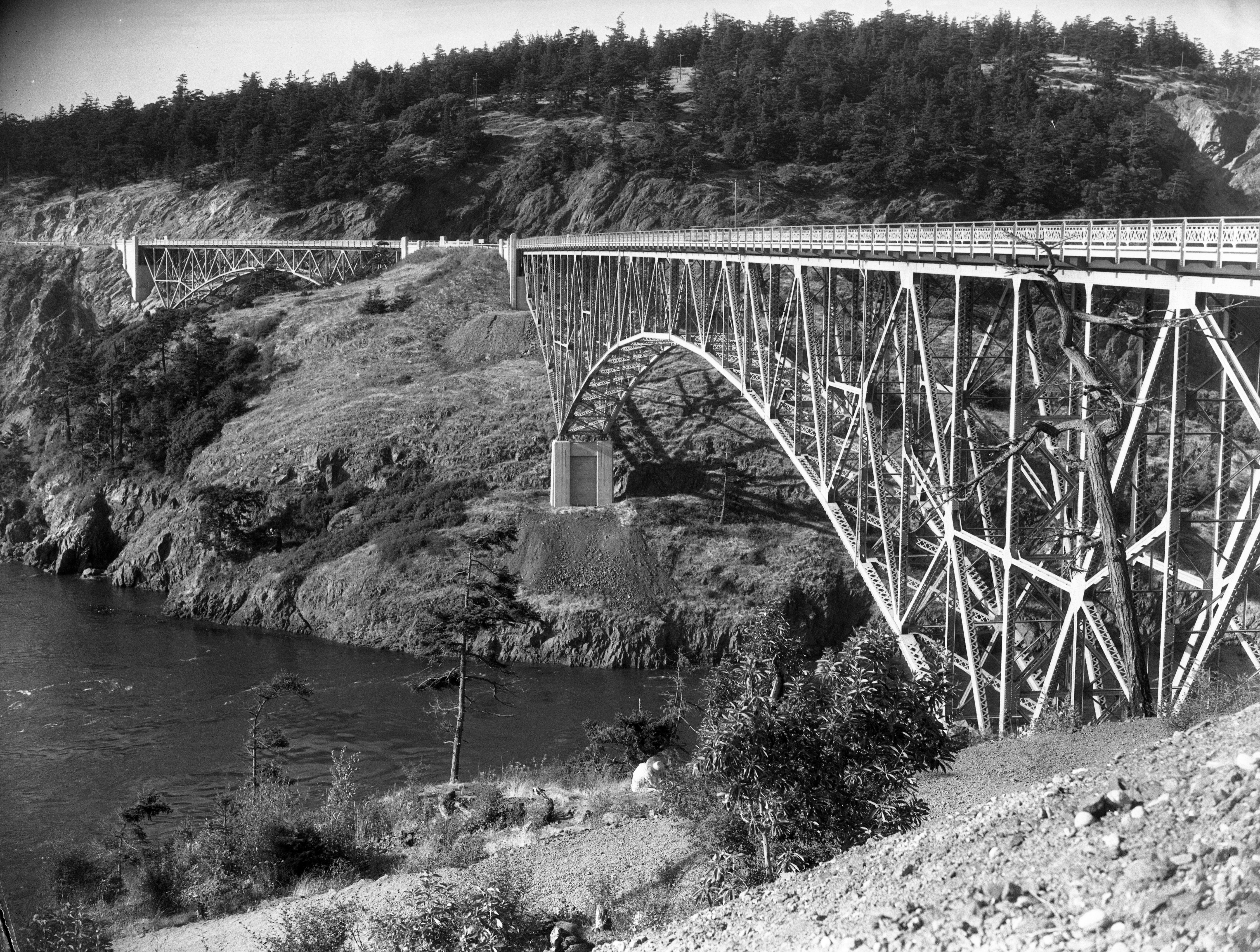
These bridges are located in Deception Pass State Park and the bridges and they views they offer are major attractions for visitors to the area.

![]()
![]()
![]()
Coordinates (Latitude, Longitude):
Search For Additional Bridge Listings:
Bridgehunter.com: View listed bridges within 0.5 miles (0.8 kilometers) of this bridge.
Bridgehunter.com: View listed bridges within 10 miles (16 kilometers) of this bridge.
Additional Maps:
Google Streetview (If Available)
GeoHack (Additional Links and Coordinates)
Apple Maps (Via DuckDuckGo Search)
Apple Maps (Apple devices only)
Android: Open Location In Your Map or GPS App
Flickr Gallery (Find Nearby Photos)
Wikimedia Commons (Find Nearby Photos)
Directions Via Sygic For Android
Directions Via Sygic For iOS and Android Dolphin Browser
USGS National Map (United States Only)
Historical USGS Topo Maps (United States Only)
Historic Aerials (United States Only)
CalTopo Maps (United States Only)

© Copyright 2003-2026, HistoricBridges.org. All Rights Reserved. Disclaimer: HistoricBridges.org is a volunteer group of private citizens. HistoricBridges.org is NOT a government agency, does not represent or work with any governmental agencies, nor is it in any way associated with any government agency or any non-profit organization. While we strive for accuracy in our factual content, HistoricBridges.org offers no guarantee of accuracy. Information is provided "as is" without warranty of any kind, either expressed or implied. Information could include technical inaccuracies or errors of omission. Opinions and commentary are the opinions of the respective HistoricBridges.org member who made them and do not necessarily represent the views of anyone else, including any outside photographers whose images may appear on the page in which the commentary appears. HistoricBridges.org does not bear any responsibility for any consequences resulting from the use of this or any other HistoricBridges.org information. Owners and users of bridges have the responsibility of correctly following all applicable laws, rules, and regulations, regardless of any HistoricBridges.org information.
![]()