

View Information About HSR Ratings
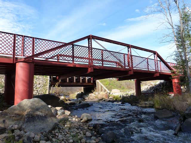
This bridge is an example of something that is sadly somewhat uncommon in Wisconsin: a historic truss bridge preservation success story. Here, Wisconsin actually went out of its way to make sure this beautiful historic truss bridge, located in a part of the state with few surviving truss bridges, remains today. At first glance, it appears that this bridge was left in its original location for pedestrian use, with a replacement vehicular bridge built on new alignment to bypass the bridge. However, this truss bridge was actually moved slightly as part of the replacement project.
One nice feature is that even though the bridge was moved, necessitating the need for a new substructure, the appearance of the original caissons were replicated in the new substructure. Bolts were used instead of rivets for the steel casing, but the bolts are round head bolts and simulate the appearance of a rivet. Some of the original caisson bracing was reused as well.
The railings on this bridge are not original, but were added during the restoration work. However the lattice design of the new railings is in keeping with the aesthetics of the bridge. Originally, the bridge appears to have had two simple angles for railing.

Above: Aerial view of bridge, August 27, 2020. Click for enlargement. Photo Credit: Doug Heim, Angelcopter, LLC
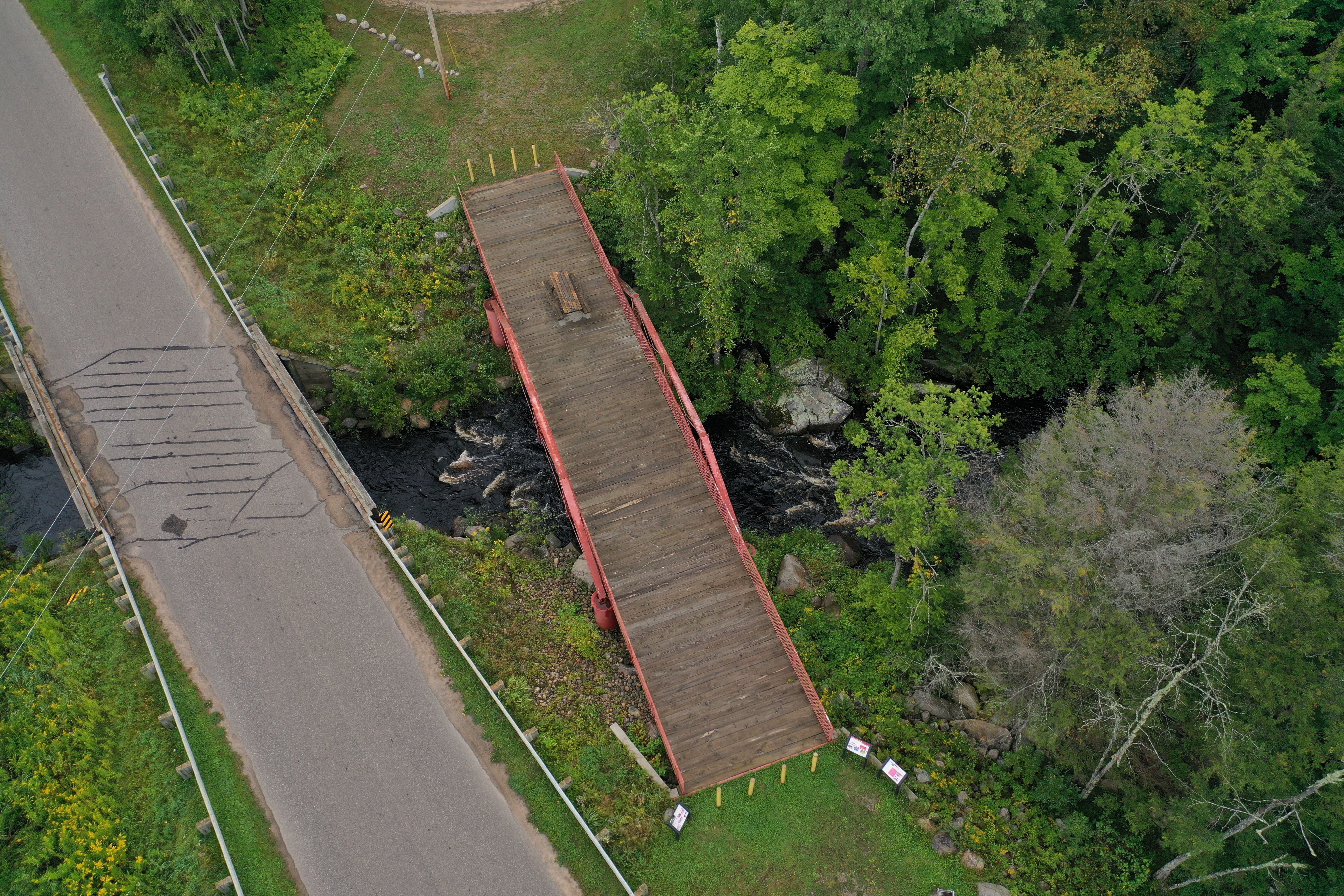
Above: Aerial view of bridge, August 27, 2020. Click for enlargement. Photo Credit: Doug Heim, Angelcopter, LLC
Information and Findings From Wisconsin Historical SocietySummary The Armstrong Creek Bridge is located on the edge of the Nicolet National Forest. It was manufactured in 1908 by the Hennepin Bridge Company, an important and prolific bridge builder in Minneapolis, Minnesota. This bridge originally carried what was then known as Highway 101 over Armstrong Creek. In the 1940s, the roadway (called Old 101 Road) was re-routed just west of the bridge and the bridge continued to serve pedestrians. The Armstrong Creek Bridge is an example of a "full-slope," or "standard," Pratt pony truss bridge. The Pratt truss was the second-most numerous pony truss ridge type on Wisconsin roadways at one time. As late as 1981, the Armstrong Creek Bridge was one of 69 standard Pratt truss bridges remaining in the state. By 1997, the number of standard Pratt truss bridges in Wisconsin had fallen to eight. The Armstrong Creek Bridge is a three-span structure; the central span is the Pratt pony truss. It is a steel, pin-connected truss with four panels on each side. It is 50 feet long and carries a 16 foot wide deck. In 2007, the bridge was removed from its original site to accommodate the realignment of Old 101 Road. In 2010, the bridge was repaired, repainted, and installed on new piers adjacent to Old 101 Road. The south end of the structure is now pivoted about 20 feet east from its original site, with the placement of the north end unchanged. The Armstrong Creek Bridge continues to present a good and intact example of a vanishing resource: the standard, Pratt pony truss bridge. Bridge Considered Historic By Survey: Yes |
![]()
![]()
![]()

![]()
Coordinates (Latitude, Longitude):
Search For Additional Bridge Listings:
Bridgehunter.com: View listed bridges within 0.5 miles (0.8 kilometers) of this bridge.
Bridgehunter.com: View listed bridges within 10 miles (16 kilometers) of this bridge.
Additional Maps:
Google Streetview (If Available)
GeoHack (Additional Links and Coordinates)
Apple Maps (Via DuckDuckGo Search)
Apple Maps (Apple devices only)
Android: Open Location In Your Map or GPS App
Flickr Gallery (Find Nearby Photos)
Wikimedia Commons (Find Nearby Photos)
Directions Via Sygic For Android
Directions Via Sygic For iOS and Android Dolphin Browser
USGS National Map (United States Only)
Historical USGS Topo Maps (United States Only)
Historic Aerials (United States Only)
CalTopo Maps (United States Only)

© Copyright 2003-2026, HistoricBridges.org. All Rights Reserved. Disclaimer: HistoricBridges.org is a volunteer group of private citizens. HistoricBridges.org is NOT a government agency, does not represent or work with any governmental agencies, nor is it in any way associated with any government agency or any non-profit organization. While we strive for accuracy in our factual content, HistoricBridges.org offers no guarantee of accuracy. Information is provided "as is" without warranty of any kind, either expressed or implied. Information could include technical inaccuracies or errors of omission. Opinions and commentary are the opinions of the respective HistoricBridges.org member who made them and do not necessarily represent the views of anyone else, including any outside photographers whose images may appear on the page in which the commentary appears. HistoricBridges.org does not bear any responsibility for any consequences resulting from the use of this or any other HistoricBridges.org information. Owners and users of bridges have the responsibility of correctly following all applicable laws, rules, and regulations, regardless of any HistoricBridges.org information.
![]()