HistoricBridges.org Menu: HistoricBridges.org Menu:


HistoricBridges.org: Bridge Browser

Map: Steep Falls Bridge

Google Map: (More Links and Maps Below)

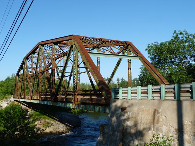
Location: ME-11 (Sokokis Avenue and Main Street) Over Saco River In Steep Falls: York County, Maine and Cumberland County, Maine, United States
Latitude: 43.789630 Longitude: -70.657790 ( 43.789630,-70.657790 )

This historic bridge has been demolished. This map is shown for reference purposes only.

View Bridge Location In:

Bridgehunter.com: View listed bridges within a half mile of this bridge.

Bridgehunter.com: View listed bridges within 10 miles of this bridge.

Android: Open Location In Your Map or GPS App

Google Maps

Google Streetview (If Available)

Bing Maps

ACME Mapper

OpenStreetMap

Google Earth (KML File)

Flickr Gallery (Find Nearby Photos)

Directions Via Sygic For Android

Directions Via Sygic For iOS and Android Dolphin Browser

MapQuest

HERE We Go Maps

ACME Mapper

Historical USGS Topo Maps (United States Only)

CalTopo Maps (United States Only)

Ordnance Survey Maps (UK Only)

GeoHack Map Links (Enter 43.789630 For Latitude and -70.657790 For Longitude)

Steep Falls Bridge

Divider

Back
Home
Top

Divider

About - Contact

Divider