HistoricBridges.org Menu: HistoricBridges.org Menu:


HistoricBridges.org: Bridge Browser

Map: Bartlett Mills Bridge

Google Map: (More Links and Maps Below)

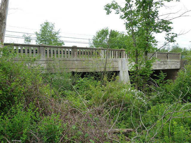
Location: US-1 (Portland Road) Over Kennebunk River In Bartlett Mills: York County, Maine, United States
Latitude: 43.402800 Longitude: -70.526300 ( 43.402800,-70.526300 )

View Bridge Location In:

Bridgehunter.com: View listed bridges within a half mile of this bridge.

Bridgehunter.com: View listed bridges within 10 miles of this bridge.

Android: Open Location In Your Map or GPS App

Google Maps

Google Streetview (If Available)

Bing Maps

ACME Mapper

OpenStreetMap

Google Earth (KML File)

Flickr Gallery (Find Nearby Photos)

Directions Via Sygic For Android

Directions Via Sygic For iOS and Android Dolphin Browser

MapQuest

HERE We Go Maps

ACME Mapper

Historical USGS Topo Maps (United States Only)

CalTopo Maps (United States Only)

Ordnance Survey Maps (UK Only)

GeoHack Map Links (Enter 43.402800 For Latitude and -70.526300 For Longitude)

Bartlett Mills Bridge

Divider

Back
Home
Top

Divider

About - Contact

Divider