HistoricBridges.org Menu: HistoricBridges.org Menu:


HistoricBridges.org: Bridge Browser

Map: Yakima Valley Trolley Bridge

Google Map: (More Links and Maps Below)

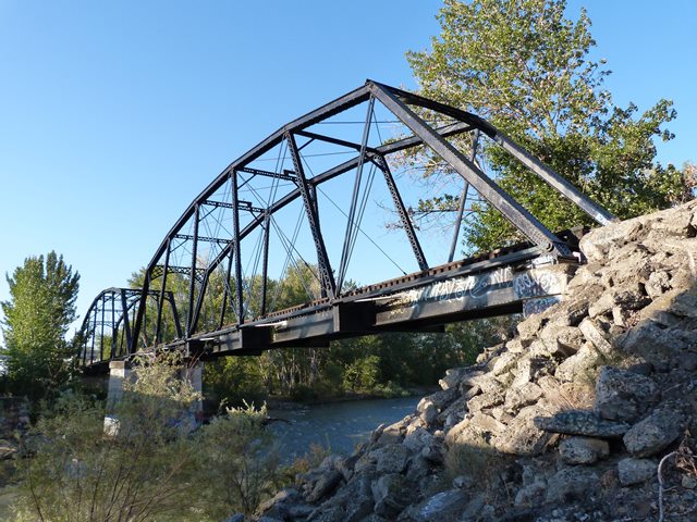
Location: Railroad (Yakima Valley Trolley Line) Over Naches River In Yakima and Selah: Yakima County, Washington, United States
Latitude: 46.627950 Longitude: -120.520460 ( 46.627950,-120.520460 )

View Bridge Location In:

Bridgehunter.com: View listed bridges within a half mile of this bridge.

Bridgehunter.com: View listed bridges within 10 miles of this bridge.

Android: Open Location In Your Map or GPS App

Google Maps

Google Streetview (If Available)

Bing Maps

ACME Mapper

OpenStreetMap

Google Earth (KML File)

Flickr Gallery (Find Nearby Photos)

Directions Via Sygic For Android

Directions Via Sygic For iOS and Android Dolphin Browser

MapQuest

HERE We Go Maps

ACME Mapper

Historical USGS Topo Maps (United States Only)

CalTopo Maps (United States Only)

Ordnance Survey Maps (UK Only)

GeoHack Map Links (Enter 46.627950 For Latitude and -120.520460 For Longitude)

Yakima Valley Trolley Bridge

Divider

Back
Home
Top

Divider

About - Contact

Divider