
View Information About HSR Ratings
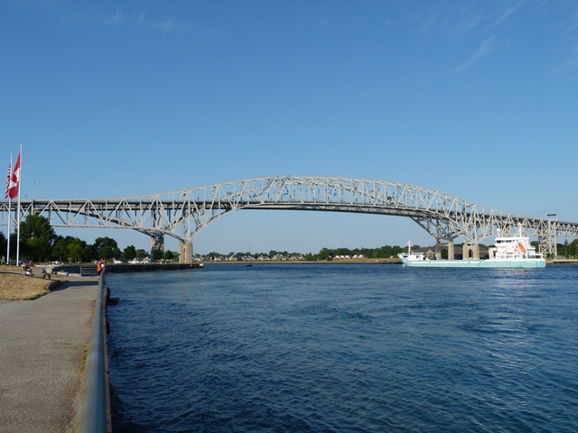
This bridge is a monumental cantilever bridge, connecting Port Huron, MI and Sarnia, Ontario. Unlike many of the historic cantilever bridges elsewhere in the country, such as those on the Ohio and Mississippi Rivers, the Blue Water Bridge has always been a treasured part of the region, and both the government agencies who own it and the general public have shown support for the preservation of this historic bridge. So strong was this commitment, that the demolition of this bridge was never even considered when it became clear additional traffic lanes were needed. Instead, a second bridge was built next to the historic bridge forming a one-way couplet of bridges. This preservation solution sets an example for others to follow, and calls into question the legitimacy of claims on the part of agencies who would claim that their historic cantilever bridges can no longer serve traffic.
The Blue Water Bridge remains today as a functional and beloved part of the Blue Water region, and it is a central feature of the area where Lake Huron becomes the St. Clair River, this site being a popular tourist area. The bridge and waterway has been the backdrop for countless wedding photos, senior photos, etc.
Today, the Blue Water Bridge carries an incredible amount of traffic, including large numbers of fully loaded semi trucks, who often spend hours on the bridge waiting to pass through United States customs. One of the reasons a second bridge was constructed was to provide more traffic lanes and thus eliminate the fatigue and stress caused by having large numbers of trucks parked on half of the bridge for long periods of time. However, extreme shortsightedness and poor planning on the part of Michigan Department of Transportation led to a customs plaza that had been built being completely insufficient for the job even after hardly a decade of use. Therefore, the trucks continued to be stuck on the bridge even after a new bridge was built. There has been talk of an enormous project underway to to replace the American plaza, which was built in the 1990s, with a much larger plaza.
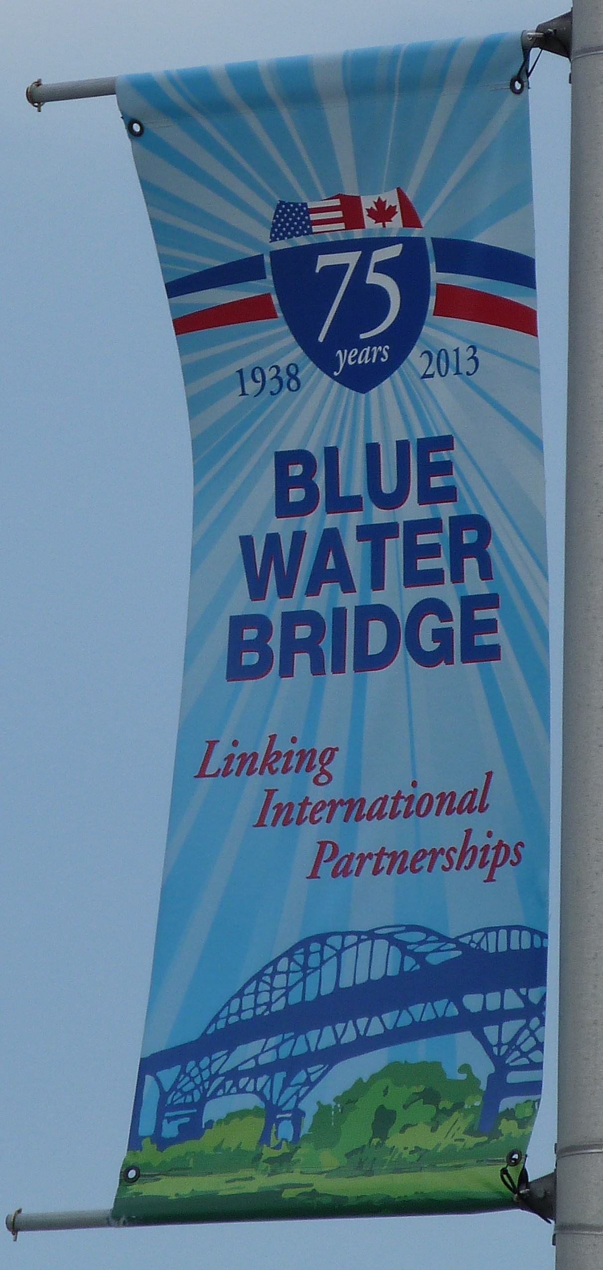
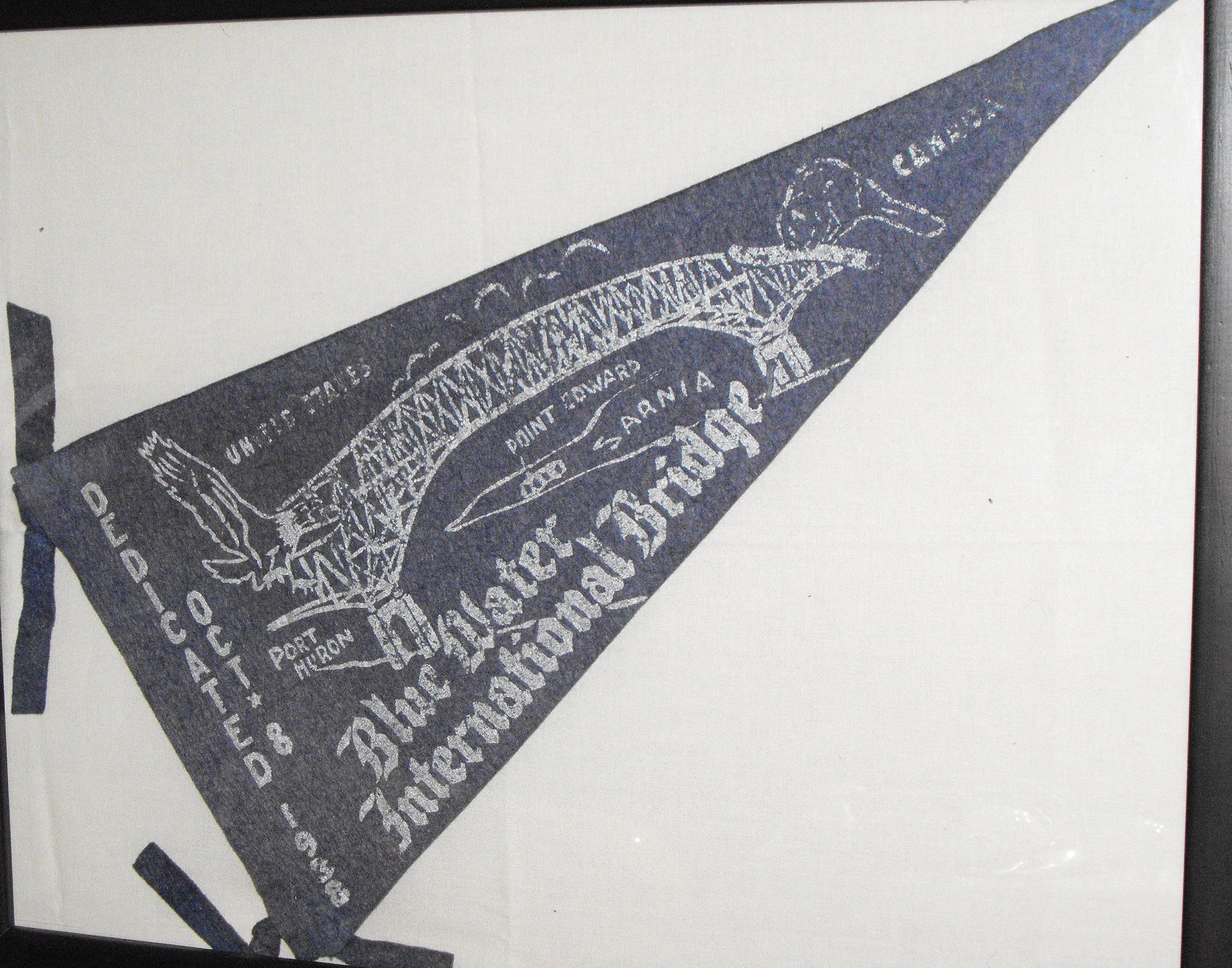
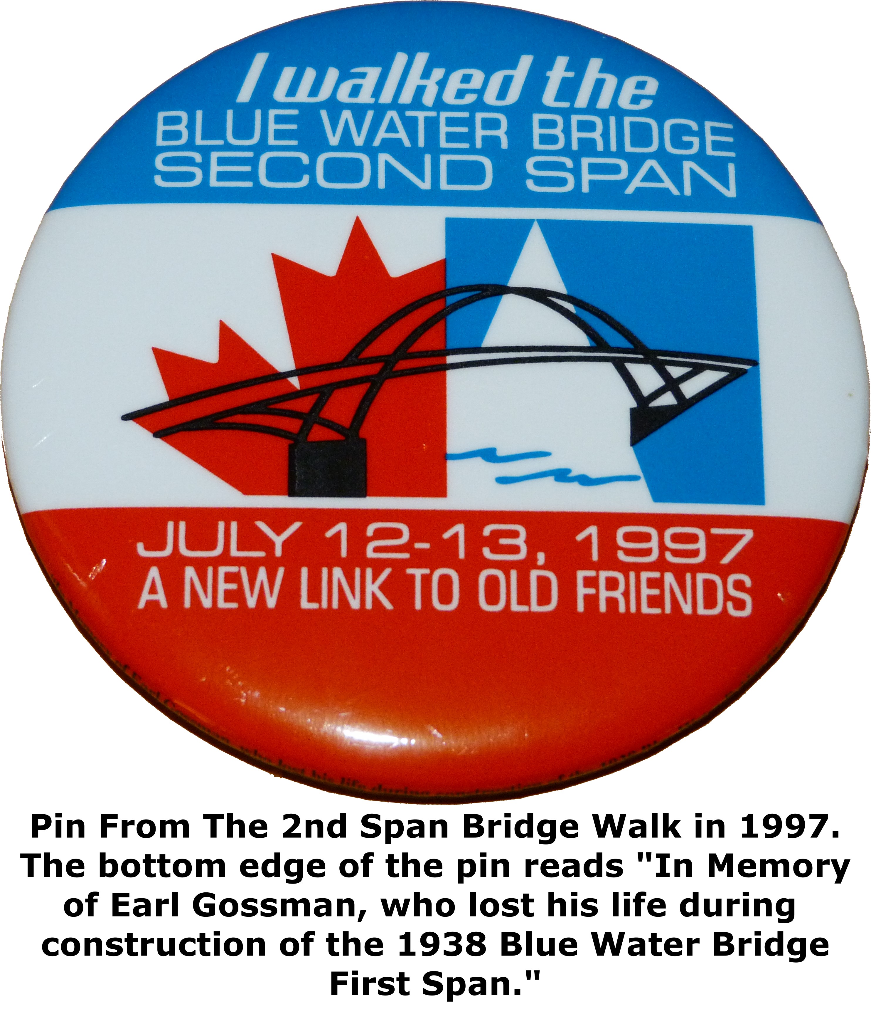
The 75th anniversary of the historic bridge in October 2013 passed with little attention. Some banners were hung up on the highways leading up to the bridge, and that is the extent of celebrations. Worse, these banners had an image of the two bridges that featured the new bridge in the foreground, rather inappropriate given that the historic bridge is the bridge that was celebrating its 75th anniversary. For such a well-known, loved, and highly historic bridge, it would have been nice to see some larger events to commemorate this milestone for the historic bridge. When the Golden Gate Bridge turned 75, there were tons of events held throughout the entire year. The Blue Water Bridge might not be as famous and significant as the Golden Gate Bridge, but it certainly was worthy of some commemoration. At the very least, it would have been nice for a bridge walk on the historic bridge to have been organized to commemorate the 76 anniversary. When the second Blue Water Bridge span was completed, a bridge walk was held to commemorate that event.
It is also worth noting that as of 2013, both the historic Blue Water Bridge and the new bridge are in need of some substantial spot painting. The time to address rust should be now, before it gets serious, which would keep painting costs down and prevent section loss to the steel. It also would maintain the pleasing appearance of landmark bridges. Reportedly, a project to cost approximately $10,900,000 and take three years to complete is in the planning stage which will involve repainting the historic bridge and miscellaneous repairs. This is definitely a good decision and it is hoped that this project will receive high priority and not be delayed. As of 2014, MDOT has posted the contract and the provisions state that work will begin not before July 7, 2015, and the scheduled completion date is October 14, 2017.
Be sure to read the Historic American Engineering Record (HAER) Data Pages for this bridge to get a detailed history of the bridge and its construction. Their are two separate HAER documentations. One is for the bridge itself, and it contains an extensive history. The other is for the original customs/toll plaza, and that documentation also has additional history, organized in a comprehensive timeline format. Together, a comprehensive and detailed history of the Blue Water Bridge is provided.

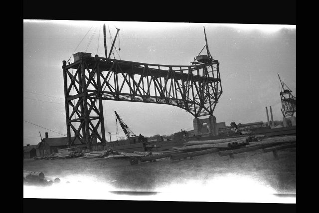
Also be sure to view the HAER photos. Taken before the second bridge was built and before the original plaza was demolished, these photos are a good compliment to the comprehensive set of present-day color photos that HistoricBridges.org is proud to provide. HistoricBridges.org also provides a captioned set of historical photos of the bridge's construction. The photos came from the Village of Point Edward, Ontario.

Above: Postcard showing the original toll plaza.

Above: Postcard showing the original toll plaza. Note Michigan State Highway Department type R4 railing in the median, which was the former overpass bridge over Pine Grove Avenue.
HistoricBridges.org did uncover one additional part of the Blue Water Bridge's history. Prior to the bridge being built, opinions on the location and design of the bridge were sought from a number of engineers and other involved people. Among those was Joseph Strauss. Pictured is a conceptual sketch showing a Blue Water Bridge proposal that Strauss Engineering had proposed. The bizarre bridge has a Port Huron approach that intersects with the cantilever at a 90 degree angle in the middle of the anchor arm. As such, there is an unused portion of the cantilever that is essentially a dead end. His proposal appears to be his solution to an interest on the part of Port Huron to have a bridge that connected directly to downtown Port Huron, while still having the cantilever part of the bridge cross at the narrowest point in the St. Clair River, which was north of downtown Port Huron. Ultimately, this proposal was rejected likely because of the bizarre approach design. Such as design would have been terribly inefficient, would have posed a safety hazard, and was also not aesthetically appealing.
Strauss is a name usually associated with movable bridges, a field in which the company excelled. However, Strauss was also involved in the design of the Golden Gate Bridge, another monumental and fixed bridge, and equally as displaced from the world of movable bridges as the Blue Water Bridge is. Strauss' initial proposal for the Golden Gate Bridge, which was not accepted, was equally as bizarre as this proposed Blue Water Bridge. His Golden Gate proposal was a hybrid bridge that combined a cantilever truss with a suspension bridge. While it would have been a fascinating bridge, it was aesthetically ugly, particularly in the perceptions of the people living in that time. The final Golden Gate Bridge seen today was in the end largely designed by a different engineer who Strauss hired. Like the rejected Golden Gate Bridge proposal, The Strauss Blue Water Bridge proposal shows an equally striking lack of attention to aesthetics, something that was corrected in the accepted proposal presented by competitor engineers Modjeski and Masters. The Strauss proposal suggests that Strauss was an engineer who did not have as much experience with large fixed bridges, and struggled with the aesthetics and design of such bridges. With the Blue Water Bridge, the aesthetics of the bridge were a major consideration in the design of the bridge, and in many cases played a larger role in the challenge of designing the bridge than did the length of the span, which for the period was not a distance that had not been bridged before.


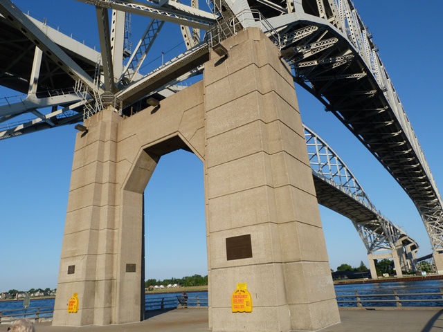
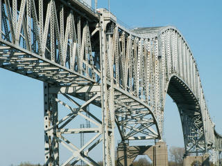
Cantilever bridges are the largest and most complex form of truss bridge. The particular design of the Blue Water Bridge is an extremely rare design that is usually called the "arch cantilever" type of bridge. The Blue Water Bridge is among the oldest surviving examples of this unique and distinctive bridge type variation. The arch cantilever design was created to offer a more graceful and aesthetic alternative to the traditional cantilever truss design that features two pointed cantilever towers that rise above the suspended span. In the case of the arch cantilever truss, the towers are essentially upside down, extending down from the deck to the piers. This eliminates the pointy top chord design, and allows for a smoothly curved top chord that is reminiscent of an arch. The suspended span is integrated into this curve, and indeed casual viewers may not even notice that there is a suspended span on the bridge, although for the close observer, pin connections give away where the cantilever arms hold the suspended span in place. The anchor arms end at large bents which conceal anchor links that hold the anchor ends of the cantilever bridge system in place.

Above: Historical photo showing the bridge with the Peerless Cements factory where the Thomas Edison Inn is today.
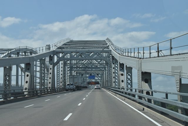
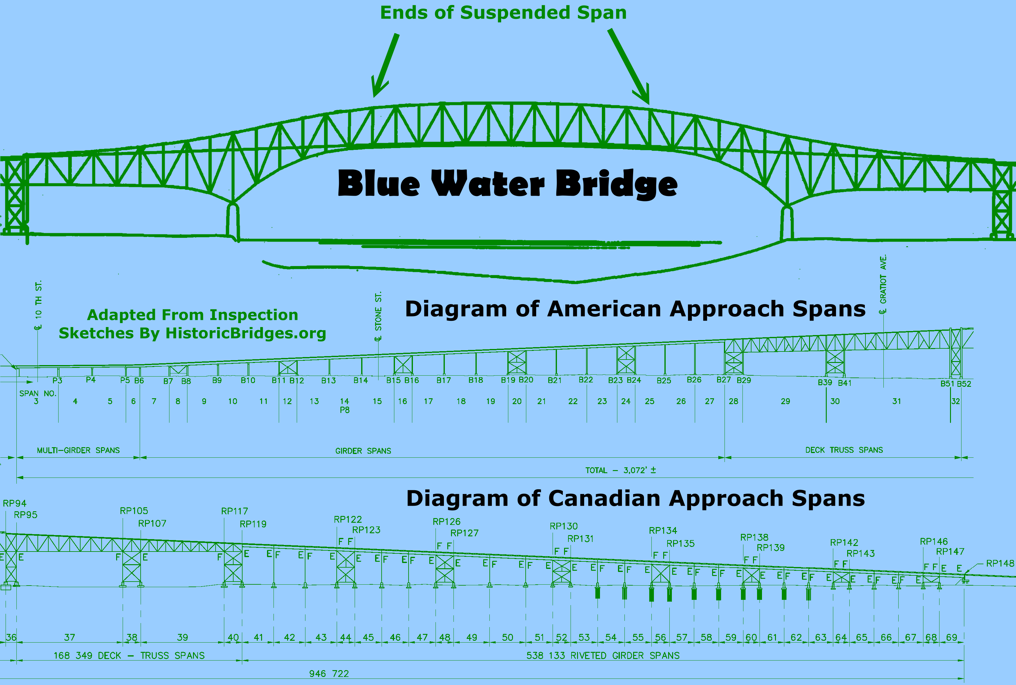
The bridge has riveted connections and most beams on the bridge are built-up. V-lacing or lattice is present on nearly all built-up beams, with some exceptions such as on the diagonals and verticals on the first quarters of each end of the main navigation span. The structure was completed in 1938. The total weight of the steel and concrete in the bridge is 86,905 Tons. There are (originally) 2,228,000 rivets on the structure. These rivets alone total 500 tons. The bridge was rehabilitated in 1999. The bridge originally had two lanes and sidewalks, but the sidewalks were removed and the bridge converted to three lanes.
A large number of contractors and engineers were involved in the construction of the bridge as well as the original customs/toll plaza (demolished in the 1990s). The original plaque for the bridge, which was located on the original customs/toll plaza building, lists the involved companies. A number of very well known names in the bridge world had a part in the Blue Water Bridge. Two of the most prolific bridge builders in each respective country were contractors for the bridge: the American Bridge Company of New York, New York, and the Hamilton Bridge Company of Hamilton, Ontario. Also, the regionally prolific and noteworthy Wisconsin Bridge and Iron Company of Milwaukee, Wisconsin was involved on the American side. On the Canadian side, a local bridge company, the Sarnia Bridge Company, was involved. As an international bridge, the construction of the bridge was unique and offers a unique view of the history of each country. Although a single bridge and project, each half of the bridge was built by the respective contractors in each country, and materials for each were acquired from their respective countries. As such, a larger number of members on the Canadian approaches were constructed as built-up beams, while many of the beams on the American side were rolled. This is because at the time, Canadian mills could not roll beams as large as the American side in an efficient manner.


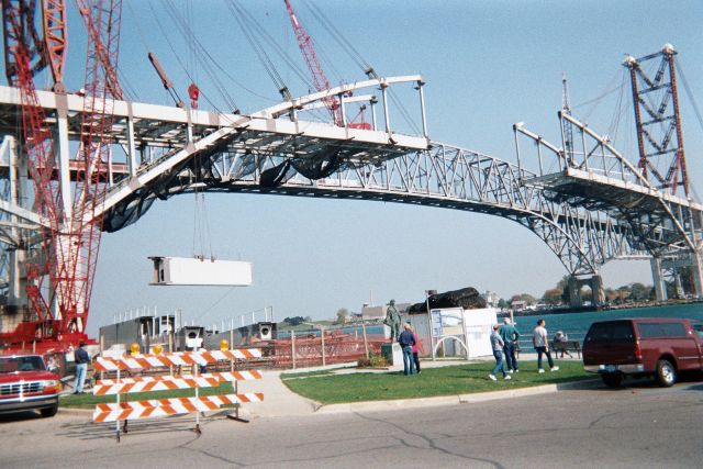
The new bridge is a continuous tied arch and it carries eastbound traffic. The design was selected after considerable public involvement as well as input from experts. The arch design was chosen because it has a similar shape as the old bridge, and does not interfere as much with the appearance of the area. For example, the general public as well as the Michigan State Historic Preservation Office (SHPO) made the very smart decision to cast aside an alternative that would have constructed a mundane cable-stayed bridge. Cable-stayed bridges are the most common type of long-span bridge being built beginning in the late 20th, and indeed, the engineers wanted to build a cable-stayed bridge for the second bridge, but SHPO and general public disgust with this idea forced them to build the arch bridge. A cable-stayed bridge would not have been unique, and its ugly, highly contrasted appearance would have destroyed the unique beauty of the location that is one of the top tourist destinations for the region. The selected arch bridge instead maintains a similar profile and size. At the same time, it does not replicate the historic bridge because doing so might create a false sense of history. Further, even a so-called replica would have lacked key elements like rivets and built-up beams, and as such would have been insulting to the beauty, history, and engineering of the historic bridge. The two bridges stand as a comparison to the intricacy of truss bridges, and the simplicity of modern bridges.

Information and Findings From MDOT
The original Blue Water Bridge linking Port Huron, Michigan and Sarnia,
Ontario was completed in 1938 at a cost of $4 million, financed jointly
by the State of Michigan and the Province of Ontario. This steel
cantilever bridge has a main span of 871 feet, anchor arms 326 feet
long, and approaches consisting of deck girder spans and two deck truss
spans adjoining the anchor arms on both the American and Canadian sides.
The American approach spans are 2283 feet in length, while the Canadian
approach is 2657 feet long, giving the bridge an overall length of 6463
feet. It is 38 feet wide, providing a roadway of 32 feet and two
sidewalks. Each of the two main piers consists of two caissons 26 feet
in diameter, whit eight foot dredging wells. These were sunk to rock 95
feet below water level. |


Above: Historical photo showing bridge construction.

Above: Historical photo showing bridge construction.
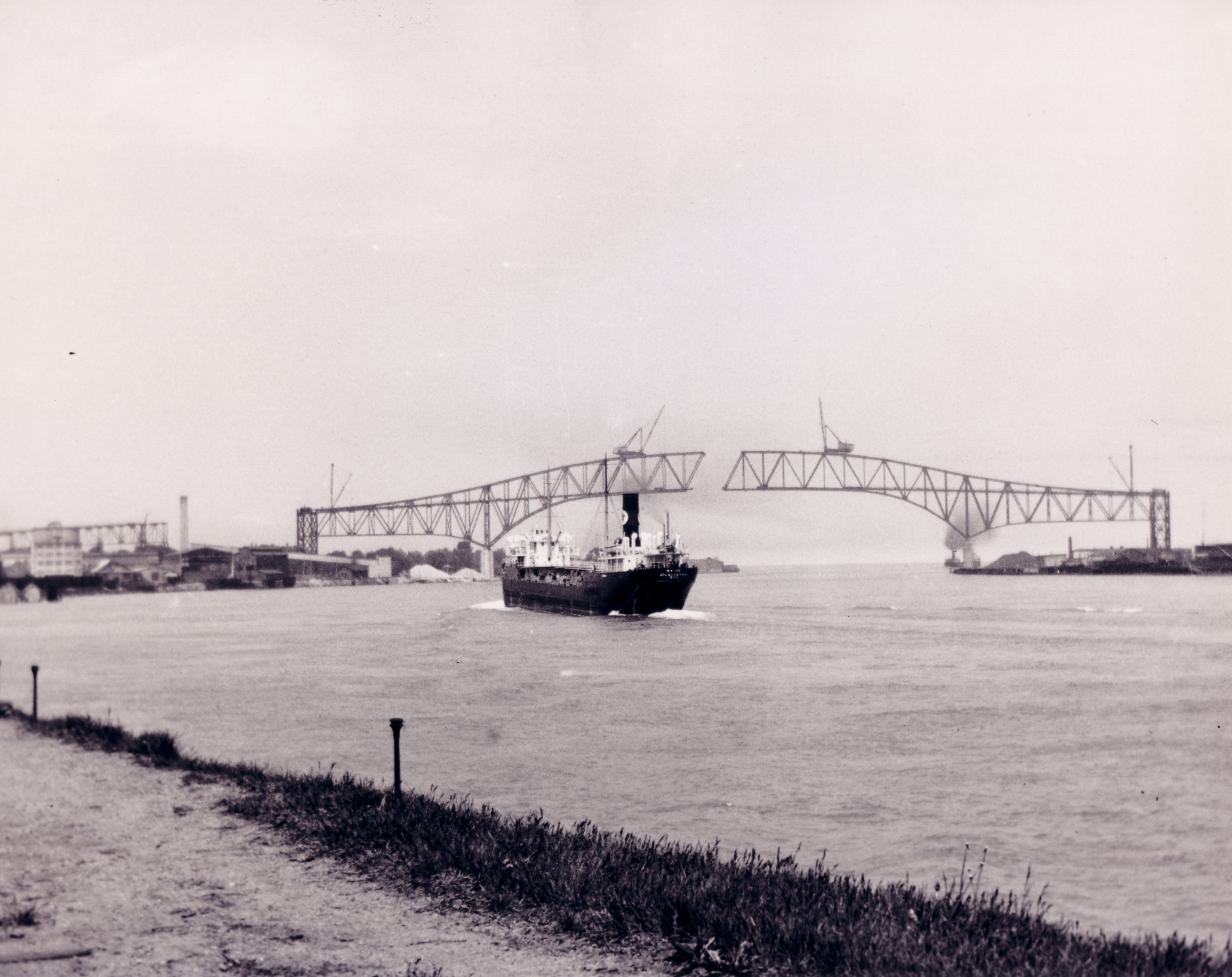
Above: Historical photo showing bridge construction.
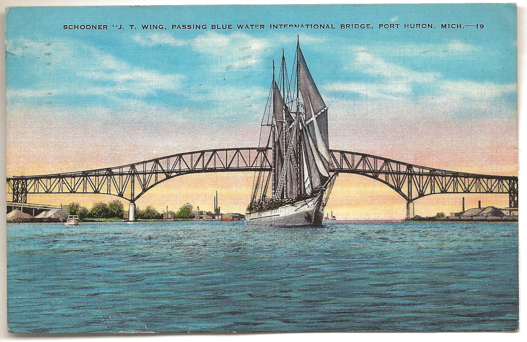
Above: Historical postcard of bridge.
This bridge is tagged with the following special condition(s): Unorganized Photos
![]()

© Copyright 2003-2024, HistoricBridges.org. All Rights Reserved. Disclaimer: HistoricBridges.org is a volunteer group of private citizens. HistoricBridges.org is NOT a government agency, does not represent or work with any governmental agencies, nor is it in any way associated with any government agency or any non-profit organization. While we strive for accuracy in our factual content, HistoricBridges.org offers no guarantee of accuracy. Information is provided "as is" without warranty of any kind, either expressed or implied. Information could include technical inaccuracies or errors of omission. Opinions and commentary are the opinions of the respective HistoricBridges.org member who made them and do not necessarily represent the views of anyone else, including any outside photographers whose images may appear on the page in which the commentary appears. HistoricBridges.org does not bear any responsibility for any consequences resulting from the use of this or any other HistoricBridges.org information. Owners and users of bridges have the responsibility of correctly following all applicable laws, rules, and regulations, regardless of any HistoricBridges.org information.
![]()