We Recommend:
Bach Steel - Experts at historic truss bridge restoration.
BridgeHunter.com Phase 1 is released to the public! - Visit Now
Red Arrow Highway Bridge
St. Joseph Street Bridge

Primary Photographer(s): Nathan Holth
Bridge Documented: 2006
Lawrence: Van Buren County, Michigan: United States
Not Available or Not Applicable
36.7 Feet (11.2 Meters)
54.8 Feet (16.7 Meters)
28 Feet (8.53 Meters)
1 Main Span(s)
804387400004B01

View Information About HSR Ratings
Bridge Documentation
This bridge no longer exists!
View Archived National Bridge Inventory Report - Has Additional Details and Evaluation
This bridge was demolished and replaced in 2006!
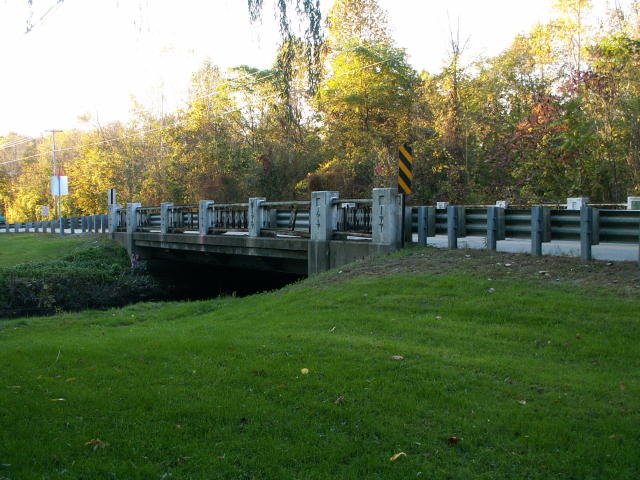
This bridge was constructed in 1949, and like the Fisher Road Bridge, is worthy of inclusion on this website, not because of its good condition, but of its lack of good condition. Salt and a lack of paint contributed to this. Red Arrow Highway was US-12 prior to I-94's completion, and this bridge is a relic of the US-12 era. The fact that existing bridges are not properly maintained by their owners needs to be exposed. Maintenance often costs less raw money than replacement, although state incentives for replacement often discourage local government from maintaining bridges. Either way, replacement costs taxpayers more.
This page is also as good as any to point out another historic bridge Van Buren County demolished before it could be photo documented by this website. The bridge was an 1882 beam bridge on 44th Avenue, a rural road that is in the middle of nowhere on a road that nobody lives on. The road and bridge in question is the 44th Avenue over Paw Paw River Bridge, and yes that date is right: 1882, listed in the Historic Bridge Inventory. This would have been one of the oldest beam bridges in the entire state of Michigan! On a road that nobody uses, its restoration would have been a good choice, as there certainly is no heavy traffic on the road. Sufficient ridges in Michigan are supposed to be un-posted for weight limits, meaning optimally, all bridges must support 77 tons, thus the new 44th Avenue Bridge would be capable of supporting 77 tons. This is quite the waste of money. Any trucks would likely sink into the mud-hole of a road that 44th Avenue is before reaching the bridge! A few photos of the slab and 44th Avenue are included to show all this.
![]()
Photo Galleries and Videos: Red Arrow Highway Bridge
Bridge Photo-Documentation
A collection of overview and detail photos. This photo gallery contains a combination of Original Size photos and Mobile Optimized photos in a touch-friendly popup viewer.Alternatively, Browse Without Using Viewer
![]()
Maps and Links: Red Arrow Highway Bridge
This historic bridge has been demolished. This map is shown for reference purposes only.
Coordinates (Latitude, Longitude):
Search For Additional Bridge Listings:
Bridgehunter.com: View listed bridges within 0.5 miles (0.8 kilometers) of this bridge.
Bridgehunter.com: View listed bridges within 10 miles (16 kilometers) of this bridge.
Additional Maps:
Google Streetview (If Available)
GeoHack (Additional Links and Coordinates)
Apple Maps (Via DuckDuckGo Search)
Apple Maps (Apple devices only)
Android: Open Location In Your Map or GPS App
Flickr Gallery (Find Nearby Photos)
Wikimedia Commons (Find Nearby Photos)
Directions Via Sygic For Android
Directions Via Sygic For iOS and Android Dolphin Browser
USGS National Map (United States Only)
Historical USGS Topo Maps (United States Only)
Historic Aerials (United States Only)
CalTopo Maps (United States Only)

