

View Information About HSR Ratings
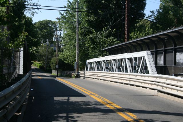
This bridge is listed as being built in 1892, but the bridge appears to have been replaced, probably at the 1994 rehab date, with a new bridge designed to look similar to the original bridge. As such, the bridge really has no place on this website. However it has been placed on the website if for no other reason than to let people know the bridge is NOT historic. In addition, it does appear that it may be designed to look similar to the original bridge, so perhaps it gives us an idea of what might have been here before. With members that are built up (with bolts, the first indication the bridge is modern) the bridge is more complex than the usual rolled beam welded truss that is often used when truss bridges are built today.
Either way, the bridge has no historic significance. It does not excuse the demolition of the historic bridge which once was located here. National Bridge Inventory still lists an 1892 construction date, which is obviously when the previous bridge was built.
In addition, the massive walling placed on the bridge to separate people from the electrified railroad lines below are beyond ugly. While the need to provide this separation may certainly outweigh any aesthetic concerns, one wonders if there might not be a more tasteful way to blockade this bridge.
![]()
![]()
![]()
Coordinates (Latitude, Longitude):
Search For Additional Bridge Listings:
Bridgehunter.com: View listed bridges within 0.5 miles (0.8 kilometers) of this bridge.
Bridgehunter.com: View listed bridges within 10 miles (16 kilometers) of this bridge.
Additional Maps:
Google Streetview (If Available)
GeoHack (Additional Links and Coordinates)
Apple Maps (Via DuckDuckGo Search)
Apple Maps (Apple devices only)
Android: Open Location In Your Map or GPS App
Flickr Gallery (Find Nearby Photos)
Wikimedia Commons (Find Nearby Photos)
Directions Via Sygic For Android
Directions Via Sygic For iOS and Android Dolphin Browser
USGS National Map (United States Only)
Historical USGS Topo Maps (United States Only)
Historic Aerials (United States Only)
CalTopo Maps (United States Only)

© Copyright 2003-2024, HistoricBridges.org. All Rights Reserved. Disclaimer: HistoricBridges.org is a volunteer group of private citizens. HistoricBridges.org is NOT a government agency, does not represent or work with any governmental agencies, nor is it in any way associated with any government agency or any non-profit organization. While we strive for accuracy in our factual content, HistoricBridges.org offers no guarantee of accuracy. Information is provided "as is" without warranty of any kind, either expressed or implied. Information could include technical inaccuracies or errors of omission. Opinions and commentary are the opinions of the respective HistoricBridges.org member who made them and do not necessarily represent the views of anyone else, including any outside photographers whose images may appear on the page in which the commentary appears. HistoricBridges.org does not bear any responsibility for any consequences resulting from the use of this or any other HistoricBridges.org information. Owners and users of bridges have the responsibility of correctly following all applicable laws, rules, and regulations, regardless of any HistoricBridges.org information.
![]()