

View Information About HSR Ratings
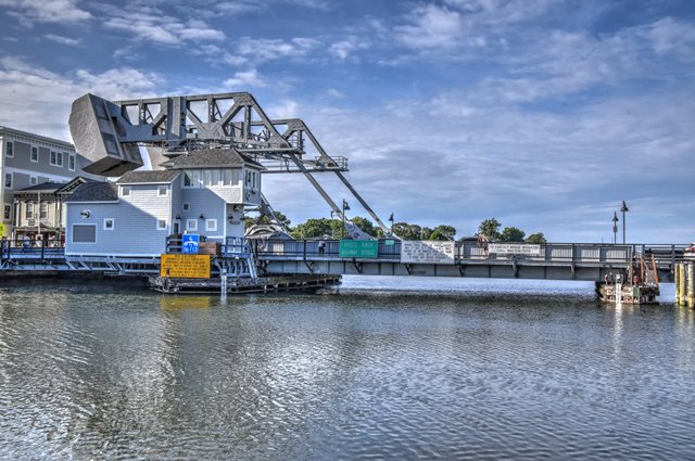
This bridge is one of the only surviving Brown type bascule bridges in the country, and the only one in Connecticut. It is an outstanding example and in a good state of preservation. The Brown bascule is distinguished by its overhead counterweight attached to a balance truss (sometimes called a rocking truss) which pivots on the counterweight tower on a fixed counterweight trunnion, while pulling up the bascule leaf via a link system. The bascule leaf rotates around a fixed main trunnion. As originally designed, and as presently operating following rehabilitation, operating machinery for this bridge is located below the deck level. A rack and pinion system is present, with the addition of an unusual large operating wheel that is visible above the deck level, this wheel being connected to the leaf via an operating strut.
This particular bridge is a single leaf bascule, uncommon since most highway bascule bridges are double leaf. The leaf is a through plate girder. The operating links and struts and the trunnions for the bridge are all out in the open enabling visitors to easily see how the bridge works. The bridge can raise to an almost perfect 90 degree angle.
The inventor and patent holder of the Brown bascule was Thomas E. Brown Jr. of New York, New York. The general contractor for the bridge was the J. E. Fitzgerald Company of New London, Connecticut. The superstructure contractor was the American Bridge Company of New York, New York.
In 2012, this bridge was extensively rehabilitated, representing a major preservation success story for one of the most significant historic bridges in the region. The machinery on the bridge was replaced, but an effort was made to replace these elements in-kind, even to the point of moving the motors back to their original location below the sidewalks. The motors had been moved above the roadway for many years after a hurricane flooding event. During rehabilitation, the massive counterweights had to have temporary girders and shoring under them to enable the repairs to take place. The trunnions were replaced, and to enable the new trunnions to slide into place easily, they were cooled with liquid nitrogen, which shrunk the steel. Once in place, they warmed and to normal temperature, expanding to the correct size. The consulting engineer for the rehab project was TranSystems.

Above: Bridge in raised position.
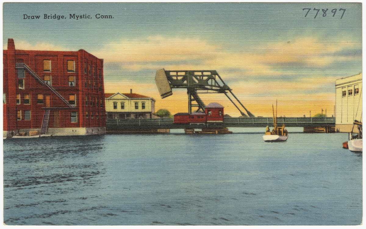
Above: Historical postcard showing original bridgetender house.

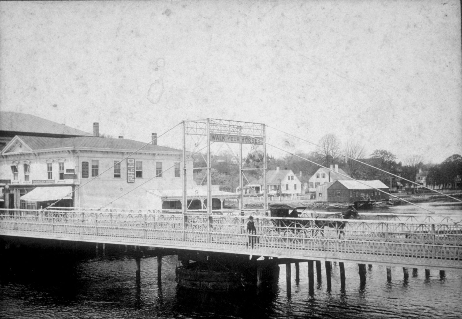
Above: Historical image showing previous bridge at location, a through truss swing bridge.

Above: Historical image showing previous bridge at location, a through truss swing bridge.
Above: Earlier bridge at this location, a rare Truesdell truss swing bridge built 1866 by A.D. Briggs & Co. of Springfield, Massachusetts and replaced in 1904.

Above: Earlier bridge at this location, a rare Truesdell truss swing bridge built 1866 by A.D. Briggs & Co. of Springfield, Massachusetts and replaced in 1904.
![]()
![]()
![]()

![]()
![]()
Coordinates (Latitude, Longitude):
Search For Additional Bridge Listings:
Bridgehunter.com: View listed bridges within 0.5 miles (0.8 kilometers) of this bridge.
Bridgehunter.com: View listed bridges within 10 miles (16 kilometers) of this bridge.
Additional Maps:
Google Streetview (If Available)
GeoHack (Additional Links and Coordinates)
Apple Maps (Via DuckDuckGo Search)
Apple Maps (Apple devices only)
Android: Open Location In Your Map or GPS App
Flickr Gallery (Find Nearby Photos)
Wikimedia Commons (Find Nearby Photos)
Directions Via Sygic For Android
Directions Via Sygic For iOS and Android Dolphin Browser
USGS National Map (United States Only)
Historical USGS Topo Maps (United States Only)
Historic Aerials (United States Only)
CalTopo Maps (United States Only)

© Copyright 2003-2024, HistoricBridges.org. All Rights Reserved. Disclaimer: HistoricBridges.org is a volunteer group of private citizens. HistoricBridges.org is NOT a government agency, does not represent or work with any governmental agencies, nor is it in any way associated with any government agency or any non-profit organization. While we strive for accuracy in our factual content, HistoricBridges.org offers no guarantee of accuracy. Information is provided "as is" without warranty of any kind, either expressed or implied. Information could include technical inaccuracies or errors of omission. Opinions and commentary are the opinions of the respective HistoricBridges.org member who made them and do not necessarily represent the views of anyone else, including any outside photographers whose images may appear on the page in which the commentary appears. HistoricBridges.org does not bear any responsibility for any consequences resulting from the use of this or any other HistoricBridges.org information. Owners and users of bridges have the responsibility of correctly following all applicable laws, rules, and regulations, regardless of any HistoricBridges.org information.
![]()