

View Information About HSR Ratings
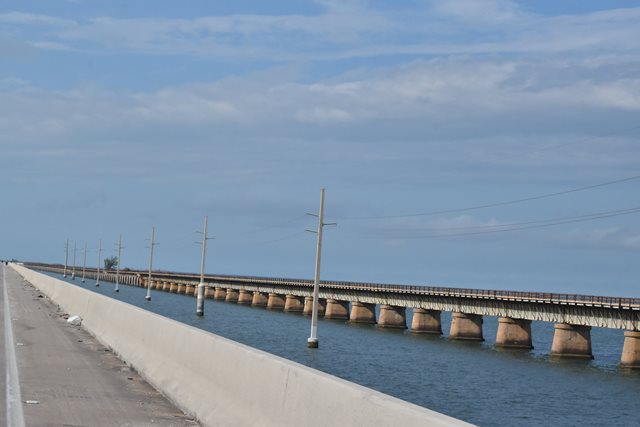
This bridge is the longest of the numerous bridge composing the Florida East Coast Railway Extension, which was converted to highway usage in 1938 as the initial structures for the Overseas Highway (US-1). The bridge was abandoned in 1972. One of the unique features of this bridge is that half of the bridge is composed of steel plate girder spans, and the other half is composed of concrete deck arch spans, making this a visually contrasted bridge. Roughly 9,090 feet of the bridge is concrete arch spans, while the rest of the bridge was built using steel. The differences in span type were due to issues such as water depth and wave height. Although HistoricBridges.org lists the main span design of this bridge as a metal deck girder (reflecting the bridge as seen today), the original bridge featured a through truss swing span as the main span over Moser Channel. The demolition of this swing span in 1982 is perhaps the single most devastating loss of heritage among the surviving pieces of the Florida East Coast Railway Extension in the years since the bridge structures have been abandoned from highway usage. The bridge is also missing a span near Pigeon Key. The section leading east from Pigeon Key remains in limited vehicular use as an access to Pigeon Key. A unique timber ramp structure leads up to the main bridge at Pigeon Key. A final section of bridge is missing, one of the concrete arch spans near the western end. West of the missing arch span is about 3,460 feet of the western end of the bridge which has been restored for pedestrian use as a fishing pier.
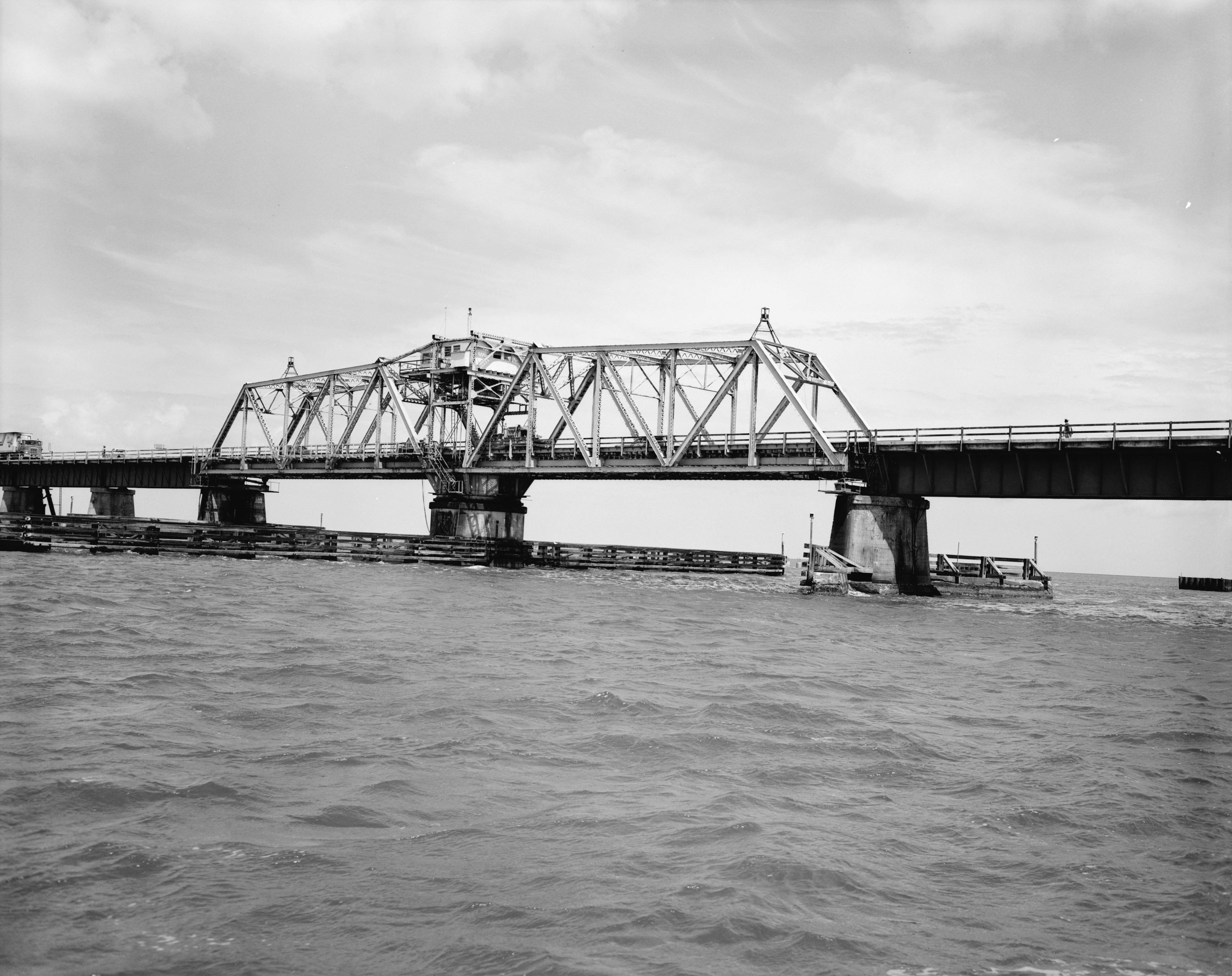
Above: Historical photo showing swing span in its final years of usage.

Above: Historical photo showing swing span in its final years of usage.

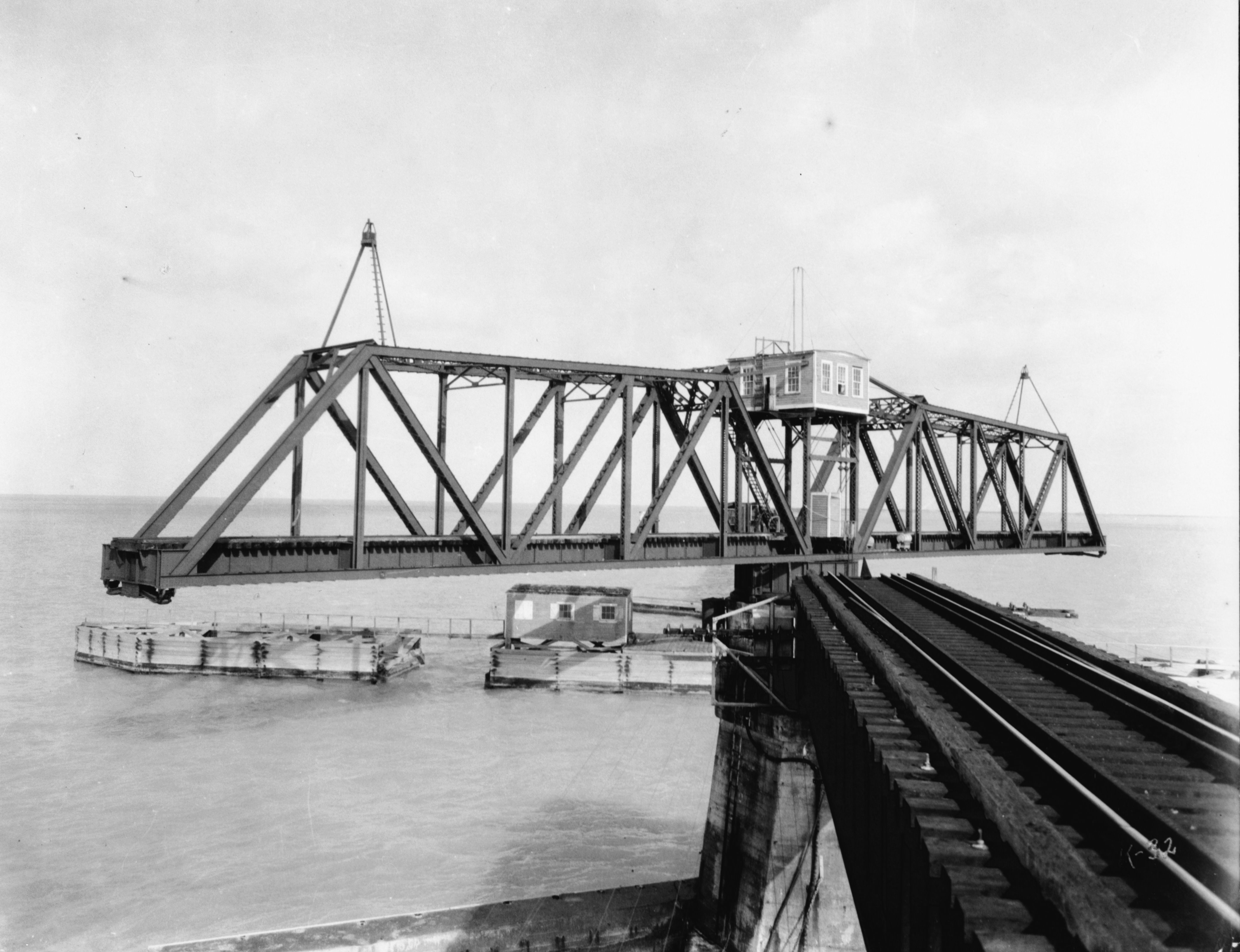
Above: Historical photo showing swing span construction.

Above: Historical photo showing girder span construction.

Above: Historical photo showing arch span construction.
Above: Historical photo showing swing span in open position.

Above: Historical photo showing train on bridge.

Above: Historical photo showing conversion of bridge from railroad to highway use.
![]()
![]()
![]()
Coordinates (Latitude, Longitude):
Search For Additional Bridge Listings:
Bridgehunter.com: View listed bridges within 0.5 miles (0.8 kilometers) of this bridge.
Bridgehunter.com: View listed bridges within 10 miles (16 kilometers) of this bridge.
Additional Maps:
Google Streetview (If Available)
GeoHack (Additional Links and Coordinates)
Apple Maps (Via DuckDuckGo Search)
Apple Maps (Apple devices only)
Android: Open Location In Your Map or GPS App
Flickr Gallery (Find Nearby Photos)
Wikimedia Commons (Find Nearby Photos)
Directions Via Sygic For Android
Directions Via Sygic For iOS and Android Dolphin Browser
USGS National Map (United States Only)
Historical USGS Topo Maps (United States Only)
Historic Aerials (United States Only)
CalTopo Maps (United States Only)

© Copyright 2003-2026, HistoricBridges.org. All Rights Reserved. Disclaimer: HistoricBridges.org is a volunteer group of private citizens. HistoricBridges.org is NOT a government agency, does not represent or work with any governmental agencies, nor is it in any way associated with any government agency or any non-profit organization. While we strive for accuracy in our factual content, HistoricBridges.org offers no guarantee of accuracy. Information is provided "as is" without warranty of any kind, either expressed or implied. Information could include technical inaccuracies or errors of omission. Opinions and commentary are the opinions of the respective HistoricBridges.org member who made them and do not necessarily represent the views of anyone else, including any outside photographers whose images may appear on the page in which the commentary appears. HistoricBridges.org does not bear any responsibility for any consequences resulting from the use of this or any other HistoricBridges.org information. Owners and users of bridges have the responsibility of correctly following all applicable laws, rules, and regulations, regardless of any HistoricBridges.org information.
![]()