


View Information About HSR Ratings
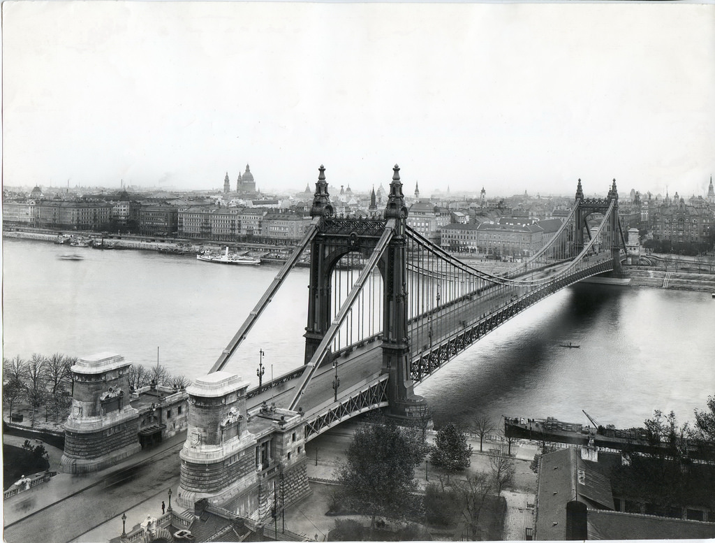
The Elisabeth Bridge (Erzsébet híd) stands out among bridges in Budapest because among the bridges destroyed in the city during the war, this is a bridge for which the pre-war design was not replicated. A photo of the previous bridge is shown above for comparison.
The original bridge was built in 1903, and it received significant attention in the engineering periodicals of the time. The bridge was an eyebar chain suspension bridge with rich ornamentation. The design and aesthetics of the bridge was purposely made to be different from other bridges in the city because it was felt that replicating the design of one of the other bridges would have been too monotonous. The war destroyed most of the bridge, with the exception of one tower and one adjacent backstay span. These ruins remained standing until a simple, modern wire cable suspension bridge with steel riveted towers and stiffening girders was erected in its place in 1964.

Above: Photo showing bridge construction.
Reportedly this bridge was designed with the aid of computers, which would have been an early use of computers for bridge design. Computers of the time reportedly were unable to calculate the design of the bridge using a traditional circular bundle for the main cable, therefore the main cable on this bridge takes on the form of a hexagon which was easier for the computers to handle.
The bridge is named after Wittelsbach Erzsébet (Empress Elisabeth of Austria).
The general contractor for the bridge is not listed, the company responsible for the cables on the bridge was Ganz–MÁVAG.
Above: View of the 1903 bridge.

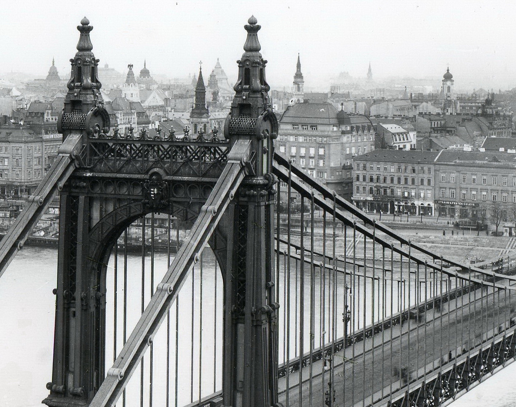
Above: View of the 1903 bridge after destruction.

Above: View of the 1903 bridge after destruction.

Above: View of the 1903 bridge after destruction.
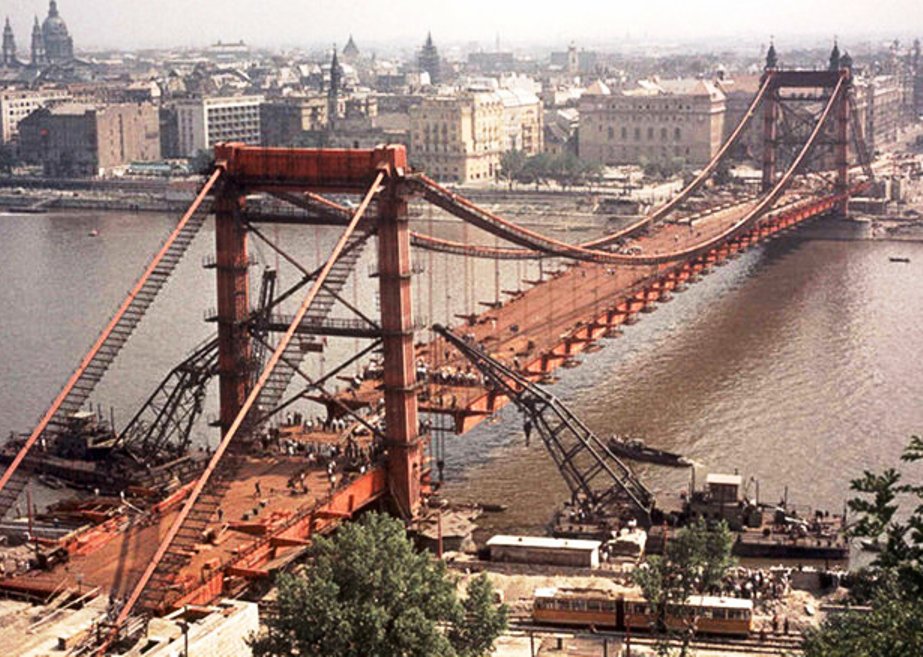
Above: Photo showing bridge construction.
![]()
![]()
![]()
Coordinates (Latitude, Longitude):
Search For Additional Bridge Listings:
Additional Maps:
Google Streetview (If Available)
GeoHack (Additional Links and Coordinates)
Apple Maps (Via DuckDuckGo Search)
Apple Maps (Apple devices only)
Android: Open Location In Your Map or GPS App
Flickr Gallery (Find Nearby Photos)
Wikimedia Commons (Find Nearby Photos)
Directions Via Sygic For Android
Directions Via Sygic For iOS and Android Dolphin Browser

© Copyright 2003-2024, HistoricBridges.org. All Rights Reserved. Disclaimer: HistoricBridges.org is a volunteer group of private citizens. HistoricBridges.org is NOT a government agency, does not represent or work with any governmental agencies, nor is it in any way associated with any government agency or any non-profit organization. While we strive for accuracy in our factual content, HistoricBridges.org offers no guarantee of accuracy. Information is provided "as is" without warranty of any kind, either expressed or implied. Information could include technical inaccuracies or errors of omission. Opinions and commentary are the opinions of the respective HistoricBridges.org member who made them and do not necessarily represent the views of anyone else, including any outside photographers whose images may appear on the page in which the commentary appears. HistoricBridges.org does not bear any responsibility for any consequences resulting from the use of this or any other HistoricBridges.org information. Owners and users of bridges have the responsibility of correctly following all applicable laws, rules, and regulations, regardless of any HistoricBridges.org information.
![]()