

View Information About HSR Ratings
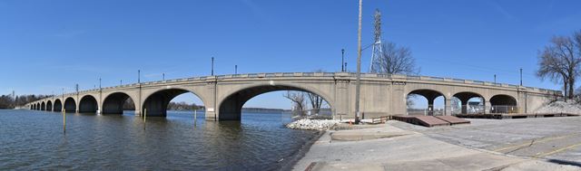
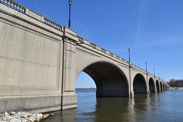
This bridge is one of the rarest types of concrete bridge, a cantilevered concrete arch bridge. It does not function as a true arch, in fact at the center of each arch span there is a small physical gap in the bridge, allowing each half of the bridge span to function as a cantilever out from the pier. This design is similar to the Belle Isle Bridge in Michigan. The National Bridge Inventory lists the Vachel Lindsay Bridge as a concrete girder bridge. This makes sense, because the bridge does not function as a true arch. On top of that, the arch design consists of two solid ribs, with transverse floorbeams under the deck. It could technically be thought of as a cantilevered concrete curved deck girder bridge, much like this through girder example in Ohio. Despite the Ohio bridge having a different aesthetic intent and a different girder position, the cantilever girder function is essentially the same.
The Vachel Lindsay Bridge retains excellent historic integrity, and the structural integrity is excellent too. The unusually extensive and handsome architectural details of this bridge remain intact and are not deteriorated. The cantilever design remains unchanged and unaltered. It is one of the finest and most historically significant concrete bridges in Illinois.
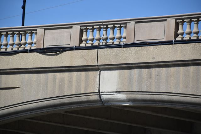
Above: A view showing the gap at the center of each arch span, showing that each half of the arch is structurally independent; a cantilever, not a true arch.
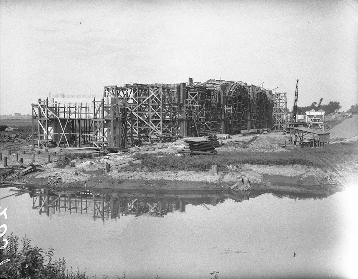
Above: Historical photo showing bridge construction.
![]()
![]()
![]()
Coordinates (Latitude, Longitude):
Search For Additional Bridge Listings:
Bridgehunter.com: View listed bridges within 0.5 miles (0.8 kilometers) of this bridge.
Bridgehunter.com: View listed bridges within 10 miles (16 kilometers) of this bridge.
Additional Maps:
Google Streetview (If Available)
GeoHack (Additional Links and Coordinates)
Apple Maps (Via DuckDuckGo Search)
Apple Maps (Apple devices only)
Android: Open Location In Your Map or GPS App
Flickr Gallery (Find Nearby Photos)
Wikimedia Commons (Find Nearby Photos)
Directions Via Sygic For Android
Directions Via Sygic For iOS and Android Dolphin Browser
USGS National Map (United States Only)
Historical USGS Topo Maps (United States Only)
Historic Aerials (United States Only)
CalTopo Maps (United States Only)

© Copyright 2003-2026, HistoricBridges.org. All Rights Reserved. Disclaimer: HistoricBridges.org is a volunteer group of private citizens. HistoricBridges.org is NOT a government agency, does not represent or work with any governmental agencies, nor is it in any way associated with any government agency or any non-profit organization. While we strive for accuracy in our factual content, HistoricBridges.org offers no guarantee of accuracy. Information is provided "as is" without warranty of any kind, either expressed or implied. Information could include technical inaccuracies or errors of omission. Opinions and commentary are the opinions of the respective HistoricBridges.org member who made them and do not necessarily represent the views of anyone else, including any outside photographers whose images may appear on the page in which the commentary appears. HistoricBridges.org does not bear any responsibility for any consequences resulting from the use of this or any other HistoricBridges.org information. Owners and users of bridges have the responsibility of correctly following all applicable laws, rules, and regulations, regardless of any HistoricBridges.org information.
![]()