We Recommend:
Bach Steel - Experts at historic truss bridge restoration.
106th Street Bridge
Primary Photographer(s): Nathan Holth
Bridge Documented: August 12, 2006, September 7, 2011, and September 10, 2012
Chicago: Cook County, Illinois: United States
Metal Rivet-Connected Pratt Pony Truss, Movable: Double Leaf Bascule (Fixed Trunnion) and Approach Spans: Metal Stringer (Multi-Beam), Fixed
1930 By Builder/Contractor: Ketler-Elliott Company of Chicago, Illinois and Engineer/Design: City of Chicago
1998
250.0 Feet (76.2 Meters)
349.0 Feet (106.4 Meters)
38 Feet (11.58 Meters)
1 Main Span(s) and 4 Approach Span(s)
16604326832

View Information About HSR Ratings
Bridge Documentation
View Archived National Bridge Inventory Report - Has Additional Details and Evaluation
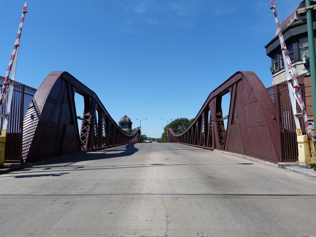
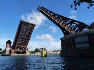
This bascule bridge has very large and impressive trusses on account of its long span length. The bridge's trusses are tall like downtown Chicago's Clark Street Bridge, but do not have the smooth curve at the top of the tallest part of the trusses, even though both bridges are essentially the same design and are part of the same generation in terms of the development of the Chicago bascule bridge. This difference in truss curvature, which is somewhat less graceful in the 106th Street Bridge, is something shared with similar Sanitary and Ship Canal bridges, as well as other Calumet River bridges of similar design. This may indicate a lesser concern for aesthetics in these more industrial areas as opposed to the bridges in the downtown Loop, where the concern of aesthetics was paramount. Even so, the 106th Street Bridge has handsome bridgetender buildings although again these are not quite as elaborate as those found in the Loop. The bridge tender buildings consist of brick with belt courses of Indiana Limestone.
The bridge's trusses appear to be in good condition overall. The built-up riveted lateral bracing and floorbeams under the bridge have all been replaced with modern rolled beams. However, the abutments and bridgetender buildings are in a state of significant deterioration. Entire sections of walls have bricks falling out of them, and other areas of the walls that have been repaired were not done so in a very tasteful manner. Chicago has traditionally done a good job maintaining its bascule bridges, and even the trusses on this bridge are in good condition. It is therefore unclear why the substructure and buildings of this bridge are in contrast so neglected.
Like the other movable bridges on the Calumet River these are the most frequently operated movable bridges in Chicago. They are staffed by bridgetenders 24 hours a day and open fairly frequently each day for barge and other ship traffic. For barges, the bridge's leaves are normally only lifted partially. However HistoricBridges.org was able to photograph a full bridge lift during a field visit. The very large, historic bascule bridge, powered by electric motors, can open quite quickly, indeed far more quickly than many modern hydraulic-powered bascule bridges.
This bridge has fences and industrial properties surrounding it, making it impossible to get beside or under the bridge from on land, therefore requiring a boat to get a full photo-documentation of the bridge. Thanks to Tom Winkle for providing boat transportation to assist in the photo-documentation of this historic bridge.
The 1930 Annual Report of the Public Works Department provided some interesting details about the construction of this bridge. The bascule bridge actually opened to traffic in Fall 1929. At this time, the bridge structure was completed, but the bridge tender houses were not complete, so operation of the bridge was conducted in a temporary building. The previous bridge at this location was a center pier swing bridge. Fitzsimons & Connell Dredge & Dock Company constructed the substructure. Ketler-Elliott Company constructed the superstructure. Ralph H. Simpson Company constructed the bridge tender houses. Pierce Electric Company installed electrical equipment. William J. Gormley Company installed the plumbing. Central Dredging Company and Fitzsimons & Connell Dredge & Dock Company both played a role in removing the previous bridge.
The first documented bridge at this location was the bridge that preceded the existing bridge. It was constructed at an unknown date and was a hand-turned iron swing bridge with a length of 179 feet and a width of 31 feet.
|
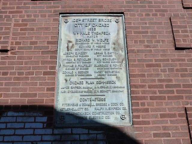
Main Plaque 106TH STREET BRIDGECITY OF CHICAGO 1930 WM HALE THOMPSON MAYOR RICHARD W. WOLFE COMMISSIONER OF PUBLIC WORKS EDWARD F. MOORE DEPUTY COMMISSIONER OF PUBLIC WORKS
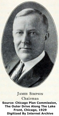
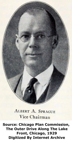
CHICAGO PLAN COMMISSION
CONTRACTORS FITZSIMONS & CONNELL DREDGE & DOCK CO.
KELLY-ATKINSON CONSTRUCTION CO. PIERCE ELECTRIC CO. |
![]()
Historic Bridges of Chicago and Cook County


Chicago and Cook County are home to one of the largest collections of historic bridges in the country, and no other city in the world has more movable bridges. HistoricBridges.org is proud to offer the most extensive coverage of historic Chicago bridges on the Internet.
General Chicago / Cook County Bridge Resources
Chicago's Bridges - By Nathan Holth, author of HistoricBridges.org, this book provides a discussion of the history of Chicago's movable bridges, and includes a virtual tour discussing all movable bridges remaining in Chicago today. Despite this broad coverage, the book is presented in a compact format that is easy to take with you and carry around for reference on a visit to Chicago. The book includes dozens of full color photos. Only $9.95 U.S! ($11.95 Canadian). Order Now Direct From The Publisher! or order on Amazon.
Chicago River Bridges - By Patrick T. McBriarty, this is a great companion to Holth's book shown above. This much larger book offers an extremely in-depth exploration of Chicago's movable highway bridges, including many crossings that have not existed for many years. Order Now Direct From The Publisher! or order on Amazon.
View Historic American Engineering Record (HAER) Overview of Chicago Bascule Bridges (HAER Data Pages, PDF)
Chicago Loop Bridges - Chicago Loop Bridges is another website on the Internet that is a great companion to the HistoricBridges.org coverage of the 18 movable bridges within the Chicago Loop. This website includes additional information such as connections to popular culture, overview discussions and essays about Chicago's movable bridges, additional videos, and current news and events relating to the bridges.
Additional Online Articles and Resources - This page is a large gathering of interesting articles and resources that HistoricBridges.org has uncovered during research, but which were not specific to a particular bridge listing.
![]()
Photo Galleries and Videos: 106th Street Bridge
Structure Overview
Original / Full Size PhotosA collection of overview photos that show the bridge as a whole and general areas of the bridge. This gallery offers photos in the highest available resolution and file size in a touch-friendly popup viewer.
Alternatively, Browse Without Using Viewer
![]()
Structure Details
Original / Full Size PhotosA collection of detail photos that document the parts, construction, and condition of the bridge. This gallery offers photos in the highest available resolution and file size in a touch-friendly popup viewer.
Alternatively, Browse Without Using Viewer
![]()
Structure Overview
Mobile Optimized PhotosA collection of overview photos that show the bridge as a whole and general areas of the bridge. This gallery features data-friendly, fast-loading photos in a touch-friendly popup viewer.
Alternatively, Browse Without Using Viewer
![]()
Structure Details
Mobile Optimized PhotosA collection of detail photos that document the parts, construction, and condition of the bridge. This gallery features data-friendly, fast-loading photos in a touch-friendly popup viewer.
Alternatively, Browse Without Using Viewer
![]()
Bridge Being Lowered
Full Motion VideoTaken from a boat at the northwest quadrant around the bridge. Streaming video of the bridge. Also includes a higher quality downloadable video for greater clarity or offline viewing.
![]()
Bridge Being Raised
Full Motion VideoTaken from a boat at the northwest quadrant around the bridge. Streaming video of the bridge. Also includes a higher quality downloadable video for greater clarity or offline viewing.
![]()
Bridge Being Partially Raised
Full Motion VideoTaken from a boat at the northwest quadrant around the bridge. Streaming video of the bridge. Also includes a higher quality downloadable video for greater clarity or offline viewing.
![]()
Bumpercam: Eastbound Crossing
Full Motion VideoNote: The downloadable high quality version of this video (available on the video page) is well worth the download since it offers excellent 1080 HD detail and is vastly more impressive than the compressed streaming video. Streaming video of the bridge. Also includes a higher quality downloadable video for greater clarity or offline viewing.
![]()
Bumpercam: Westbound Crossing
Full Motion VideoNote: The downloadable high quality version of this video (available on the video page) is well worth the download since it offers excellent 1080 HD detail and is vastly more impressive than the compressed streaming video. Streaming video of the bridge. Also includes a higher quality downloadable video for greater clarity or offline viewing.
![]()
Maps and Links: 106th Street Bridge
Coordinates (Latitude, Longitude):
Search For Additional Bridge Listings:
Bridgehunter.com: View listed bridges within 0.5 miles (0.8 kilometers) of this bridge.
Bridgehunter.com: View listed bridges within 10 miles (16 kilometers) of this bridge.
Additional Maps:
Google Streetview (If Available)
GeoHack (Additional Links and Coordinates)
Apple Maps (Via DuckDuckGo Search)
Apple Maps (Apple devices only)
Android: Open Location In Your Map or GPS App
Flickr Gallery (Find Nearby Photos)
Wikimedia Commons (Find Nearby Photos)
Directions Via Sygic For Android
Directions Via Sygic For iOS and Android Dolphin Browser
USGS National Map (United States Only)
Historical USGS Topo Maps (United States Only)
Historic Aerials (United States Only)
CalTopo Maps (United States Only)

