

View Information About HSR Ratings

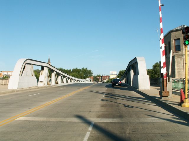
This bridge has the distinction of being associated with a roadway that was once US-66, which is the most-loved U.S. route in the country. Although US-66 is no longer officially signed here, historic US-66 signage is present near the bridge.

While the City of Chicago has only one remaining Scherzer rolling lift highway bascule bridge yet has dozens of trunnion bascule bridges, Joliet is the opposite and has four Scherzer rolling lift bascule bridges yet only one trunnion bascule bridge, and this is it. The bridge is very similar to trunnion bascule bridges seen in Chicago, however almost appears out-of-place here in Joliet with all the other rolling lift bridges. It is unclear why a trunnion bascule was selected for this crossing. To make matters even more strange, the bridge was designed by the Scherzer Rolling Lift Bridge Company, making this bridge a rare example of where the company departed from its trademark type of bascule bridge and instead designed a fixed trunnion bascule bridge that is strikingly similar to those designed by the City of Chicago during this same period. Details similar to Chicago city-designed bridges include the low-profile Pratt pony truss, curved top chord, and the concealment of the leaf racks on the inside of the truss web, with the pinion being located under the roadway, along with the counterweight and the fixed trunnion.
In 2011 a contract was let to rehabilitate this bridge. Like the other recently repainted bridges in Joliet, the bridge will be repainted in a blue color.
Be sure to view the photo gallery for this bridge which includes photos of the inside of the bridge tender house and the machinery room. Video of the bridge in motion is available here.


![]()
![]()
![]()
Coordinates (Latitude, Longitude):
Search For Additional Bridge Listings:
Bridgehunter.com: View listed bridges within 0.5 miles (0.8 kilometers) of this bridge.
Bridgehunter.com: View listed bridges within 10 miles (16 kilometers) of this bridge.
Additional Maps:
Google Streetview (If Available)
GeoHack (Additional Links and Coordinates)
Apple Maps (Via DuckDuckGo Search)
Apple Maps (Apple devices only)
Android: Open Location In Your Map or GPS App
Flickr Gallery (Find Nearby Photos)
Wikimedia Commons (Find Nearby Photos)
Directions Via Sygic For Android
Directions Via Sygic For iOS and Android Dolphin Browser
USGS National Map (United States Only)
Historical USGS Topo Maps (United States Only)
Historic Aerials (United States Only)
CalTopo Maps (United States Only)

© Copyright 2003-2024, HistoricBridges.org. All Rights Reserved. Disclaimer: HistoricBridges.org is a volunteer group of private citizens. HistoricBridges.org is NOT a government agency, does not represent or work with any governmental agencies, nor is it in any way associated with any government agency or any non-profit organization. While we strive for accuracy in our factual content, HistoricBridges.org offers no guarantee of accuracy. Information is provided "as is" without warranty of any kind, either expressed or implied. Information could include technical inaccuracies or errors of omission. Opinions and commentary are the opinions of the respective HistoricBridges.org member who made them and do not necessarily represent the views of anyone else, including any outside photographers whose images may appear on the page in which the commentary appears. HistoricBridges.org does not bear any responsibility for any consequences resulting from the use of this or any other HistoricBridges.org information. Owners and users of bridges have the responsibility of correctly following all applicable laws, rules, and regulations, regardless of any HistoricBridges.org information.
![]()