We Recommend:
Bach Steel - Experts at historic truss bridge restoration.
Western Avenue Bridge
Primary Photographer(s): Nathan Holth
Bridge Documented: August 12, 2006, June 28, 2011, and September 7, 2011
Chicago: Cook County, Illinois: United States
Metal Through Girder, Movable: Vertical Lift (Tower Drive) and Approach Spans: Metal Through Girder, Fixed
1940 By Builder/Contractor: Strobel Steel Construction Company of Chicago, Illinois and Engineer/Design: City of Chicago
1942
109.0 Feet (33.2 Meters)
295.0 Feet (89.9 Meters)
107.3 Feet (32.71 Meters)
1 Main Span(s) and 2 Approach Span(s)
16605623164

View Information About HSR Ratings
Bridge Documentation
This bridge's future is at risk!
Bridge Status: Slated for demolition and replacement. Section 106 started in May 2022.View Archived National Bridge Inventory Report - Has Additional Details and Evaluation
View Historic American Engineering Record (HAER) Documentation For This Bridge
HAER Data Pages, PDF
View Historical Article About This Bridge
View Selected Original Plans For This Bridge
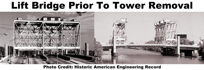
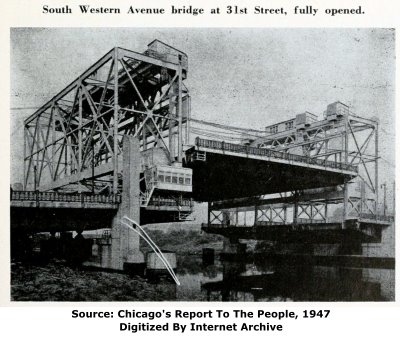
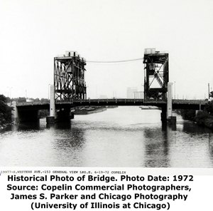
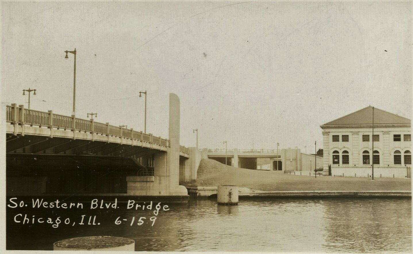
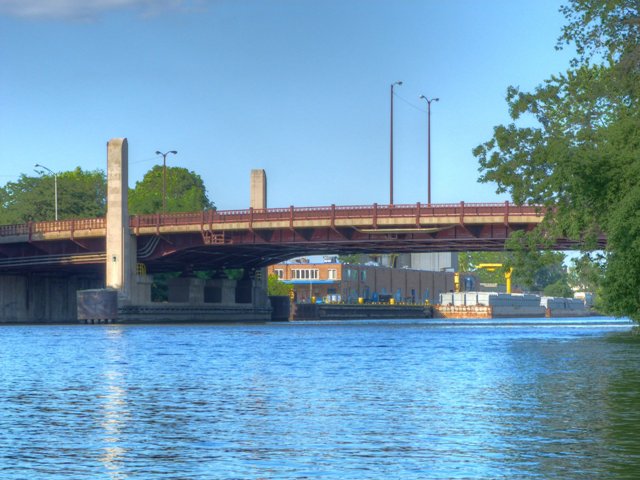
Few who cross this bridge today and do not know the history of this bridge probably are completely unaware that what looks like a typical, albeit very wide, fixed riveted through plate girder bridge was once an impressive vertical lift bridge. As unbelievable as it may seem, this bridge once had giant trussed towers and the associated mechanical equipment that enabled the central plate girder span to be lifted up, making it one of the widest vertical lift bridges known. Although this bridge was originally constructed as a fixed plate girder bridge, in 1942, the bridge was altered by the addition of towers and machinery that converted the bridge into a vertical lift bridge, to allow the Navy to move boats as part of the ongoing World War II. Unfortunately, all of those elaborate furnishings have once again been removed, leaving behind a very wide fixed plate girder that may in fact be representative of how the bridge appeared when originally built.
As a movable bridge, this bridge has lost all integrity that conveys its function. It is no longer significant as a movable bridge. However if considered for what it is today, a fixed through plate girder, the bridge is noteworthy for its art deco design including concrete pillars and a large and handsome bronze plaque design. Even the original ornate railings remain on the bridge, ironic because many of the movable bridges which retain structural integrity have lost their original railings.
Thanks to Tom Winkle for providing boat transportation to assist in the photo-documentation of this historic bridge.
Description of Bridge Conversion From Chicago's Report To The People, 1933-1946
The advent of war stopped new bridge construction and prevented completion of the State Street and Canal Street bridge projects. Material and manpower shortages made maintenance of existing structures a difficult task. But engineers and men of the Bureau of Bridges and Viaducts carried on with great resourcefulness, maintaining these essential links in the city's system of war production traffic arteries. In addition, they rehabilitated six bridges over the drainage canal which had been inoperative for about fifteen years to permit passage of Navy vessels en route to the Gulf of Mexico.
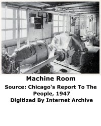
A notable achievement in this connection was the conversion of a 10-lane fixed bridge on south Western Avenue into a lift bridge. As a fixed bridge, its 21-foot vertical clearance over the sanitary and ship canal was inadequate to permit passage of newly-built war vessels from Great Lakes shipyards to the Gulf of Mexico. Some vessels had been taken through by omitting their superstructures and lowering the canal four feet, but this method had serious drawbacks. In July, 1942, the city entered into a contract with the Navy department for the alteration to be done by the city. The first shipment of steel for the towers arrived at the site on January 22nd. During the next ten weeks - in one of Chicago's coldest winters - the basic job of con- version was done. Trial tests were made on April 4th and on the following day naval vessels passed through the open draw of the reconverted bridge! One of the great aspects of this achievement is the fact that traffic on the ten lanes provided by the 140-foot deck of the crossing - including two street car tracks, and two sidewalks - was not seriously interrupted during the remodeling.
Above: A photo showing the bridge with its lift towers in place and the lift span in raised position.
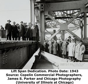
Above: Photos showing the dedication ceremony following the conversion of the fixed Western Avenue Bridge into a lift bridge.
Above: Photos from 1943 and 1972, respectively, showing the bridge with the lift towers in place.
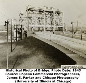
Above: Historical photo, showing bridge before conversion to vertical lift bridge.
|
Main Plaque FEDERAL WORKS AGENCYPUBLIC WORKS ADMINISTRATION JOHN M. CARMODY FEDERAL WORKS ADMINISTRATOR FRANKLIN D. ROOSEVELT PRESIDENT OF THE UNITED STATES S. WESTERN AVENUE IMPROVEMENT 1940 BUILT BY THE CITY OF CHICAGO EDWARD J. KELLY, MAYOR BOARD OF LOCAL IMPROVEMENTS MICHAEL F. MULCAHY, PRESIDENT WILLIAM W. LINK, VICE PRESIDENT MEMBERS
PAUL H. MUELLER, SECRETRY DEPARTMENT OF PUBLIC WORKS OSCAR E. HEWITT COMMISSIONER DESIGN AND SUPERVISION ARTHUR ENGH CHIEF ENGINEER
M. J. BURKE, RESIDENT ENGINEER CONTRACTORS
SEC. S. WESTERN AVE - S. A. 055 - 1111 - C. S. |
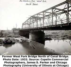
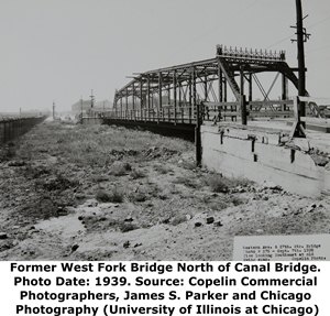
Above: While this is a completed different bridge, it is interesting to note that as late as 1939, there was an impressive, yet narrow through truss that crossed a body of water (The West Fork of the South Branch Chicago River) that was filled in around 1939, after which the bridge was likely demolished. The two photos above show the bridge before and after the fill project. The Annual Report of the Department of Public Works provides the following information about former Western Avenue bridges: Among canal bridges: The first documented bridge was built in 1870 of wood by C. Fitz Simons and the bridge was a fixed bridge. This bridge was replaced by an iron fixed bridge in 1882. This bridge was built by the Massillon Bridge Company of Massillon, Ohio. It had a length of 118 feet and a width of 18 feet. The Public Works Report also listed a history of crossings for South Western Avenue, which is presumed to refer to the West Fork of the South Branch Chicago River Bridges. The first listed bridge was a hand-turned swing bridge that was a wood/iron combination bridge built by F. E. Canda in 1869. It was replaced in 1906 when the old 18th Street Bridge was moved and reused at Western Avenue. That bridge was built in 1888 by the King Bridge Company of Cleveland, Ohio and was a hand-turned iron and steel swing bridge.
![]()
Historic Bridges of Chicago and Cook County


Chicago and Cook County are home to one of the largest collections of historic bridges in the country, and no other city in the world has more movable bridges. HistoricBridges.org is proud to offer the most extensive coverage of historic Chicago bridges on the Internet.
General Chicago / Cook County Bridge Resources
Chicago's Bridges - By Nathan Holth, author of HistoricBridges.org, this book provides a discussion of the history of Chicago's movable bridges, and includes a virtual tour discussing all movable bridges remaining in Chicago today. Despite this broad coverage, the book is presented in a compact format that is easy to take with you and carry around for reference on a visit to Chicago. The book includes dozens of full color photos. Only $9.95 U.S! ($11.95 Canadian). Order Now Direct From The Publisher! or order on Amazon.
Chicago River Bridges - By Patrick T. McBriarty, this is a great companion to Holth's book shown above. This much larger book offers an extremely in-depth exploration of Chicago's movable highway bridges, including many crossings that have not existed for many years. Order Now Direct From The Publisher! or order on Amazon.
View Historic American Engineering Record (HAER) Overview of Chicago Bascule Bridges (HAER Data Pages, PDF)
Chicago Loop Bridges - Chicago Loop Bridges is another website on the Internet that is a great companion to the HistoricBridges.org coverage of the 18 movable bridges within the Chicago Loop. This website includes additional information such as connections to popular culture, overview discussions and essays about Chicago's movable bridges, additional videos, and current news and events relating to the bridges.
Additional Online Articles and Resources - This page is a large gathering of interesting articles and resources that HistoricBridges.org has uncovered during research, but which were not specific to a particular bridge listing.
![]()
Photo Galleries and Videos: Western Avenue Bridge
Bridge Photo-Documentation
Original / Full Size PhotosA collection of overview and detail photos. This gallery offers photos in the highest available resolution and file size in a touch-friendly popup viewer.
Alternatively, Browse Without Using Viewer
![]()
Bridge Photo-Documentation
Mobile Optimized PhotosA collection of overview and detail photos. This gallery features data-friendly, fast-loading photos in a touch-friendly popup viewer.
Alternatively, Browse Without Using Viewer
![]()
Maps and Links: Western Avenue Bridge
Coordinates (Latitude, Longitude):
Search For Additional Bridge Listings:
Bridgehunter.com: View listed bridges within 0.5 miles (0.8 kilometers) of this bridge.
Bridgehunter.com: View listed bridges within 10 miles (16 kilometers) of this bridge.
Additional Maps:
Google Streetview (If Available)
GeoHack (Additional Links and Coordinates)
Apple Maps (Via DuckDuckGo Search)
Apple Maps (Apple devices only)
Android: Open Location In Your Map or GPS App
Flickr Gallery (Find Nearby Photos)
Wikimedia Commons (Find Nearby Photos)
Directions Via Sygic For Android
Directions Via Sygic For iOS and Android Dolphin Browser
USGS National Map (United States Only)
Historical USGS Topo Maps (United States Only)
Historic Aerials (United States Only)
CalTopo Maps (United States Only)

