

View Information About HSR Ratings
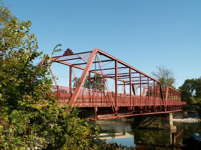
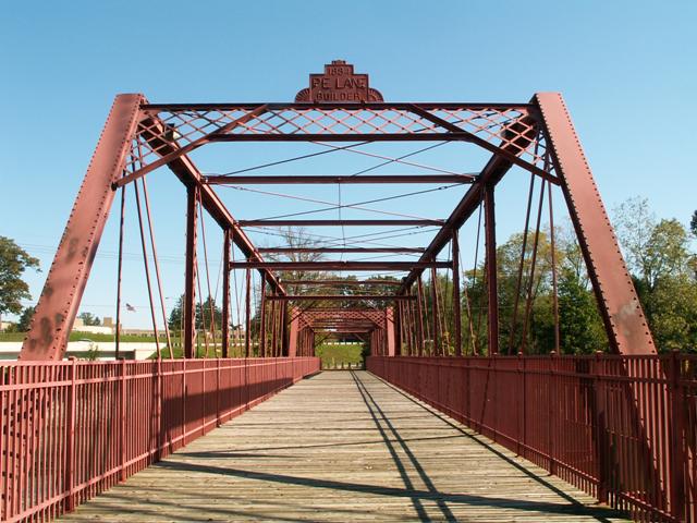
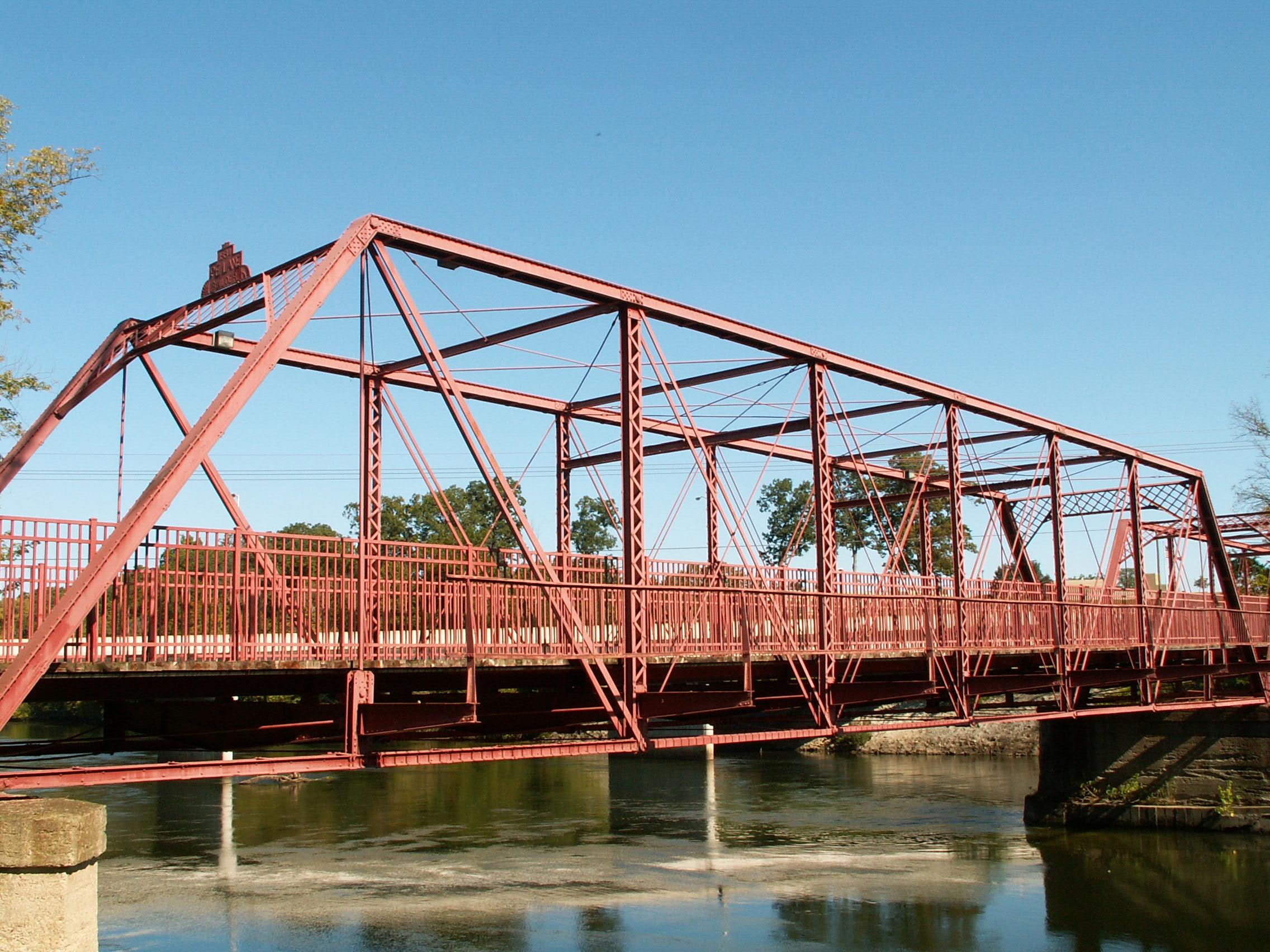
This is the only known truss bridge remaining in St. Joseph County, Indiana which has fortunately been preserved by South Bend, who apparently recognized that if this bridge had been lost, the county would have become devoid of the rich heritage and beauty provided by a historic metal truss bridge. It is an impressive and rare structure, with a long two span length. Each span is composed of eight panels. There is v-lacing on the verticals. The portal bracing is a lattice design. A simple steel stinger approach is present at the east end of the bridge. The deck stringers, and the stringers on the approach span, are not original. Piers and abutments are concrete. This bridge was restored in 1997. In 1999, the new bridge for vehicles was completed immediately north of this bridge. For reasons that are unclear, the original builder plaque for this bridge was never repaired and placed back on the portal, and was instead simple cast into a concrete stand near the bridge. The plaques present on top of the portals today are modern, and quite a bit different looking than the original plaque. The deck is positioned in the trusses at a high level, a design feature that does indeed appear to be original. Although it has no deck, railings and brackets from a sidewalk system remain on the south side of the bridge. The railings on this sidewalk are unusual lightweight railings, but appear to be original. Railings on the main deck of the bridge are not original, nor do they respect the original design of the structure. Other railings could have been selected for the restoration that would have provided a better combination of safety and visual quality. However, the railings are the only detrimental alteration that is readily visible, which is good news. Otherwise, the bridge remains as a beautiful structure, and represents a city that cares for its historic bridges and the city's general desirability. It is a significant attraction, and located near the main strip in South Bend, an Indiana Turnpike exit, and Notre Dame University, this is a bridge that is easily accessible to many people.
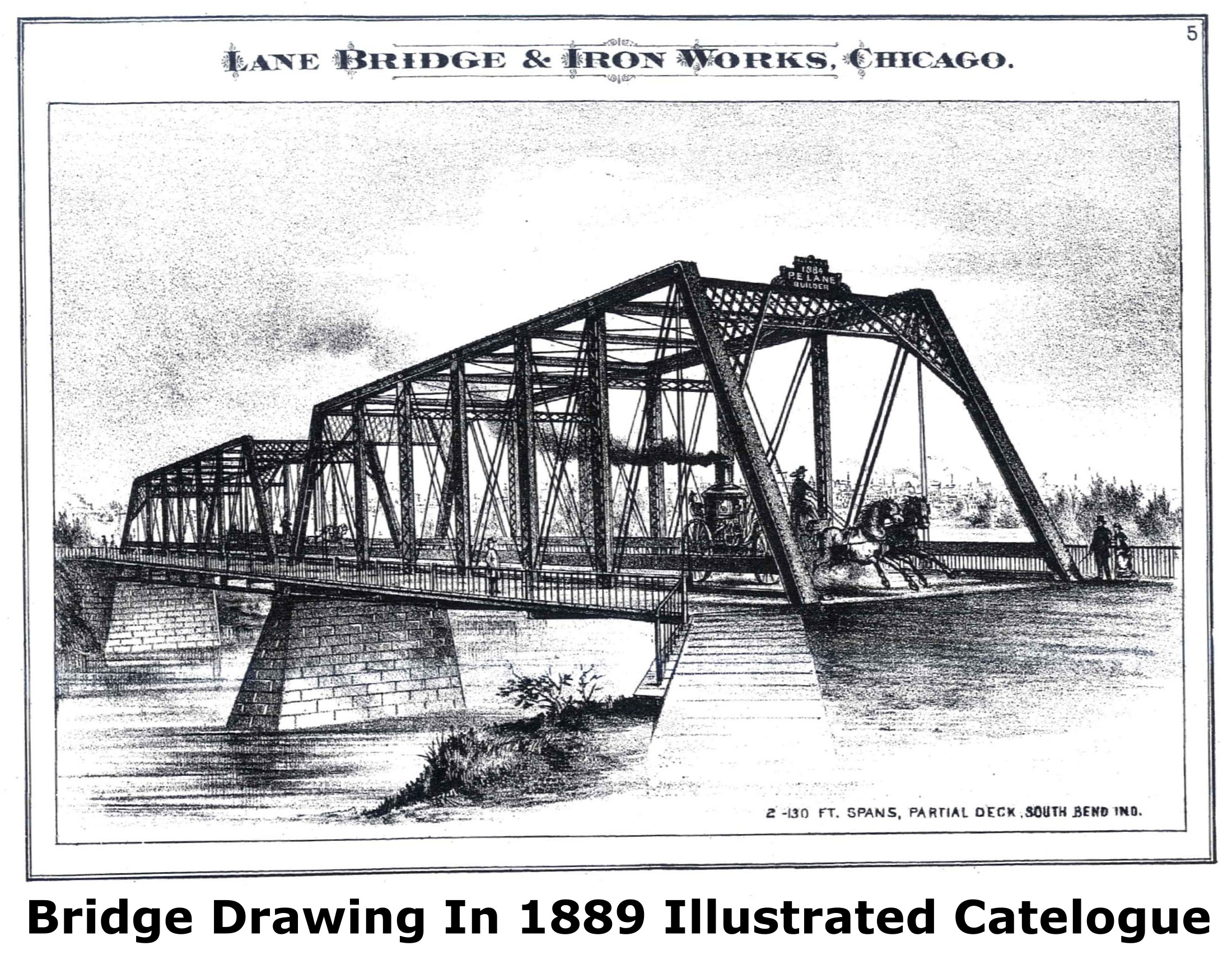
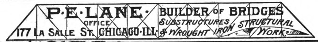
The bridge is historically significant as a long-two span truss bridge, and one of the few remaining truss bridges in the extreme northern region of Indiana. Finally, the bridge is significant as a rare surviving work of P. E. Lane who operated a bridge works in Chicago, and may have been involved with the construction of a couple unusual arch bridges in Indiana and Illinois. Indiana's example is the Dunns Bridge, while the Illinois example is the Sugar Creek Chapel Bridge.
Information and Findings From DHPA Historic Bridge SurveyDescription of Bridge (Pre-Restoration) The bridge was moved on July 24, 1906 from Water (now La Salle) St. to Darden Rd. It originally had two spans; after being moved, two approach spans were added. The portal bracing is missing for the easternmost pair of endposts. The nameplates are also gone. The wooden sidewalk deck is almost gone. In addition, a portion of the sidewalk handrail is missing on the western approach span, and the sidewalk has been barricaded from pedestrian traffic for several years. Modern aluminum highway barriers have been added to each side of the bridge, although one section is missing on the northern side of the bridge. In 1957, a new wood deck was laid on the bridge, and a year later it was covered with asphalt. This deck was eventually replaced by a corrugated metal and asphalt deck. The bridge was closed to traffic in 1970, and has received no maintenance since that time. There is minor rusting in the superstructure. Several of the tie rods that form the lateral bracing and the sway bracing are missing or in poor condition. The steel girders and I-beams of the newer approach spans both show signs of corrosion, the I-beams to such a degree that there are gaping holes and collapsed beams. The retaining wall for the western bank abutments was washed out by a storm sewer and is causing a severe erosion problem. There is also some erosion at the south retaining wall. [SHPO database] History of Bridge In 1908 the bridge, then known as Four Mile Bridge, provided an important transriver link in northern St. Joseph County. The Four Mile Bridge was the only bridge to cross the St. Joseph River between Angela Boulevard in South Bend and the Bertrand Bridge in Bertrand, Michigan, a distance of approximately eight miles. This river crossing in northern St. Joseph County greatly aided in the development and growth of Clay and German Townships in the early 20th century by providing residents of the area with a convenient crossing. The Darden Road Bridge remained the only river crossing in northern St. Joseph County until 1960, when the Auten Road Bridge was built one mile north. In 1970 the bridge was closed to vehicular traffic after the opening of the Cleveland Road Bridge, one-half mile south, but the bridge has remained a vital pedestrian crossing since its closing. In 1978 the Darden Road Bridge was declared a County Landmark by the Historic Preservation Commission and the County Commissioners because of its importance to St. Joseph County as an example of a late 19th century iron truss bridge, and for the major role it had in South Bend and St. Joseph County's early transportation history. Bridge Considered Historic By Survey: Yes |
This bridge is tagged with the following special condition(s): Reused and Unorganized Photos
![]()
![]()
![]()

![]()
![]()
![]()
Coordinates (Latitude, Longitude):
Search For Additional Bridge Listings:
Bridgehunter.com: View listed bridges within 0.5 miles (0.8 kilometers) of this bridge.
Bridgehunter.com: View listed bridges within 10 miles (16 kilometers) of this bridge.
Additional Maps:
Google Streetview (If Available)
GeoHack (Additional Links and Coordinates)
Apple Maps (Via DuckDuckGo Search)
Apple Maps (Apple devices only)
Android: Open Location In Your Map or GPS App
Flickr Gallery (Find Nearby Photos)
Wikimedia Commons (Find Nearby Photos)
Directions Via Sygic For Android
Directions Via Sygic For iOS and Android Dolphin Browser
USGS National Map (United States Only)
Historical USGS Topo Maps (United States Only)
Historic Aerials (United States Only)
CalTopo Maps (United States Only)

© Copyright 2003-2025, HistoricBridges.org. All Rights Reserved. Disclaimer: HistoricBridges.org is a volunteer group of private citizens. HistoricBridges.org is NOT a government agency, does not represent or work with any governmental agencies, nor is it in any way associated with any government agency or any non-profit organization. While we strive for accuracy in our factual content, HistoricBridges.org offers no guarantee of accuracy. Information is provided "as is" without warranty of any kind, either expressed or implied. Information could include technical inaccuracies or errors of omission. Opinions and commentary are the opinions of the respective HistoricBridges.org member who made them and do not necessarily represent the views of anyone else, including any outside photographers whose images may appear on the page in which the commentary appears. HistoricBridges.org does not bear any responsibility for any consequences resulting from the use of this or any other HistoricBridges.org information. Owners and users of bridges have the responsibility of correctly following all applicable laws, rules, and regulations, regardless of any HistoricBridges.org information.
![]()