

View Information About HSR Ratings
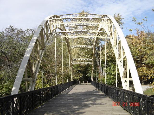
This extremely unusual bridge is similar to the even more unusual Sugar Creek Chapel Bridge in Illinois. The two bridges are undoubted related in their histories and origins.

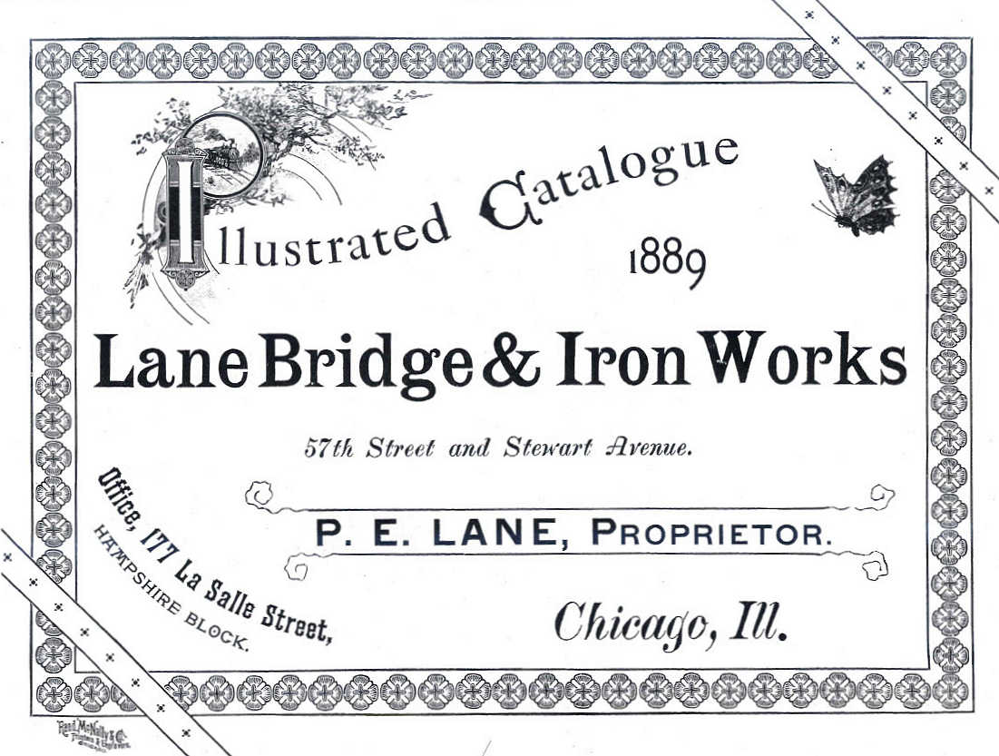
Thanks to James Cooper and James Stewart for helping think up some ideas on the origins and construction of this bridge as discussed below. This bridge is only seven panels in length rather than eight as in Iroquois County's example. According to James Cooper's Iron Monuments book, which documents Indiana's historic bridges, there have been rumors that the Dunn's Bridge's trussed arch came from the 1893 World Columbian Exposition Ferris Wheel. This claim is not well backed up, especially considering that the arches are not concentric. Some have also claimed the bridge came from a 1904 Indiana Building at the St. Louis World Fair. This however does not seem as likely. Rather, the bridge may have come from some other 1893 World Columbian Exposition structure. There were other buildings besides the Ferris Wheel in the 1893 Columbian Exposition from which the trusses of this arch bridge could have originated from. An identification of the builder remains a mystery, although the names P.E. Lane and a "Chicago Bridge Company" have come up as possible builder. P.E. Lane operated a Lane Bridge and Iron Works company, but it is possible he has some sort of relationship with the Chicago Bridge Company as well. These are all speculations, but they are the best ideas that have surfaced so far. Thanks to James Stewart and James Cooper for doing some research and investigating to turn up these ideas.
Interesting arched lattice railings still remain on the approach for this restored bridge. These may have been taken from a different section of those roof trusses, as they are essentially identical to the sway bracing seen on the bridge.
This bridge is completely unique among Indiana bridges, and along with its sister in Illinois are some of the most unusual bridges in the country with equally unusual histories. Dunn's Bridge has fortunately been preserved in place for pedestrian use.
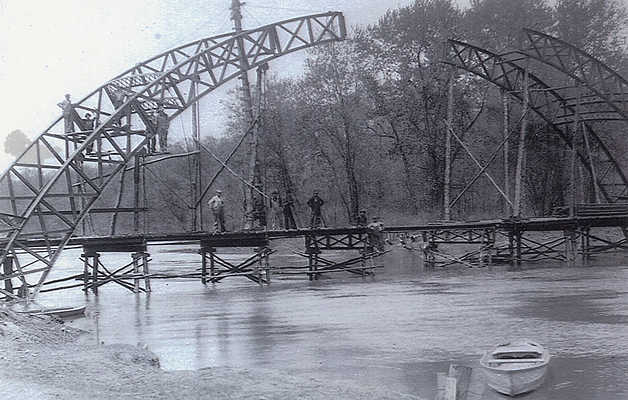
Above: Historical post showing bridge construction.

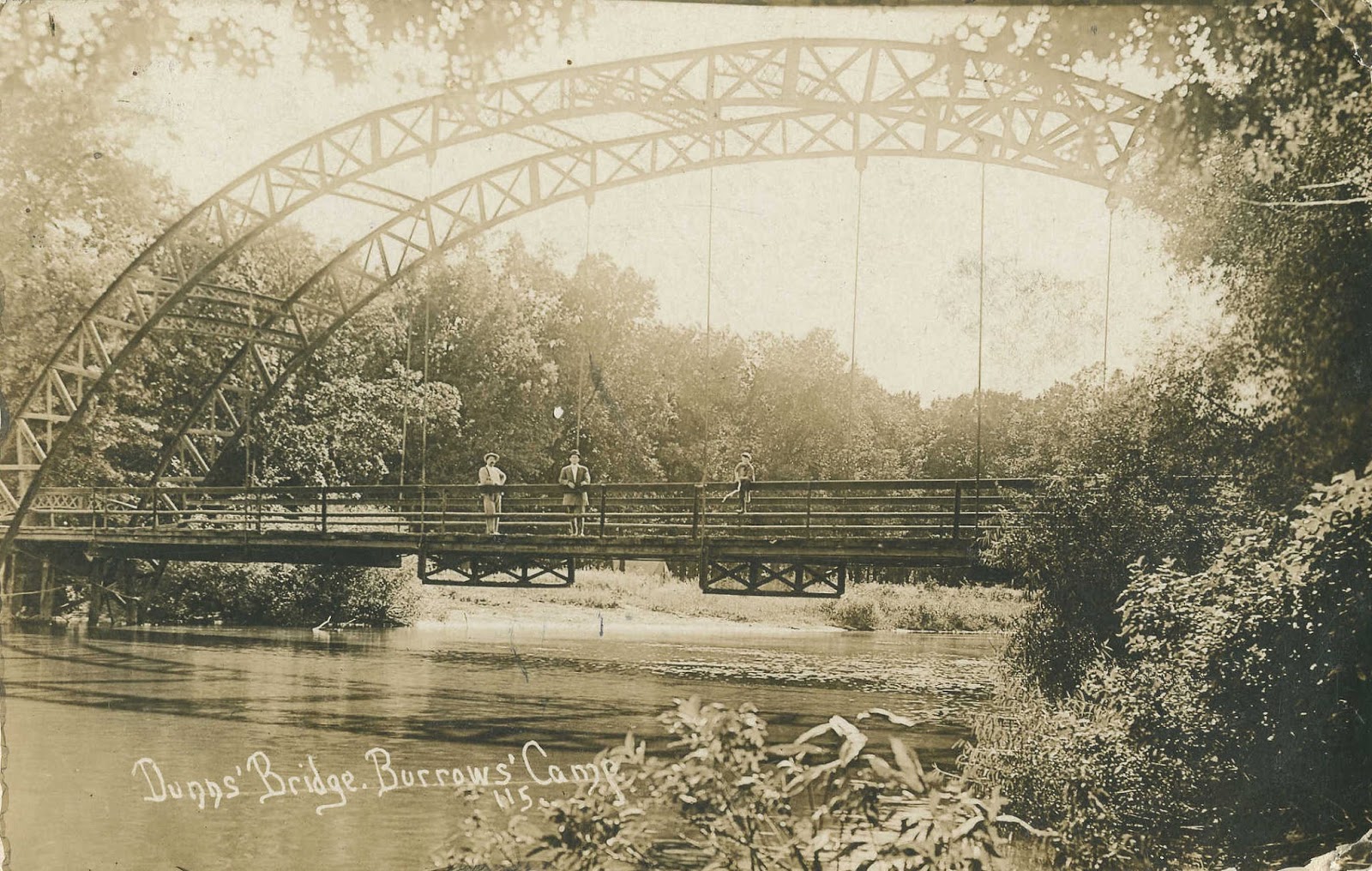
Above: Historical postcard of bridge.
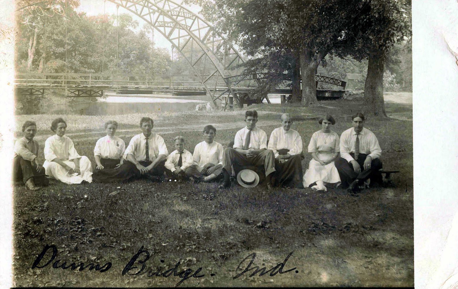
Above: Historical photo of bridge.

Above: Historical photo of bridge.
Above: Historical photo of bridge.
Information and Findings From DHPA Historic Bridge SurveyDiscussion of Bridge According to Julian Rangus, Porter County's engineering consultant, P. E. Lane designed the main or through span of this bridge from roof trusses salvaged from the 1893 World Columbian Exhibition in Chicago. The steel through arch and the two I beam approaches to the north sit upon concrete abutments, wingwalls, and piers. The arches are framed from two pairs of curved angles, each pair riveted and then the pairs latticed with angles about 3' apart. Two six-panel, two three-panel, and two six-panel sections are bolted together to compose an arch. Five eyebars hang from the arch and are attached to the floor-beams. The two most central floor-beams are manufactured as open and latticed rectangular girders; the others are I beams. They carry the asphalt-over-timber deck. The bridge does not have a lower chord. Since Rangus' 1974 assessment, others have associated the trusses with the Indiana building of the St. Louis World's Fair held in 1903. Regarded as a historic monument by residents of the two adjacent counties because of its origins, this bridge is a one-of-a-kind at an established river crossing. It retains its original members, including curved latticed struts and guardrails on its approaches. References Other Information Julian E. Rangus & Associates, Bridge Inspection Report: Porter County (Valparaiso, 1974). Bengel Engineering & Associates, Porter County Bridge Inspection Report (Valparaiso, 1980). Warren T. Hobson & Associates, Bridge Inspection Report: Jasper County (Indianapolis, 1974, 1980). Indianapolis Star, 20 Oct. 1986: 25-26. Bridge Considered Historic By Survey: Yes |
![]()
![]()
Coordinates (Latitude, Longitude):
Search For Additional Bridge Listings:
Bridgehunter.com: View listed bridges within 0.5 miles (0.8 kilometers) of this bridge.
Bridgehunter.com: View listed bridges within 10 miles (16 kilometers) of this bridge.
Additional Maps:
Google Streetview (If Available)
GeoHack (Additional Links and Coordinates)
Apple Maps (Via DuckDuckGo Search)
Apple Maps (Apple devices only)
Android: Open Location In Your Map or GPS App
Flickr Gallery (Find Nearby Photos)
Wikimedia Commons (Find Nearby Photos)
Directions Via Sygic For Android
Directions Via Sygic For iOS and Android Dolphin Browser
USGS National Map (United States Only)
Historical USGS Topo Maps (United States Only)
Historic Aerials (United States Only)
CalTopo Maps (United States Only)

© Copyright 2003-2024, HistoricBridges.org. All Rights Reserved. Disclaimer: HistoricBridges.org is a volunteer group of private citizens. HistoricBridges.org is NOT a government agency, does not represent or work with any governmental agencies, nor is it in any way associated with any government agency or any non-profit organization. While we strive for accuracy in our factual content, HistoricBridges.org offers no guarantee of accuracy. Information is provided "as is" without warranty of any kind, either expressed or implied. Information could include technical inaccuracies or errors of omission. Opinions and commentary are the opinions of the respective HistoricBridges.org member who made them and do not necessarily represent the views of anyone else, including any outside photographers whose images may appear on the page in which the commentary appears. HistoricBridges.org does not bear any responsibility for any consequences resulting from the use of this or any other HistoricBridges.org information. Owners and users of bridges have the responsibility of correctly following all applicable laws, rules, and regulations, regardless of any HistoricBridges.org information.
![]()