

View Information About HSR Ratings
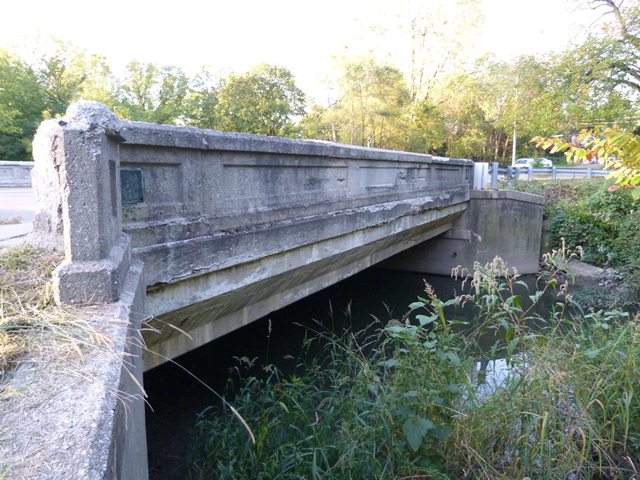
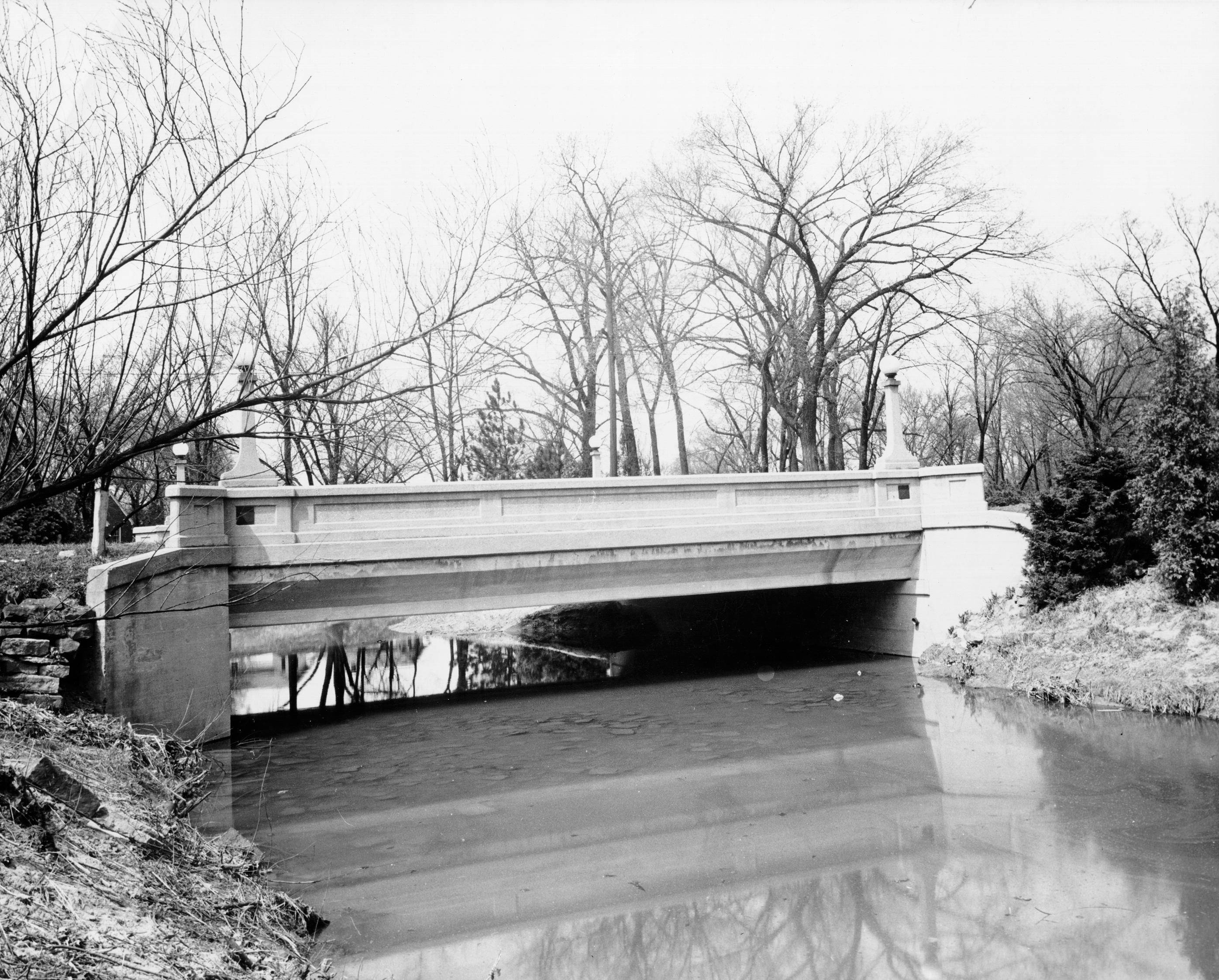
This concrete t-beam bridge is significant for its design by noted local engineer A. W. Grosvenor. The bridge originally had decorative light standards which have been removed. Otherwise, the bridge is unaltered.
Information and Findings From DHPA Historic Bridge SurveyStatement of Significance Seeming to have followed the rules of thumb then current, the the county engineers who designed and the noted contractor who built this bridge produced a rather standard T-beam structure. Architectural Description The T-shape has been used far more extensively in reinforced concrete than in metal spans. Commonly made at the bridge-site, T-beams of concrete can be adjusted to the special needs of the crossing and bonded to
one another. The designer can vary the width and depth of the beam stem (the vertical part of the T) from structure to structure. Following the rule of thumb in common use during the 20s and 30s, the stem's width often approximates
a third of its depth. One or two rows of steel rods reinforce the lower part of each stem for tension and bundled to reduce shearing by stirrups which interlock with the rods of the beam flanges (horizontal part of the T). The
reinforcing of the flanges of one beam carries over into adjacent ones, producing a concrete slab deck integrated with the beam stems. Commonly used rules of thumb suggested that the width of each flange not exceed the width of the
stem and that the flanges (or deck) be at least as deep as one-third of the stem's depth. Other Information Allen county engineers, A. W. Grosvenor and Orin M. Darling, designed and Herman W. Tapp built this particular reinforced, concrete T-beam structure. At the letting on 17 August 1926, Tapp's proposal at $10,395 was next to the lowest. The county "accepted" the bridge as complete at the end of July 1927. Commonly cast at the bridge-site, T-beams of concrete can be adjusted to the special needs of the crossing and bonded to one another. The designer can vary the width and depth of the beam stem from structure to structure. Following the rule of thumb in common use during the 20s and 30s, the stem's width often approximated a third of its depth. One or two rows of steel rods reinforce the lower part of each stem for tension and are bundled to reduce shearing by stirrups which interlock with the rods of the beam flanges. The reinforcing of the flanges of one beam carries over into adjacent ones, producing a concrete slab deck integrated with the beam stems. Commonly used rules of thumb suggested that the width of each flange not exceed the width of the stem and that the flanges (or deck) be at least as deep as one-third of the stem's depth. As Grosvenor noted, "These plans are similar to design of 'Concrete Girder Bridge' prepared by the Indiana State Highway Commission." The stems of the 13 beams are about a foot wide, three feet deep, and three feet apart. The outer beams are flared to carry the parapet rails with the state's standard decor of coped and bush-hammered panels. The roadway is flanked by a 5-foot and 5-inch sidewalk on each side. Seeming to have followed the rules of thumb then current, the county engineers who designed and the noted contractor who built this bridge copied state plans to produce a quite standard T-beam structure. References Butler, Fairman & Seufert, Inc., Bridge Inspection/Reinspection Report: Allen County (Indianapolis, 1973, 1977, 1981).SIECO, Inc., Bridge Reinspection Report: Allen County (Columbus, 1993, 1995). Bridge nameplate. Allen County, "Commissioners Record," 17: 112, 119, 132-133, 136, 250-251, 459. Light standards removed. Bridge Considered Historic By Survey: Yes |
![]()
![]()
![]()
This historic bridge has been demolished. This map is shown for reference purposes only.
Coordinates (Latitude, Longitude):
Search For Additional Bridge Listings:
Bridgehunter.com: View listed bridges within 0.5 miles (0.8 kilometers) of this bridge.
Bridgehunter.com: View listed bridges within 10 miles (16 kilometers) of this bridge.
Additional Maps:
Google Streetview (If Available)
GeoHack (Additional Links and Coordinates)
Apple Maps (Via DuckDuckGo Search)
Apple Maps (Apple devices only)
Android: Open Location In Your Map or GPS App
Flickr Gallery (Find Nearby Photos)
Wikimedia Commons (Find Nearby Photos)
Directions Via Sygic For Android
Directions Via Sygic For iOS and Android Dolphin Browser
USGS National Map (United States Only)
Historical USGS Topo Maps (United States Only)
Historic Aerials (United States Only)
CalTopo Maps (United States Only)

© Copyright 2003-2025, HistoricBridges.org. All Rights Reserved. Disclaimer: HistoricBridges.org is a volunteer group of private citizens. HistoricBridges.org is NOT a government agency, does not represent or work with any governmental agencies, nor is it in any way associated with any government agency or any non-profit organization. While we strive for accuracy in our factual content, HistoricBridges.org offers no guarantee of accuracy. Information is provided "as is" without warranty of any kind, either expressed or implied. Information could include technical inaccuracies or errors of omission. Opinions and commentary are the opinions of the respective HistoricBridges.org member who made them and do not necessarily represent the views of anyone else, including any outside photographers whose images may appear on the page in which the commentary appears. HistoricBridges.org does not bear any responsibility for any consequences resulting from the use of this or any other HistoricBridges.org information. Owners and users of bridges have the responsibility of correctly following all applicable laws, rules, and regulations, regardless of any HistoricBridges.org information.
![]()