We Recommend:
Bach Steel - Experts at historic truss bridge restoration.
Black Hawk Bridge
Lansing Bridge

Primary Photographer(s): Nathan Holth and Rick McOmber
Bridge Documented: June 29, 2009, August 9, 2013, and October 16, 2021
Lansing: Allamakee County, Iowa and Crawford County, Wisconsin: United States
Metal Cantilever 22 Panel Multiple-Type-Connected Pennsylvania Through Truss, Fixed and Approach Spans: Metal 6 Panel Rivet-Connected Pratt Deck Truss, Fixed
1931 By Builder/Contractor: McClintic-Marshall Company of Pittsburgh, Pennsylvania and Engineer/Design: Melvin B. Stone of Minneapolis, Minnesota
1955
652.3 Feet (198.8 Meters)
1,630.7 Feet (497 Meters)
21 Feet (6.4 Meters)
3 Main Span(s) and 6 Approach Span(s)
13520

View Information About HSR Ratings
Bridge Documentation
This bridge's future is at risk!
Bridge Status: This historic bridge is slated for replacement followed by demolition, with 2 year project letting in July 2023, construction in the fall of 2023 or spring 2024.This bridge's song is:
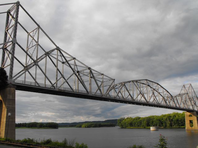
Additional Note: This is one of the most unique historic bridges in the country. The key detail is the fact that the suspended span is only connected at the bottom with no connection (visual or structural) to the top chord of the suspended span. This arranagement makes the bridge unique and gives it a distrinctive appearance. It perfectly illustrates how a cantilever truss bridge works in a visual way that even non-engineers can understand. The media/DOT may attempt to claim that the proposed replacement bridge "replicates, mimics, or honors" this historic bridge. If such statements are made, be aware they are NOT true because the replacement bridge will NOT contain the key character-defining feature of this bridge which is the lack of top chord connection to the suspended span. As a Section 106 Consulting Party we tried to advocate for preservation, and failing that we expressed strong opposition to any public communications trying to claim that the replacement bridge replicates the historic bridge.
View Archived National Bridge Inventory Report - Has Additional Details and Evaluation
View Historic American Engineering Record (HAER) Documentation For This Bridge
HAER Data Pages, PDF
View Original Plan Sheets For This Bridge
View Historical Black Hawk Bridge Opening Day Booklet
View Historical Articles About This Bridge

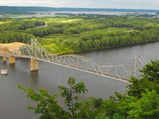
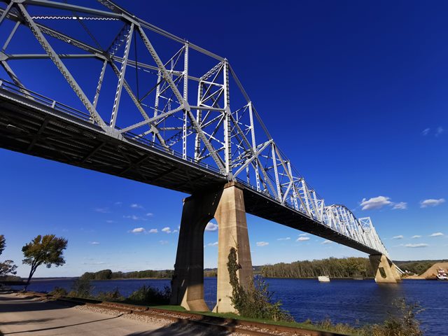
This bridge is among the most unusual and significant large scale cantilever truss bridges in the country, on account of its excellent historic integrity, relatively old age, increasing rarity, and unusual design. Located in one of the most beautiful and photogenic settings imaginable, with a small town on the Iowa side, and expansive flood plains on the Wisconsin side, all contained within a large and impressive river valley. There are ample locations to view the bridge from numerous angles, including a truly spectacular and unique view of the bridge from the Mount Hosmer lookout in Lansing, this is a bridge that must be seen in person to be truly appreciated. The bridge has very a very impressive appearance, with well-defined cantilever towers which rise dramatically above the surrounding trusses. The bridge has a camber that is not curved, but is composed of an inclined deck that immediately ends between the cantilever towers at the center of the bridge. The transition is sharp enough that it acts almost like a speed bump, and helps to calm traffic speed on the bridge, increasing the safety of the structure.
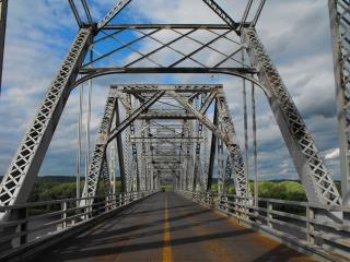

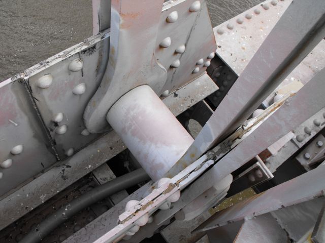
Perhaps the bridge's most distinctive and unusual feature is that the central suspended span, which is a Pennsylvania through truss, is not connected to the cantilever arms at the top, and is only connected by the bottom chord and by vertical eye bar suspenders from the top chord. Viewing the bridge from elevation (side view) this unusual design makes the suspended span very easy to discern. The bridge is actually a good teaching tool for demonstrating how a cantilever truss bridge's suspended span is structurally independent from the cantilever arms, in other words, the suspended span it is a complete bridge on its own being held at the ends by the cantilever arms.
The significance of all surviving cantilever truss bridges has risen rapidly in recent years. This is due to the decimation of the nation's historic cantilever truss bridges by short-sighted owners who feel the only solution is to demolish a historic cantilever bridge and replace it with a mundane cable-stayed bridge with no heritage value or engineering significance. The Black Hawk Bridge is a beautiful historic monument that is one of the most defining landmarks and top attractions of the small town of Lansing, Iowa. In addition, the bridge retains excellent historic integrity, is a relatively old surviving large-scale highway cantilever bridge, and has a unique design. Its preservation, whether it continues to serve vehicular traffic or is bypassed by a new bridge and used for non-motorized traffic only, should be pursued at all costs.
The bridge was rehabilitated in 1955. In 2013, additional work took place including a repainting of the bridge. Some of the photos available on this website are from during the repainting.
Above: Historical photo showing bridge construction. Note that the suspended span is being erected via cantilever method, rather than prefabrication off-site and lifting into place.
Information and Findings From Iowa's Historic Bridge InventoryDiscussion of Bridge "A reality! Finished!" The Book of the Black Hawk
Bridge, enthused at the structure's dedication in 1931. "The Black Hawk
Bridge, three quarters of a million dollars of steel and concrete,
linking the states of Iowa and Wisconsin, running eastward from Lansing
across the Winneshiek Bottoms to De Soto, is a reality. It is the first
passenger bridge to join these two states, the result of more than a
generation of dreaming and scheming, planning and promoting--and two
years of actual construction." Planning for the bridge had begun in 1898
by Lansing businessmen J.P. Conway and Tom Bakeman. The two promoted the
proposed structure for years as a boon to the community, eventually
forming the Interstate Bridge Company in 1914 to secure a Congressional
charter for the bridge. The charter, secured in 1916, was turned over to
the Iowa-Wisconsin Bridge Company in late 1929. Under the direction of
Des Moines financier John Thompson, the latter firm sold bridge bonds to
finance construction, hired Minneapolis engineer Melvin B. Stone to
design the bridge, and contracted with the McClintic-Marshall Company of
Chicago to fabricate and erect the trusses. The bridge was christened
the Black Hawk Bridge to honor famous Indian Chief Black Hawk. Bridge Considered Historic By Survey: Yes |
![]()
Photo Galleries and Videos: Black Hawk Bridge
2021 Bridge Photo-Documentation
Original / Full Size PhotosA collection of overview and detail photos, with focus on the main spans. This gallery offers photos in the highest available resolution and file size in a touch-friendly popup viewer.
Alternatively, Browse Without Using Viewer
![]()
2021 Bridge Photo-Documentation
Mobile Optimized PhotosA collection of overview and detail photos, with focus on the main spans. This gallery features data-friendly, fast-loading photos in a touch-friendly popup viewer.
Alternatively, Browse Without Using Viewer
![]()
Pre-2021 Structure Overview
Original / Full Size PhotosA collection of overview photos that show the bridge as a whole and general areas of the bridge. This gallery offers photos in the highest available resolution and file size in a touch-friendly popup viewer.
Alternatively, Browse Without Using Viewer
![]()
Pre-2021 Structure Details
Original / Full Size PhotosA collection of detail photos that document the parts, construction, and condition of the bridge including deck truss spans. This gallery offers photos in the highest available resolution and file size in a touch-friendly popup viewer.
Alternatively, Browse Without Using Viewer
![]()
Pre-2021 Structure Overview
Mobile Optimized PhotosA collection of overview photos that show the bridge as a whole and general areas of the bridge. This gallery features data-friendly, fast-loading photos in a touch-friendly popup viewer.
Alternatively, Browse Without Using Viewer
![]()
Pre-2021 Structure Details
Mobile Optimized PhotosA collection of detail photos that document the parts, construction, and condition of the bridge including deck truss spans. This gallery features data-friendly, fast-loading photos in a touch-friendly popup viewer.
Alternatively, Browse Without Using Viewer
![]()
CarCam: Westbound Crossing
Full Motion VideoNote: The downloadable high quality version of this video (available on the video page) is well worth the download since it offers excellent 1080 HD detail and is vastly more impressive than the compressed streaming video. Streaming video of the bridge. Also includes a higher quality downloadable video for greater clarity or offline viewing.
![]()
Maps and Links: Black Hawk Bridge
Coordinates (Latitude, Longitude):
Search For Additional Bridge Listings:
Bridgehunter.com: View listed bridges within 0.5 miles (0.8 kilometers) of this bridge.
Bridgehunter.com: View listed bridges within 10 miles (16 kilometers) of this bridge.
Additional Maps:
Google Streetview (If Available)
GeoHack (Additional Links and Coordinates)
Apple Maps (Via DuckDuckGo Search)
Apple Maps (Apple devices only)
Android: Open Location In Your Map or GPS App
Flickr Gallery (Find Nearby Photos)
Wikimedia Commons (Find Nearby Photos)
Directions Via Sygic For Android
Directions Via Sygic For iOS and Android Dolphin Browser
USGS National Map (United States Only)
Historical USGS Topo Maps (United States Only)
Historic Aerials (United States Only)
CalTopo Maps (United States Only)


