

View Information About HSR Ratings
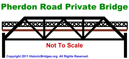
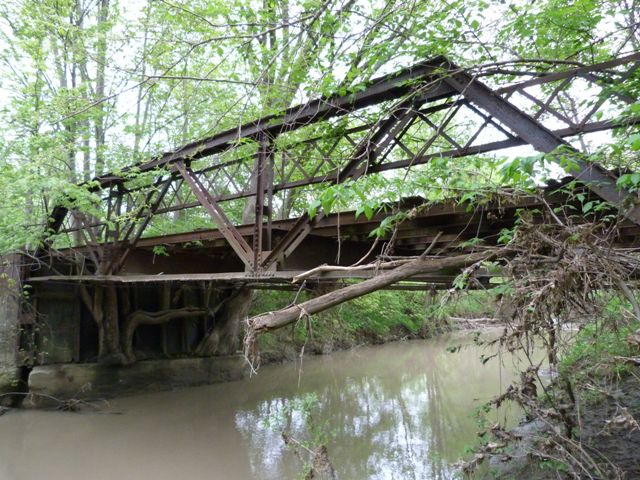
At first glance this bridge appears to be a typical and small example of a bridge design that is common among early 20th Century truss bridges, a riveted Warren pony truss. However a closer look reveals that the bridge is something far more. The design of this bridge is extremely unusual and at the time HistoricBridges.org documented it, no similar bridge existed among the over 2000 bridges documented on the website. The bridge could be described as a bedstead with inclined endposts. The bridge truss design overall is a Warren pony truss with inclined endposts, but instead of this truss sitting on bearings and an abutment, it is riveted rigidly to a vertical built-up beam that functions like a bedstead leg, and extends down below the truss a significant distance to rest on a concrete abutment base. This design is highly unusual, and should be considered historically and technologically significant due to its rarity and creative design. Another uncommon feature is the built-up floorbeams. By the time riveted connections and Warren pony truss bridges were being built for highway use in Michigan, rolled floorbeams were more common. Another interesting feature of the bridge is the retaining wall behind the bridge and abutments. The retaining wall might at first glance appear to be an abutment, but as mentioned, the actual abutment is a very low concrete ledge on which the legs rest. The retaining wall simply holds dirt behind it to allow the roadway to reach the bridge deck. The retaining wall consists of vertical rolled beams which are riveted to metal plate panels, which hold the dirt behind. Some of these panels are deteriorating and bending, allowing gaps to form. On the north side of the bridge, these gaps have allowed trees to grow out. These trees have been around long enough that they are of significant size and they have grown around several parts of the truss on the north end.
This bridge is tagged with the following special condition(s): Available
![]()
![]()
![]()
This historic bridge has been demolished. This map is shown for reference purposes only.
This bridge is privately owned and on private land.
Coordinates (Latitude, Longitude):
Search For Additional Bridge Listings:
Bridgehunter.com: View listed bridges within 0.5 miles (0.8 kilometers) of this bridge.
Bridgehunter.com: View listed bridges within 10 miles (16 kilometers) of this bridge.
Additional Maps:
Google Streetview (If Available)
GeoHack (Additional Links and Coordinates)
Apple Maps (Via DuckDuckGo Search)
Apple Maps (Apple devices only)
Android: Open Location In Your Map or GPS App
Flickr Gallery (Find Nearby Photos)
Wikimedia Commons (Find Nearby Photos)
Directions Via Sygic For Android
Directions Via Sygic For iOS and Android Dolphin Browser
USGS National Map (United States Only)
Historical USGS Topo Maps (United States Only)
Historic Aerials (United States Only)
CalTopo Maps (United States Only)

© Copyright 2003-2024, HistoricBridges.org. All Rights Reserved. Disclaimer: HistoricBridges.org is a volunteer group of private citizens. HistoricBridges.org is NOT a government agency, does not represent or work with any governmental agencies, nor is it in any way associated with any government agency or any non-profit organization. While we strive for accuracy in our factual content, HistoricBridges.org offers no guarantee of accuracy. Information is provided "as is" without warranty of any kind, either expressed or implied. Information could include technical inaccuracies or errors of omission. Opinions and commentary are the opinions of the respective HistoricBridges.org member who made them and do not necessarily represent the views of anyone else, including any outside photographers whose images may appear on the page in which the commentary appears. HistoricBridges.org does not bear any responsibility for any consequences resulting from the use of this or any other HistoricBridges.org information. Owners and users of bridges have the responsibility of correctly following all applicable laws, rules, and regulations, regardless of any HistoricBridges.org information.
![]()