

View Information About HSR Ratings
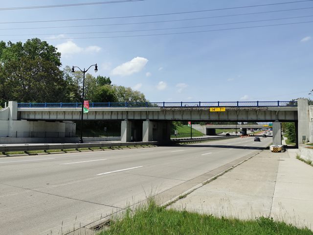
This is one of several attractive railroad overpasses on Telegraph Road noted for their use of R4 railing. This bridge has a somewhat unusual span configuration. From west to east, a large span crosses over the sidewalk, then at the median there are not one but two piers, then a span over the two lanes of northbound Telegraph Road, another pier, and a final short span over the sidewalk before meeting the abutment. In considering what happened to another 1930s overpass on Telegraph Road in 1961, it is suspected that the portion of the bridge over the southbound lanes, with the longer single span clearing both the road and sidewalk, was an addition to an original overpass over the northbound lanes. Unlike the other bridge, this section had a narrower median so rather than build up an earthen division between the two grade separations, the old bridge was simply expanded, using architectural detailing on the piers and matching R4 railing throughout to create the appearance of a single, original bridge, aside from the unusual pier arrangement that would result from such an expansion.
In support of this theory, the section of Telegraph Road which was expanded into a divided highway during the 1960s ran from Haskell Street (south of this bridge) up to 8 Mile Road (north of this bridge, and encompassing the other Telegraph Road Railroad Bridge discussed here).
This bridge is tagged with the following special condition(s): Unorganized Photos
![]()
![]()
![]()
Coordinates (Latitude, Longitude):
Search For Additional Bridge Listings:
Bridgehunter.com: View listed bridges within 0.5 miles (0.8 kilometers) of this bridge.
Bridgehunter.com: View listed bridges within 10 miles (16 kilometers) of this bridge.
Additional Maps:
Google Streetview (If Available)
GeoHack (Additional Links and Coordinates)
Apple Maps (Via DuckDuckGo Search)
Apple Maps (Apple devices only)
Android: Open Location In Your Map or GPS App
Flickr Gallery (Find Nearby Photos)
Wikimedia Commons (Find Nearby Photos)
Directions Via Sygic For Android
Directions Via Sygic For iOS and Android Dolphin Browser
USGS National Map (United States Only)
Historical USGS Topo Maps (United States Only)
Historic Aerials (United States Only)
CalTopo Maps (United States Only)

© Copyright 2003-2024, HistoricBridges.org. All Rights Reserved. Disclaimer: HistoricBridges.org is a volunteer group of private citizens. HistoricBridges.org is NOT a government agency, does not represent or work with any governmental agencies, nor is it in any way associated with any government agency or any non-profit organization. While we strive for accuracy in our factual content, HistoricBridges.org offers no guarantee of accuracy. Information is provided "as is" without warranty of any kind, either expressed or implied. Information could include technical inaccuracies or errors of omission. Opinions and commentary are the opinions of the respective HistoricBridges.org member who made them and do not necessarily represent the views of anyone else, including any outside photographers whose images may appear on the page in which the commentary appears. HistoricBridges.org does not bear any responsibility for any consequences resulting from the use of this or any other HistoricBridges.org information. Owners and users of bridges have the responsibility of correctly following all applicable laws, rules, and regulations, regardless of any HistoricBridges.org information.
![]()