

View Information About HSR Ratings
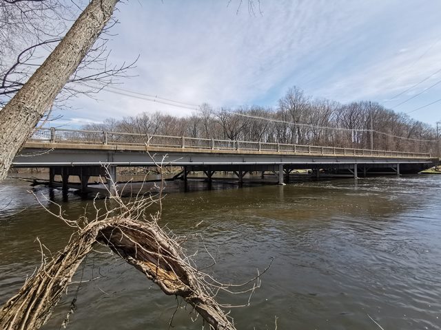
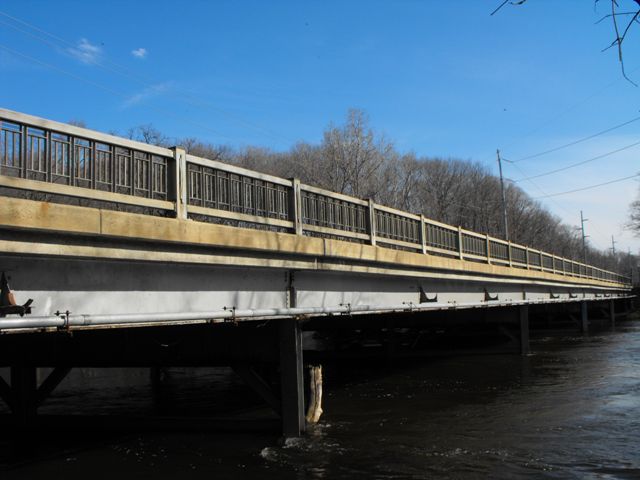
This bridge would appear to be a late example of a stringer bridge displaying ornamental "R4" railings on it. However plaques on the bridge as well as an inspection under the bridge show that it is a 1940 bridge that was widened by adding beams to the eastern side of the bridge in 1966. It was likely at this time the deck was redone and railings likely replaced too. Today however, whether you consider it s 1940 or 1966 bridge, it is a highly attractive bridge mainly due to the railings which have not had modern guardrails added to them, which in 2022 is becoming quite rare in Michigan. For Michigan, the bridge is also a decent length of a river crossing, at five spans.
Waverly Road Bridge follows the county line. The 1940 plaque says it was built jointly by both counties, but the 1966 plaque only lists Ingham County. Incidentally, the beams were added on the Ingham County side, but whether this has anything to do with why it appears that Ingham County alone funded the widening is uncertain. Parmalee and Carpenter was the contractor for the widening project.
A historical news article indicates that before this bridge was built, Waverly Road dead-ended at the river. The bridge was intended to turn Waverly Road into an important connector for Eaton County Residents, providing connectivity to US-27 (today I-69) and US-16 (today Grand River Avenue and the I-96 travel corridor).
This bridge is tagged with the following special condition(s): Unorganized Photos
![]()
![]()
![]()
![]()
![]()
Coordinates (Latitude, Longitude):
Search For Additional Bridge Listings:
Bridgehunter.com: View listed bridges within 0.5 miles (0.8 kilometers) of this bridge.
Bridgehunter.com: View listed bridges within 10 miles (16 kilometers) of this bridge.
Additional Maps:
Google Streetview (If Available)
GeoHack (Additional Links and Coordinates)
Apple Maps (Via DuckDuckGo Search)
Apple Maps (Apple devices only)
Android: Open Location In Your Map or GPS App
Flickr Gallery (Find Nearby Photos)
Wikimedia Commons (Find Nearby Photos)
Directions Via Sygic For Android
Directions Via Sygic For iOS and Android Dolphin Browser
USGS National Map (United States Only)
Historical USGS Topo Maps (United States Only)
Historic Aerials (United States Only)
CalTopo Maps (United States Only)

© Copyright 2003-2025, HistoricBridges.org. All Rights Reserved. Disclaimer: HistoricBridges.org is a volunteer group of private citizens. HistoricBridges.org is NOT a government agency, does not represent or work with any governmental agencies, nor is it in any way associated with any government agency or any non-profit organization. While we strive for accuracy in our factual content, HistoricBridges.org offers no guarantee of accuracy. Information is provided "as is" without warranty of any kind, either expressed or implied. Information could include technical inaccuracies or errors of omission. Opinions and commentary are the opinions of the respective HistoricBridges.org member who made them and do not necessarily represent the views of anyone else, including any outside photographers whose images may appear on the page in which the commentary appears. HistoricBridges.org does not bear any responsibility for any consequences resulting from the use of this or any other HistoricBridges.org information. Owners and users of bridges have the responsibility of correctly following all applicable laws, rules, and regulations, regardless of any HistoricBridges.org information.
![]()