We Recommend:
Bach Steel - Experts at historic truss bridge restoration.
BridgeHunter.com Phase 1 is released to the public! - Visit Now
Portland Avenue Bridge

Primary Photographer(s): Nathan Holth
Bridge Documented: June 3, 2013
Minneapolis: Hennepin County, Minnesota: United States
Not Available or Not Applicable
31.8 Feet (9.7 Meters)
94.2 Feet (28.7 Meters)
39 Feet (11.89 Meters)
3 Main Span(s)
90494

View Information About HSR Ratings
Bridge Documentation
View Archived National Bridge Inventory Report - Has Additional Details and Evaluation
View A Detailed Study Conducted About The Chicago Milwaukee and St. Paul Railroad Grade Separations
View The Minnesota Context For Historic Concrete Bridges
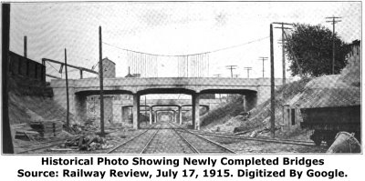
View Historical Articles About The Grade Separations
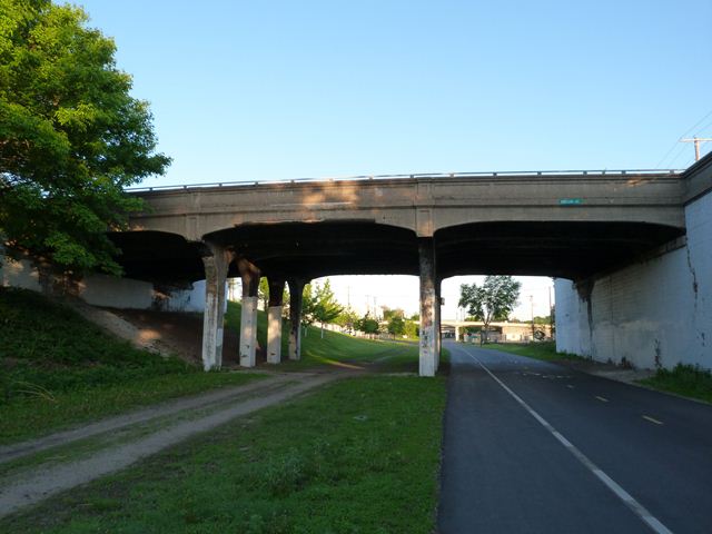
The Chicago Milwaukee and St. Paul Railroad Grade Separation Historic District is a unique historic district that was created to encompass a true rarity: approximately 26 bridges from a ca. 1914-1915 project to create a depressed section of railroad line, allowing all roads in that area to pass over the railroad tracks on bridges, thereby eliminating grade crossings. The historic district is unique because not only were so many bridges constructed as part of this project, so many of these bridges from so long ago still survive today. This however may be changing. A study conducted concerning the historic bridges talked a lot about replacement and bridges "reaching the end of their service life" which is legal lingo for "we don't feel like preserving this bridge anymore." At the same time, there has been recommendation for preservation of some of these bridges. The destruction of too many of these bridges will destroy the continuity of the historic district. However, the individual bridges do have some aesthetic and historic value even on their own, so any preservation effort would be worthwhile, however the more bridges that can be preserved the better!
The bridges documented by HistoricBridges.org follow a concrete t-beam design, and the t-beams have a slight haunched detail at the ends. The bridges have solid concrete paneled railings. The concrete piers are technically described as bents and an arched design connects between each column. Most bridges have construction years cast into the abutments.
HistoricBridges.org only had time to photo-document a few representative bridges in this historic district. Most of the bridges are of similar design and appearance. This page is the "home page" for these bridges, containing additional information and links.
![]()
Photo Galleries and Videos: Portland Avenue Bridge
Bridge Photo-Documentation
Original / Full Size PhotosA collection of overview and detail photos. This gallery offers photos in the highest available resolution and file size in a touch-friendly popup viewer.
Alternatively, Browse Without Using Viewer
![]()
Bridge Photo-Documentation
Mobile Optimized PhotosA collection of overview and detail photos. This gallery features data-friendly, fast-loading photos in a touch-friendly popup viewer.
Alternatively, Browse Without Using Viewer
![]()
Maps and Links: Portland Avenue Bridge
Coordinates (Latitude, Longitude):
Search For Additional Bridge Listings:
Bridgehunter.com: View listed bridges within 0.5 miles (0.8 kilometers) of this bridge.
Bridgehunter.com: View listed bridges within 10 miles (16 kilometers) of this bridge.
Additional Maps:
Google Streetview (If Available)
GeoHack (Additional Links and Coordinates)
Apple Maps (Via DuckDuckGo Search)
Apple Maps (Apple devices only)
Android: Open Location In Your Map or GPS App
Flickr Gallery (Find Nearby Photos)
Wikimedia Commons (Find Nearby Photos)
Directions Via Sygic For Android
Directions Via Sygic For iOS and Android Dolphin Browser
USGS National Map (United States Only)
Historical USGS Topo Maps (United States Only)
Historic Aerials (United States Only)
CalTopo Maps (United States Only)


