We Recommend:
Bach Steel - Experts at historic truss bridge restoration.
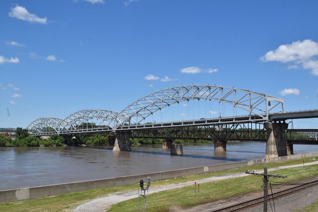
Broadway Bridge
Buck O'Neil Bridge
Primary Photographer(s): Nathan Holth
Bridge Documented: June 7, 2016
US-169 (Broadway Boulevard) Over Missouri River and Various Streets and Railroads
Kansas City: Jackson County, Missouri and Clay County, Missouri: United States
Metal Tied Braced Ribbed Through Arch, Fixed and Approach Spans: Metal Stringer (Multi-Beam), Fixed
1955 By Builder/Contractor: American Bridge Company of New York, New York and Engineer/Design: Howard, Needles, Tammen and Bergendorff of Kansas City, Missouri
1990
540.0 Feet (164.6 Meters)
2,764.0 Feet (842.5 Meters)
48 Feet (14.63 Meters)
3 Main Span(s) and 13 Approach Span(s)
3807

View Information About HSR Ratings
Bridge Documentation
This bridge no longer exists!
Bridge Status: This landmark historic bridge was demolished and replaced by MoDOT April 2024!View Archived National Bridge Inventory Report - Has Additional Details and Evaluation
Download ZIP File With Original Bridge Plans and Original Shop Drawings
Download ZIP File With Archived MoDOT Inspection Photos
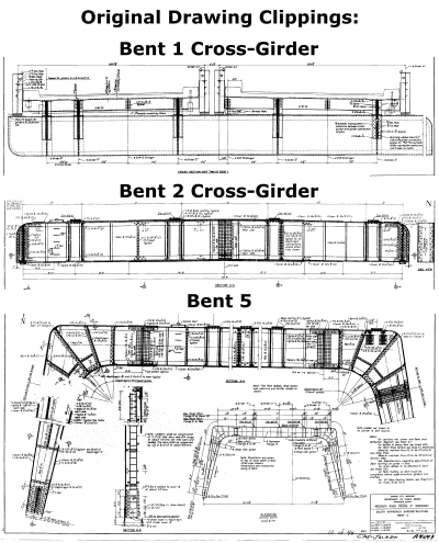
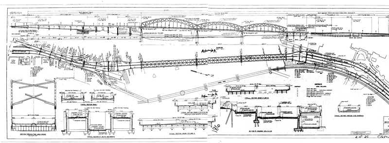
This bridge was built at an interesting time in the history of transportation. During this time, the traditional methods of construction, specifically the use of riveted, built-up steel construction was still in heavy use, yet also the new trend of what was then sometimes called "superhighway" design was taking off in full force. This so-called "superhighway" was in reference to high-speed and limited access highway construction, which later included the Interstate Highway System. This type of construction required design and construction effort not typically found in more traditional highway/bridge design. Of note, this would include superelevation for curves, grades to adjust vertical elevation, curved designs for ramps, support systems for elevated ramps, and complex substructure systems that often had to be custom-designed to fit around existing infrastructure underneath the bridge. The Broadway Bridge includes most of these "superhighway" design features, but all using traditional riveted construction. This combination is rare among bridges surviving today, and it greatly adds to the historic significance of this bridge. Moreover, this design resulted in an approach system (particularly the southern approach) that is incredibly complex and offers as much (if not more) in the way of interesting things to look at as the beautiful main spans over the river. Only 15 years after this bridge was built (around 1970), the once "state-of-the-art" superhighway design would have become commonplace with Interstate Highways stretching across the country. At this same time, the last rivets were being driven, which were abandoned in favor of welded and bolted steel construction as well as concrete construction. Therefore, this bridge is a rare combination of two eras in highway bridge design.
This bridge was a replacement for a roadway that crossed the Missouri River by way of the parallel Hannibal Railroad Bridge, which originally included an upper deck for highway traffic.
The Broadway Bridge is centrally located in Kansas City and its iconic arch spans make this a major landmark for the area. The bridge also appears to be in overall good condition. Despite this, Missouri Department of Transportation (MoDOT) is considering demolition and replacement of this bridge. MoDOT has one of the worst preservation track records in the entire country, and have refused to preserve even wide, well-maintained bridges that common sense suggests are sufficient for traffic and feasible to rehabilitate. As such, while at first glance it might seem unthinkable to waste so much money to destroy this iconic landmark, given the track record to date, the risk of demolition for this bridge should be considered very substantial indeed.
HistoricBridges.org offers an enormous photo gallery for this bridge which includes full coverage of the southern approach spans and bents. Also included are GoPro Car-Cam photos showing views on the bridge.
Above: Three of the most unusual southern approach span bents are shown above.
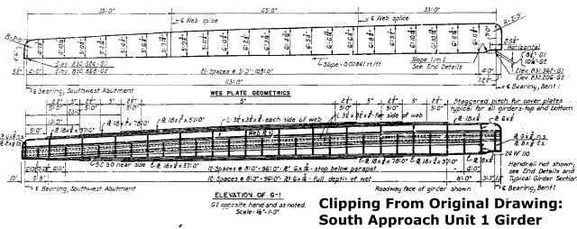
Above: The southernmost span of the bridge features these unusual riveted girders that support a "Y" configuration in the deck.
![]()
Photo Galleries and Videos: Broadway Bridge
Bridge Photo-Documentation
Original / Full Size PhotosA collection of overview and detail photos. This gallery offers photos in the highest available resolution and file size in a touch-friendly popup viewer.
Alternatively, Browse Without Using Viewer
![]()
Bridge Photo-Documentation
Mobile Optimized PhotosA collection of overview and detail photos. This gallery features data-friendly, fast-loading photos in a touch-friendly popup viewer.
Alternatively, Browse Without Using Viewer
![]()
CarCam: Southbound Crossing
Full Motion VideoStreaming video of the bridge. Also includes a higher quality downloadable video for greater clarity or offline viewing.
![]()
Maps and Links: Broadway Bridge
This historic bridge has been demolished. This map is shown for reference purposes only.
Coordinates (Latitude, Longitude):
Search For Additional Bridge Listings:
Bridgehunter.com: View listed bridges within 0.5 miles (0.8 kilometers) of this bridge.
Bridgehunter.com: View listed bridges within 10 miles (16 kilometers) of this bridge.
Additional Maps:
Google Streetview (If Available)
GeoHack (Additional Links and Coordinates)
Apple Maps (Via DuckDuckGo Search)
Apple Maps (Apple devices only)
Android: Open Location In Your Map or GPS App
Flickr Gallery (Find Nearby Photos)
Wikimedia Commons (Find Nearby Photos)
Directions Via Sygic For Android
Directions Via Sygic For iOS and Android Dolphin Browser
USGS National Map (United States Only)
Historical USGS Topo Maps (United States Only)
Historic Aerials (United States Only)
CalTopo Maps (United States Only)


