We Recommend:
Bach Steel - Experts at historic truss bridge restoration.
BridgeHunter.com Phase 1 is released to the public! - Visit Now
Easton-Phillipsburg Toll Bridge
Bushkill Street Bridge
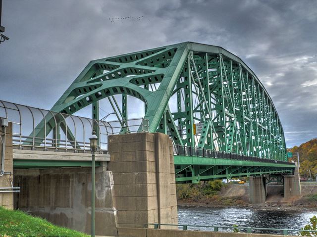
Primary Photographer(s): Nathan Holth and Rick McOmber
Bridge Documented: July 10, 2008 and November 7, 2015
Easton and Phillipsburg: Northampton County, Pennsylvania and Warren County, New Jersey: United States
1938 By Builder/Contractor: Bethlehem Steel Company of Bethlehem, Pennsylvania and Engineer/Design: John Edwin Greiner (J. E. Greiner Company of Baltimore, Maryland and Chicago, Illinois)
2015
550.0 Feet (167.6 Meters)
550.0 Feet (167.6 Meters)
40 Feet (12.19 Meters)
1 Main Span(s)
48730299920010

View Information About HSR Ratings
Bridge Documentation
View Archived National Bridge Inventory Report - Has Additional Details and Evaluation
Visit Delaware River Joint Toll Bridge Commission's Page For This Historic Bridge
View A Historical Text About The Bethlehem Steel Company
This bridge was the first bridge to be built by the Delaware Joint Toll Bridge Commission. While older bridges are owned by the commission, those bridges were acquired from previous owners.
The Easton-Phillipsburg Toll Bridge was one of the largest simply spanning truss bridge around when it was completed in 1938.
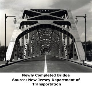
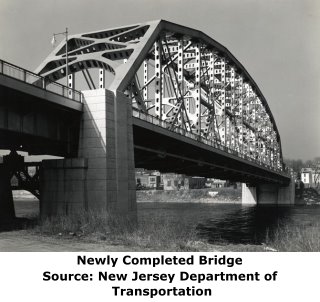
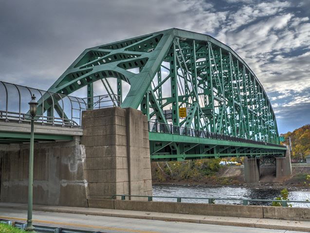
Visually, this is an impressive bridge that truly appears massive. Its wide, four lane configuration and long span result in its members being very massive indeed. It is an early example of a metal truss bridge that does not have any v-lacing, lattice, or battens in any of its built-up beams. This gives the bridge a rather simplistic appearance, but the bridge is enhanced aesthetically by attractive arch-shaped portal and sway bracing.
The main diagonal members of this bridge are pin-connected, indeed it must have been one of the last truss bridges to use pins as a primary connection type. The large size of the truss span likely accounted for why pins were selected over more rigid forms of connection.
This bridge is owned by the Delaware River Joint Toll Bridge Commission (DRJTBC). The DRJTBC has a unique commitment to maintaining the many historic bridges under its ownership, and working with the communities the bridges serve, and sets an example for the rest of the country to follow. The front page of their website often features a photo of a historic bridge, and their slogan is Preserving Our Past, Enhancing Our Future. How many other road/bridge agencies in the United States promote their commitment to historic bridges in this way? Not many.
Not only is the DRJTBC an example of how money might be better spent in regards to non-toll bridges, the DRJTBC bridges are also a great reference when arguing that a historic bridge can be rehabilitated and can also safely continue to function as a vehicular crossing.
As of 2015, this bridge has been comprehensively rehabilitated. A video showing highlights of the rededication ceremony can be viewed here.
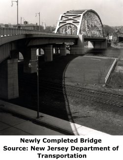
Above: Historical photo of bridge construction. Provided Courtesy of Joseph Chando Sr.
Information and Findings From Pennsylvania's Historic Bridge InventoryDiscussion of Bridge The 1 span, 550'-long, steel Pennsylvania thru truss bridge built in 1937 is supported on horizontally scored reinforced concrete piers with a steel truss cross member at the eastern pier. The upper chords, verticals, and compression diagonals are built-up box sections with oval cutouts. The lower chords and tension diagonals are eye bars. The upper chord connections are riveted and the lower chord connections are pinned. The pin connections better accommodate secondary stresses in a large truss bridge. The bridge is the latest of at least 20 Pennsylvania truss bridges from 1890 to 1937 in the state. Although not an early example of its type/design, it is by far the longest and pushes the simple span truss design to about what was considered its practical limit. The bridge and its approaches were a major project of the Delaware River Joint Toll Bridge Commission, established in 1913 to take over and maintain bridges between New Jersey and Pennsylvania. It was designed to relieve congestion on the 1896 bridge located downstream. The bridge is historically and technologically distinguished. Discussion of Surrounding Area The bridge carries a 4 lane state highway over the Delaware River between Easton and Phillipsburg, NJ. Their are ramps at the west (PA) end of the bridge. It is a toll bridge owned and maintained by the Delaware River Joint Toll Bridge Commission. Bridge Considered Historic By Survey: Yes |
![]()
Photo Galleries and Videos: Easton-Phillipsburg Toll Bridge
2015 Bridge Photo-Documentation
Original / Full Size PhotosA collection of overview and detail photos. This gallery offers photos in the highest available resolution and file size in a touch-friendly popup viewer.
Alternatively, Browse Without Using Viewer
![]()
2015 Bridge Photo-Documentation
Mobile Optimized PhotosA collection of overview and detail photos. This gallery features data-friendly, fast-loading photos in a touch-friendly popup viewer.
Alternatively, Browse Without Using Viewer
![]()
2008 Bridge Photo-Documentation
Original / Full Size PhotosA collection of overview and detail photos. This gallery offers photos in the highest available resolution and file size in a touch-friendly popup viewer.
Alternatively, Browse Without Using Viewer
![]()
2008 Bridge Photo-Documentation
Mobile Optimized PhotosA collection of overview and detail photos. This gallery features data-friendly, fast-loading photos in a touch-friendly popup viewer.
Alternatively, Browse Without Using Viewer
![]()
Historical Photos
Original / Full Size PhotosA collection of photos showing bridge construction courtesy of Joseph Chando Sr. This gallery offers photos in the highest available resolution and file size in a touch-friendly popup viewer.
Alternatively, Browse Without Using Viewer
![]()
Historical Photos
Mobile Optimized PhotosA collection of photos showing bridge construction courtesy of Joseph Chando Sr. This gallery features data-friendly, fast-loading photos in a touch-friendly popup viewer.
Alternatively, Browse Without Using Viewer
![]()
Maps and Links: Easton-Phillipsburg Toll Bridge
Coordinates (Latitude, Longitude):
Search For Additional Bridge Listings:
Bridgehunter.com: View listed bridges within 0.5 miles (0.8 kilometers) of this bridge.
Bridgehunter.com: View listed bridges within 10 miles (16 kilometers) of this bridge.
Additional Maps:
Google Streetview (If Available)
GeoHack (Additional Links and Coordinates)
Apple Maps (Via DuckDuckGo Search)
Apple Maps (Apple devices only)
Android: Open Location In Your Map or GPS App
Flickr Gallery (Find Nearby Photos)
Wikimedia Commons (Find Nearby Photos)
Directions Via Sygic For Android
Directions Via Sygic For iOS and Android Dolphin Browser
USGS National Map (United States Only)
Historical USGS Topo Maps (United States Only)
Historic Aerials (United States Only)
CalTopo Maps (United States Only)

