

View Information About HSR Ratings
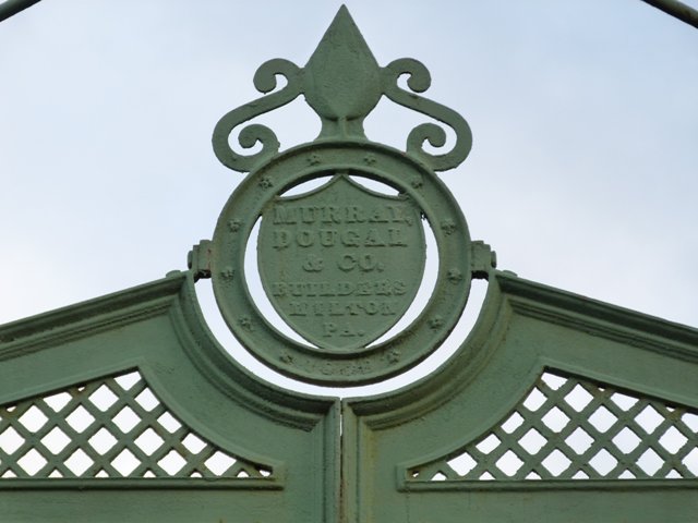
This bridge is an extremely rare example of a bridge built by Murray Dougal and Company of Milton, Pennsylvania. As the advertisement shows, the company specialized mainly in railroad cars and other such equipment, and bridges does not appear to have been a major undertaking by the company. This is unfortunate, since the Upper Bridge is evidence of the beautiful bridges the company could have produced. Another example of a bridge built by this company is a pony truss in Pennsylvania. The pony truss in Pennsylvania shares a number of details with this through truss in Keeseville, New York. William Law, an engineer with the company also worked in Canada with the Central Bridge and Engineering Company, and he took his plaque design with him, and thus similarities in plaque design can be found on his bridges in Canada such as the footbridge in Waterloo.

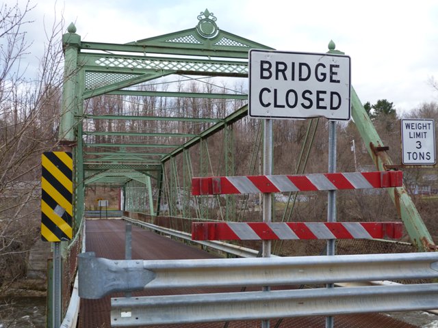
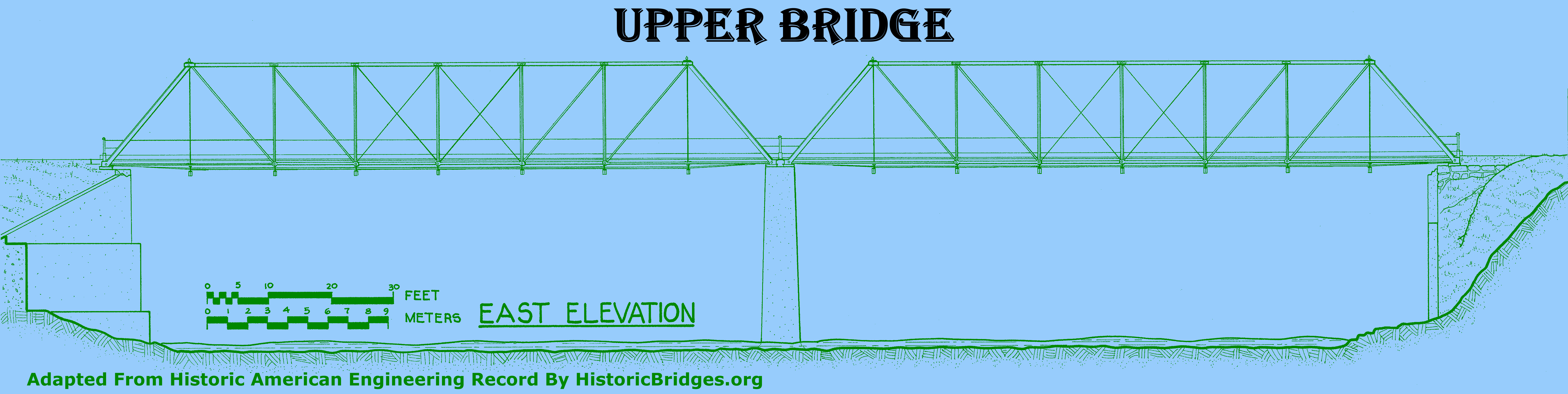
The Upper Bridge is noted for its beautifully ornate cast iron portal bracing as well as its distinctive decorative finials on the top of the end posts. Structurally, the bridge also has unusual details including cast iron connection assemblies at the top chord / end post connection. Unique cast iron connection assemblies are also present where the overhead lateral bracing ties are attached to the struts. Cast iron details can also be found along the bottom chord at the hip vertical and end post connections. The end post has an unusual design where the cover plate has an arched shape to it.
The bridge is significant as a rare surviving example of a bridge built by a company of whom very little bridges remain, as an early example of a pin-connected Pratt truss bridge, and for its cast iron construction details.
Be sure to view the HAER Data Pages for this bridge, since they contain scans of the original contract for the construction of the bridge.

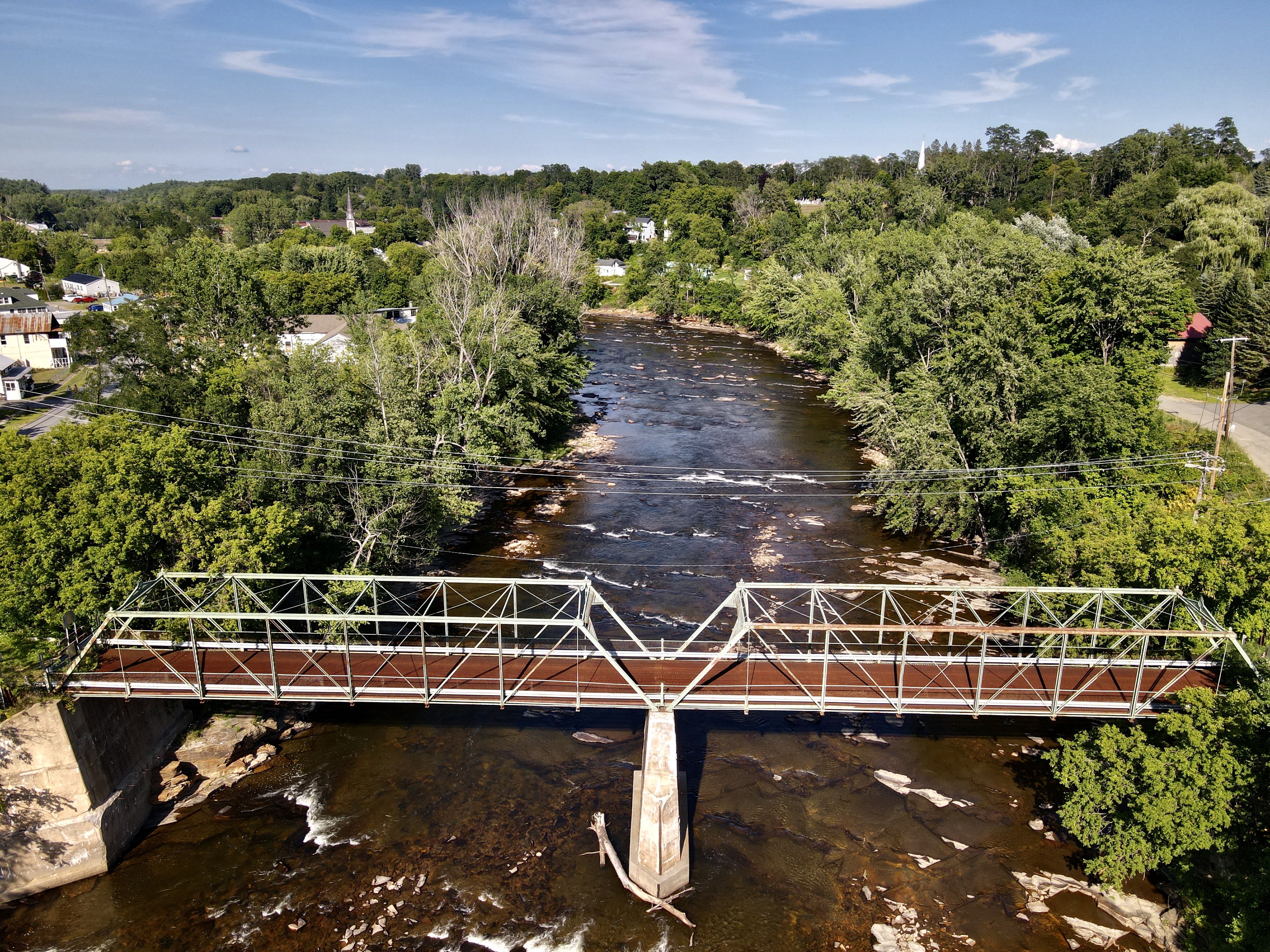
Above: Aerial view of bridge in August, 2020. Click for enlargement. Photo Credit: Small Town Drone.
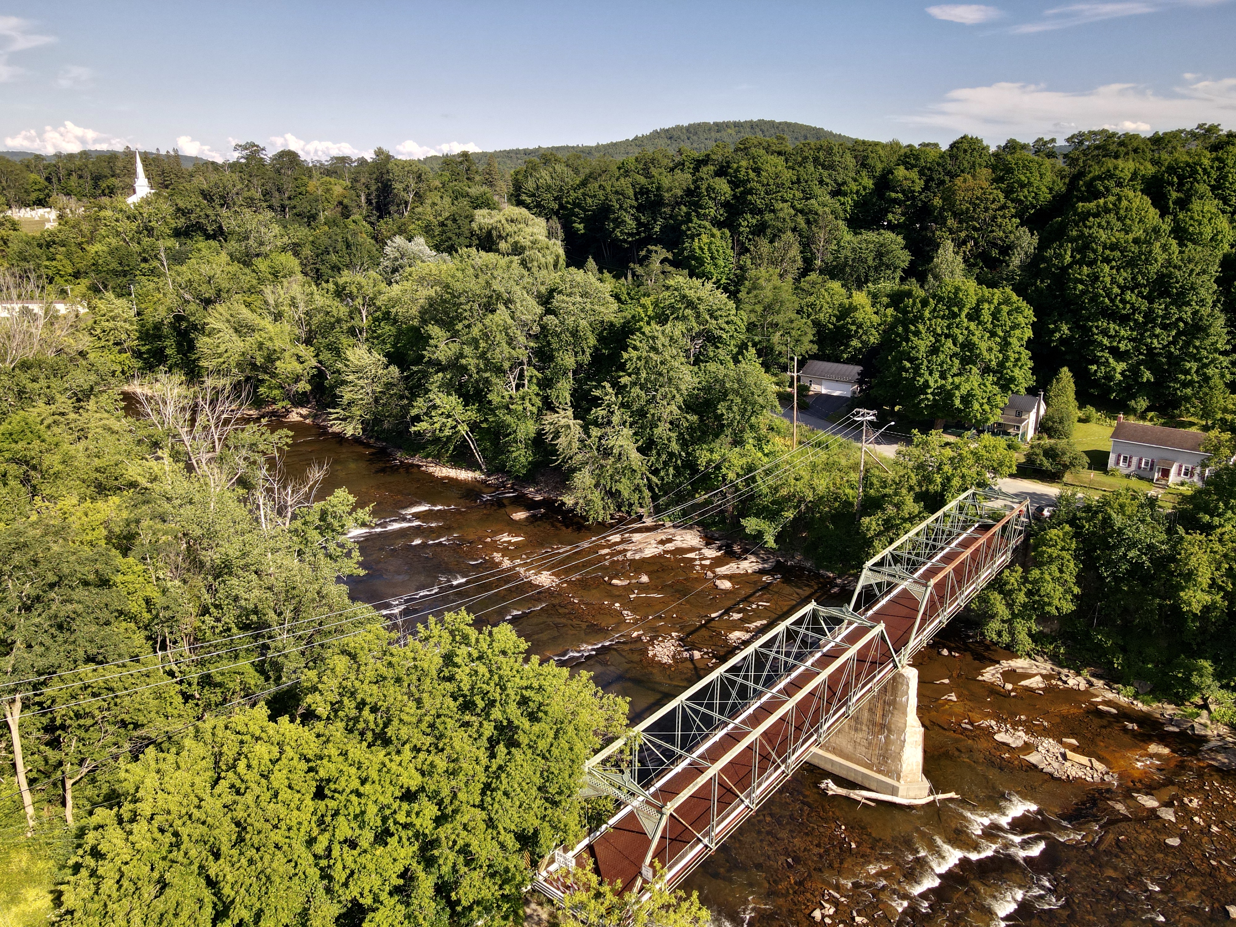
Above: Aerial view of bridge in August, 2020. Click for enlargement. Photo Credit: Small Town Drone.

Above: Aerial view of bridge in August, 2020. Click for enlargement. Photo Credit: Small Town Drone.

Above: Aerial view of bridge in August, 2020. Click for enlargement. Photo Credit: Small Town Drone.

Above: Aerial view of bridge in August, 2020. Click for enlargement. Photo Credit: Small Town Drone.

Above: Aerial view of bridge in August, 2020. Click for enlargement. Photo Credit: Small Town Drone.
![]()
![]()
![]()
![]()
![]()
Coordinates (Latitude, Longitude):
Search For Additional Bridge Listings:
Bridgehunter.com: View listed bridges within 0.5 miles (0.8 kilometers) of this bridge.
Bridgehunter.com: View listed bridges within 10 miles (16 kilometers) of this bridge.
Additional Maps:
Google Streetview (If Available)
GeoHack (Additional Links and Coordinates)
Apple Maps (Via DuckDuckGo Search)
Apple Maps (Apple devices only)
Android: Open Location In Your Map or GPS App
Flickr Gallery (Find Nearby Photos)
Wikimedia Commons (Find Nearby Photos)
Directions Via Sygic For Android
Directions Via Sygic For iOS and Android Dolphin Browser
USGS National Map (United States Only)
Historical USGS Topo Maps (United States Only)
Historic Aerials (United States Only)
CalTopo Maps (United States Only)

© Copyright 2003-2026, HistoricBridges.org. All Rights Reserved. Disclaimer: HistoricBridges.org is a volunteer group of private citizens. HistoricBridges.org is NOT a government agency, does not represent or work with any governmental agencies, nor is it in any way associated with any government agency or any non-profit organization. While we strive for accuracy in our factual content, HistoricBridges.org offers no guarantee of accuracy. Information is provided "as is" without warranty of any kind, either expressed or implied. Information could include technical inaccuracies or errors of omission. Opinions and commentary are the opinions of the respective HistoricBridges.org member who made them and do not necessarily represent the views of anyone else, including any outside photographers whose images may appear on the page in which the commentary appears. HistoricBridges.org does not bear any responsibility for any consequences resulting from the use of this or any other HistoricBridges.org information. Owners and users of bridges have the responsibility of correctly following all applicable laws, rules, and regulations, regardless of any HistoricBridges.org information.
![]()