Information and Findings From Ohio's Historic Bridge
Inventory
Setting/Context
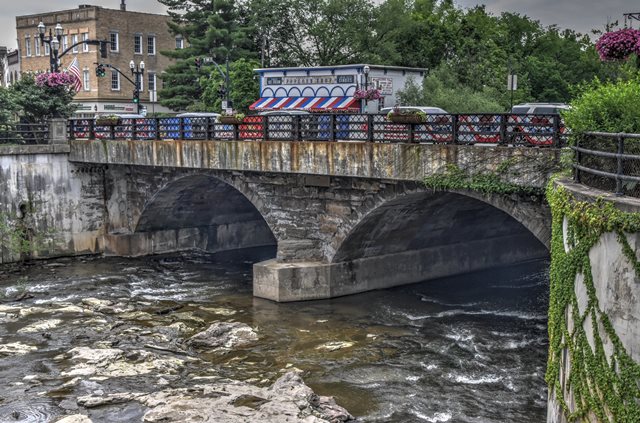
The bridge is located in downtown Chagrin Falls. It
is in the Chagrin Falls Triangle Park Commercial HD with a period of
significance of 1837 to 1929. Period commercial buildings are adjacent
to the bridge.
Physical Description
The 2 span, 82'-long stone arch bridge has ashlar
arch barrel and spandrel walls. The bridge has been widened with
prestressed concrete box sections to carry the sidewalks and decorative
railings, 1996.
Integrity
Massive concrete cantilevered sidewalks added ca.
1931and replaced in 1996. Massive toe walls placed.
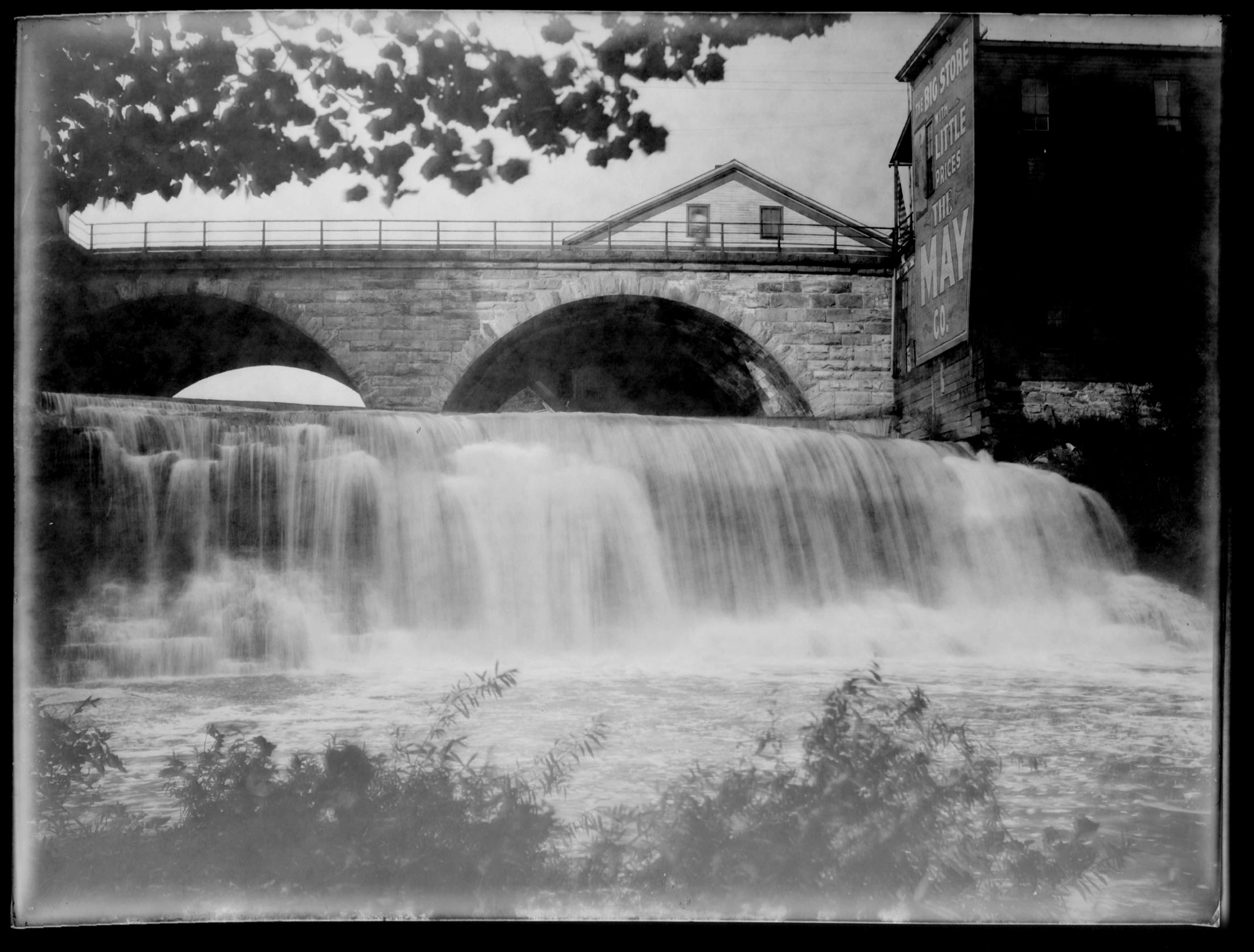
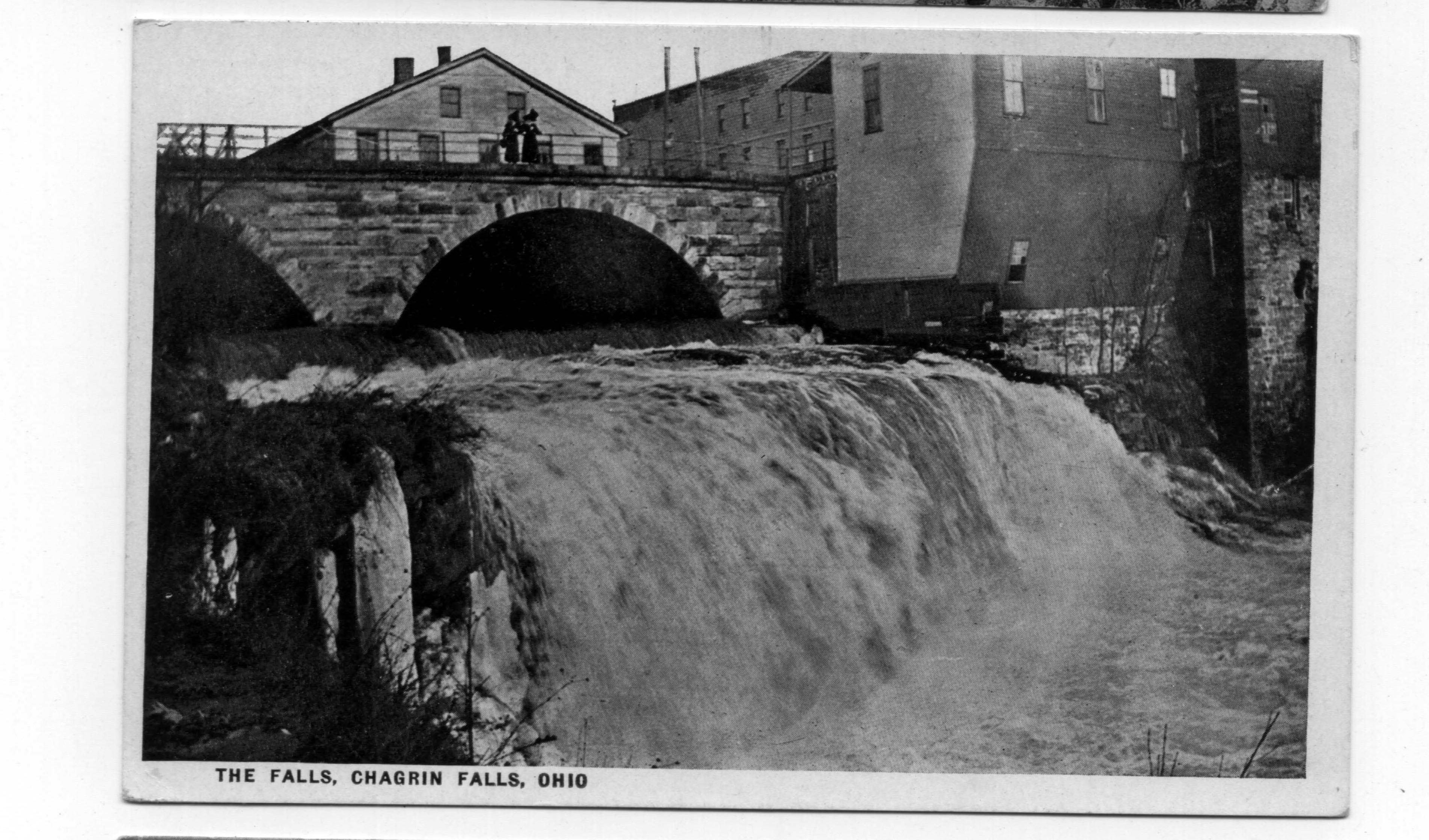
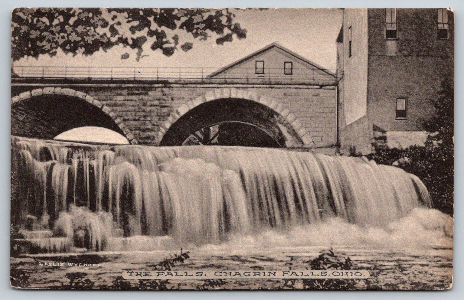
Summary of Significance
The 1857 stone arch bridge is a contributing
resource in the Chagrin Falls Triangle Park Commercial HD (NR 1995).
Stone arch highway bridges and culverts are not uncommon in Ohio
with more than 190 examples dating from ca. 1825 to 1940 (Phase 1A
Survey, 2008). Significant examples date to the 2nd quarter of the 19th
century (fewer than 26 pre-1851) and are often associated with
historically important transportation routes such as the National Road
and the state's early canals or railroads. Later examples may have
significance on the merits of the aesthetic quality/craftsmanship of the
masonry work or in association with parks, such as the stone arch
bridges in Cleveland's Rockefeller Park (ca. 1897-1904) or Youngstown's
Mill Creek Park (ca. 1913). Stone arch culverts have roadways on earth
fill atop the arch, which may or may not have headwalls, but they are
the same traditional technology as arch bridges that have spandrel walls
and parapets.
"The immigrants who settled America came from
European countries where masonry arch bridge construction was well
established. Our most distinctive collection of stone arch bridges are
found on the early, eastern trunkline railroads such as the B&O and Erie
railroads. Early turnpikes such as the National Road had impressive
stone arch bridges in Maryland. Along the road in Ohio, the famous
S-bridges were built. Canals such as the Erie and the Chesapeake & Ohio
had stone arch aqueducts. The technology of stone arch construction is
ancient. Increased use of metal truss bridges from the late 1800s into
the early twentieth century, led to a decline in stone arch bridge
construction. The strength and durability of stone arch bridges made
them popular. Generally, stone arch bridges built during the nineteenth
century are found today in areas where good stone was available. Stone
arches were common in the first half of the nineteenth century, and a
number of these structures still exist. Stone arch bridges from the late
eighteenth and first half of the nineteenth century are highly
significant if they retain their character-defining features, which
include the arch ring with keystone, barrel, spandrel wall, parapet,
headwalls and abutments/wingwalls. Piers may also be a
character-defining feature. Many of these stone arch structures possess
both engineering and historical significance for their associations with
the work programs of the Great 1930s. Stone arch bridges that do not fit
within these areas (early, Depression-era, association with parks)
generally possess less significance, but are still significant." [From:
A Context for Common Historic Bridge Types by Parsons Brinckerhoff,
October 2005]
Justification
A well represented bridge type throughout the state
for both bridges and culverts, stone arch bridges date from the mid
1830s and the building of the National Road through Belmont Co. Many are
superbly proportioned and constructed by local contractors. They were
built through World War I, particularly during the later years in park
settings. More than 125 examples remain. This example has moderate
significance based on its date of construction, detailing, and
alterations.
Original / Full Size Photos A collection of overview and detail photos. This gallery offers photos in the highest available resolution and file size in a touch-friendly popup viewer. Alternatively, Browse Without Using Viewer
Mobile Optimized Photos A collection of overview and detail photos. This gallery features data-friendly, fast-loading photos in a touch-friendly popup viewer. Alternatively, Browse Without Using Viewer