We Recommend:
Bach Steel - Experts at historic truss bridge restoration.
BridgeHunter.com Phase 1 is released to the public! - Visit Now
Smith Road Bridge

Primary Photographer(s): Nathan Holth
Bridge Documented: September 22, 2019
Columbus: Franklin County, Ohio: United States
1881 By Builder/Contractor: King Bridge Company of Cleveland, Ohio
1989
43.5 Feet (13.3 Meters)
43.5 Feet (13.3 Meters)
Not Available
1 Main Span(s)
Not Applicable

View Information About HSR Ratings
Bridge Documentation
HAER Drawings, PDF - HAER Data Pages, PDF
View National Register of Historic Places Nomination Form For This Bridge
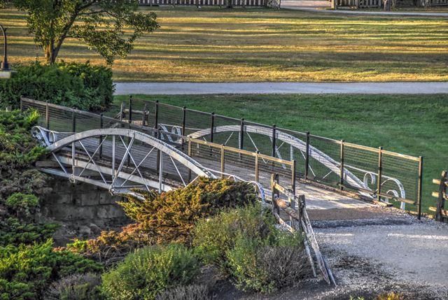
This wrought iron bowstring truss bridge was relocated to Ohio Village, an open air museum that is part of Ohio History Connection museum. The bridge came from Smith Road over Sycamore Creek in Crawford County, Ohio. It was moved in 1989. It is a classic example of the King Bridge Company's bowstring truss bridge, and includes their ornamental detail at each end of the truss. To walk on this bridge you must visit during operating hours and pay an entry fee. HistoricBridges.org visited this bridge at the end of the day after the museum had closed so only distant overview photos are available.
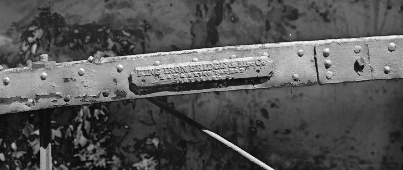
Above: Plaque. Photo Credit: Historic American Engineering Record
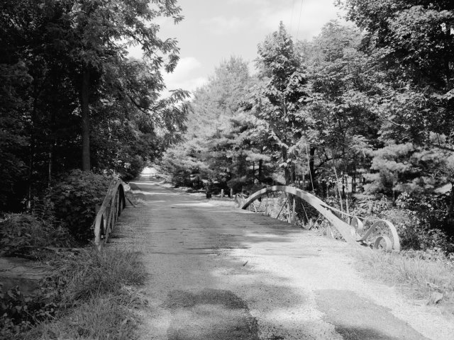
Above: Bridge prior to relocation. Photo Credit: Historic American Engineering Record
Information and Findings From Ohio's Historic Bridge InventorySetting/Context The bridge carries a pathway over a depression at the Ohio Historical Society in Columbus. Integrity Bridge was near Bucyrus in Crawford Co. on Smith Road over Sycamore Ck. SFN 1741500. Moved to the Ohio Historical Center, Columbus in 1988. Summary of Significance The bowstring truss is NR listed (1980). It was relocated to OHS in 1988, but the relocation was sensitive and did not adversely impact the bridge's integrity of design and the technological significance of this rare bridge type/design. From HAER OH-46: "It [is] a prime, existing example of a wrought iron tubular arch design, patented by Zenas King of Cleveland's King Iron Bridge and Manufacturing Company in 1861 and improved upon in 1867. The patenting and manufacturing of the prototype of this design, among the first in the United States for an iron bridge, launched the career of this bridge designer and builder." Bowstring trusses are characterized by arched top chords and a trussed or lattice web. They rank among the rarest and most technologically significant of 19th-century metal truss designs since they appeared early in the evolution of iron bridge development and were almost always based on the patents or proprietary designs of bridge builders and engineers. The progenitor of the form was the famed engineer Squire Whipple of New York, who built the first example in 1840 over the Erie Canal at Utica. After the Civil War, Ohio was a center for the development of the bowstring with its concentration of metal bridge-building companies. Companies such Wrought Iron Bridge, Champion Bridge, Massillon Bridge, and King Iron Bridge built their reputations on successful bowstring designs with a dizzying number of variant ways of forming and connecting the truss members. The companies emerged in time to fill the burgeoning demand for an economical, prefabricated bridge for use on American roads. Bowstring trusses thus document this exceptionally inventive and technologically significant period in the development of American metal trusses from the 1860s to early 1880s. The ODOT inventory has identified 22 surviving examples dating from ca. 1864 to 1880 (Phase 1A, 2008). Justification The bridge is one of the 22 extant bowstring truss bridges that survive in the state. Having so many is remarkable, and even though they are "common" based on their numbers, each is an important and irreplaceable record of the development of the metal truss bridge and the ingenuity associated with the Ohio industrial development. The bridge has high significance. Bridge Considered Historic By Survey: Yes |
![]()
Photo Galleries and Videos: Smith Road Bridge
Bridge Photo-Documentation
Original / Full Size PhotosA collection of overview and detail photos. This gallery offers photos in the highest available resolution and file size in a touch-friendly popup viewer.
Alternatively, Browse Without Using Viewer
![]()
Bridge Photo-Documentation
Mobile Optimized PhotosA collection of overview and detail photos. This gallery features data-friendly, fast-loading photos in a touch-friendly popup viewer.
Alternatively, Browse Without Using Viewer
![]()
Maps and Links: Smith Road Bridge
Coordinates (Latitude, Longitude):
Search For Additional Bridge Listings:
Bridgehunter.com: View listed bridges within 0.5 miles (0.8 kilometers) of this bridge.
Bridgehunter.com: View listed bridges within 10 miles (16 kilometers) of this bridge.
Additional Maps:
Google Streetview (If Available)
GeoHack (Additional Links and Coordinates)
Apple Maps (Via DuckDuckGo Search)
Apple Maps (Apple devices only)
Android: Open Location In Your Map or GPS App
Flickr Gallery (Find Nearby Photos)
Wikimedia Commons (Find Nearby Photos)
Directions Via Sygic For Android
Directions Via Sygic For iOS and Android Dolphin Browser
USGS National Map (United States Only)
Historical USGS Topo Maps (United States Only)
Historic Aerials (United States Only)
CalTopo Maps (United States Only)


