We Recommend:
Bach Steel - Experts at historic truss bridge restoration.
Ellis Bridge
Pennsylvania Railroad Bridge 12
Primary Photographer(s): Nathan Holth
Bridge Documented: September 11, 2015
Rural: Muskingum County, Ohio: United States
Metal Pin-Connected Whipple (Double-Intersection Pratt) Through Truss, Fixed and Approach Spans: Metal 6 Panel Rivet-Connected Warren Through Truss, Fixed
By Builder/Contractor: Unknown
1913
134.0 Feet (40.8 Meters)
550.0 Feet (167.6 Meters)
Not Available
1 Main Span(s) and 3 Approach Span(s)
Not Applicable

View Information About HSR Ratings
Bridge Documentation
View A Historical Article About This Bridge
View A Historical Pennsylvania Railroad Report On The 1913 Flood
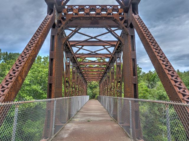
This is a bridge with a story, and a very unusual one at that. It was originally built as a multi-span pin-connected Whipple deck truss. The construction date of the Whipple truss is not known.
Some years after this Whipple truss was built, a "slack water navigation" system was created on the river through a series of dams. At this time, to provide clearance for boats, one of the deck truss spans was raised up and turned into a through truss. This alteration would would have required removing bracing inside the truss lines to allow for trains to pass through the truss, and installation of portal and sway bracing overhead where previously floorbeams have been located, while the floodbeams would need to be installed between the bottom chords. Evidence of these changes remains today in the form of empty rivet holes that can be seen on the bridge. What is interesting is that the sway bracing shows empty rivet holes, so these elements probably were salvaged and reused from the deck truss.
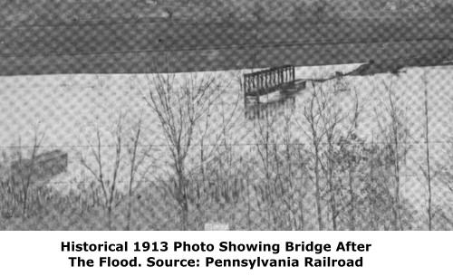
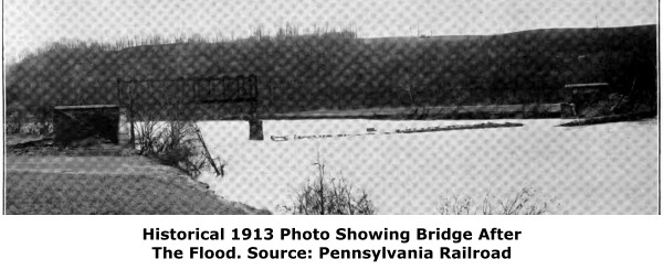
This change to a through truss actually saved this span from destruction in March 1913 when a massive flood destroyed all the unaltered deck truss spans (and an incredible number of other bridges in the region). The through truss span however was high enough that it was spared destruction.
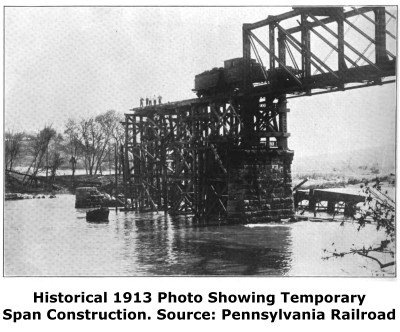
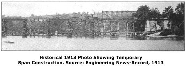
Immediately after the flood, a temporary system of spans was installed to replace the collapsed spans. Soon after this (still in 1913) Riveted Warren through truss spans were fabricated by the American Bridge Company and installed on new concrete piers. These 1913 spans have vertical end posts like the Whipple truss span, an unusual detail.
The contemporary history of this bridge is no less unusual. The bridge and the old railroad line north of the bridge eastward to Ellis Dam Road has been turned into a rail-trail. It is a fully developed rail-trail (meaning its paved with aspahlt, and the railroad bridge is fully redecked). Yet, this is the total extent of the rail-trail. The railroad grade east of Ellis Dam Road is posted with numerous "No Tresspassing" signs. Similarly, the rail line immediately south of the bridge is not a rail-trail and is totally abandoned and overgrown. Its rather unusual to see such a short, isolated rail-trail like this. It is great in the sense that this rare, historic bridge is preserved and accessible to the public. But sadly, the orphaned section of rail-trail seems to have left this Ohio attraction largely undiscoverd by the general public. The remains of the old Ellis Dam and locks are also separately viewable, at the end of Ellis Dam Road. From here, good views of the bridge can be had as well.
This bridge is historically significant as a rare example of a pin-connected Whipple railroad truss. It is also notable for its unusual story, much of which helps convey the impact of the infamous Great Flood of 1913.
![]()
Photo Galleries and Videos: Ellis Bridge
Bridge Photo-Documentation
Original / Full Size PhotosA collection of overview and detail photos. This gallery offers photos in the highest available resolution and file size in a touch-friendly popup viewer.
Alternatively, Browse Without Using Viewer
![]()
Bridge Photo-Documentation
Mobile Optimized PhotosA collection of overview and detail photos. This gallery features data-friendly, fast-loading photos in a touch-friendly popup viewer.
Alternatively, Browse Without Using Viewer
![]()
Maps and Links: Ellis Bridge
Coordinates (Latitude, Longitude):
Search For Additional Bridge Listings:
Bridgehunter.com: View listed bridges within 0.5 miles (0.8 kilometers) of this bridge.
Bridgehunter.com: View listed bridges within 10 miles (16 kilometers) of this bridge.
Additional Maps:
Google Streetview (If Available)
GeoHack (Additional Links and Coordinates)
Apple Maps (Via DuckDuckGo Search)
Apple Maps (Apple devices only)
Android: Open Location In Your Map or GPS App
Flickr Gallery (Find Nearby Photos)
Wikimedia Commons (Find Nearby Photos)
Directions Via Sygic For Android
Directions Via Sygic For iOS and Android Dolphin Browser
USGS National Map (United States Only)
Historical USGS Topo Maps (United States Only)
Historic Aerials (United States Only)
CalTopo Maps (United States Only)

