


View Information About HSR Ratings
This bridge is severely deteriorated having been abandoned for decades, but remains one of the largest and earliest Luten arch bridges in America. The bridge was built for the Ohio Electric Interurban. The bridge was built by the National Bridge Company of Indianapolis at a cost of more than $130,000. More than 130 men were employed in the construction of the bridge. The bridge was in operation between 1907 and 1937. Below photos showing the bridge under construction were taken around 1906. Today, the bridge is a long-abandoned ruin. On the east side, entire spandrel walls have fallen away revealing the earthen fill within. Small trees have even taken root in the bridge. Sadly, the bridge is now slated for demolition. The bridge was built on a rock outcropping of significance to Native American people called Roche de Boeuf.
ODOT provided the following timeline for this bridge:
1907 – Land bought by the Cincinnati & Lake Erie Railroad Company (formerly Lima and Toledo Traction Company).
1908 – Interurban bridge constructed and used as an electric interurban trolley line.
1937 – Tracks removed and bridge abandoned.
1941 – Waterville bridge (Mechanic Street) collapses and the interurban bridge was used as a temporary automobile crossing due to shortage of steel during World War II.
1943 – State of Ohio purchased the interurban bridge.
1946 – Traffic returned to the Waterville bridge (Mechanic Street) with new truss.
1972 – Interurban bridge listed on the National Register of Historic Places.
1974 – Roche de Boeuf Bridge Historical Society made an unsuccessful effort to preserve the bridge.
1983 – ODOT deemed the bridge unsafe for equipment traffic. The structure is no longer considered a bridge because it does not carry traffic and is not over vehicular traffic. It does not get a structure file number or yearly inspections like all other bridges owned by public agencies.
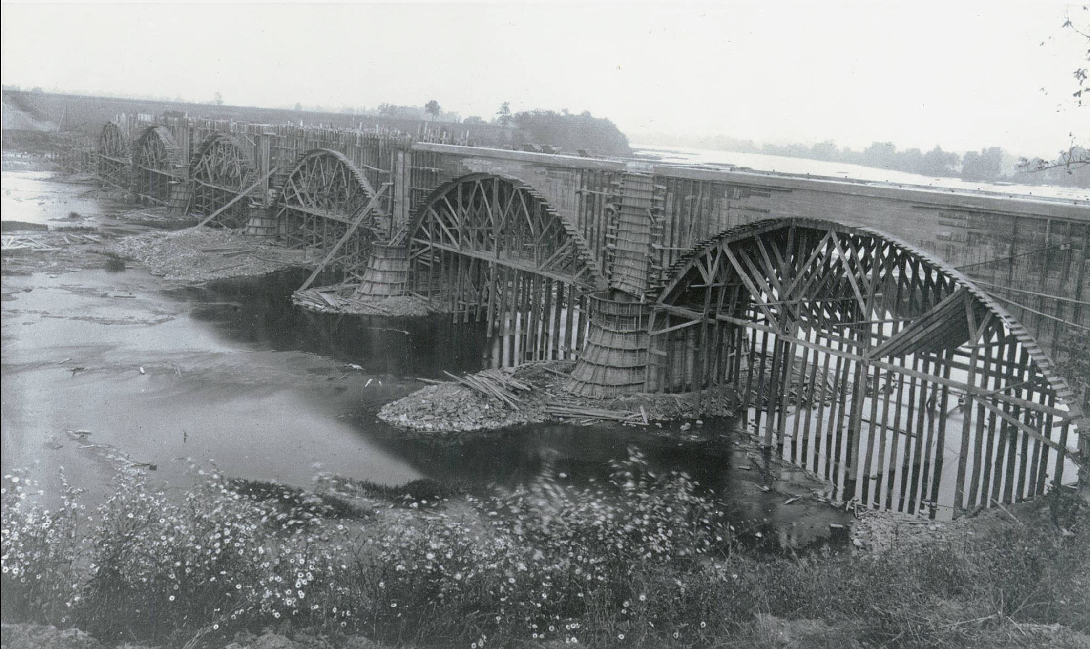
Above: Historical photo showing bridge construction.
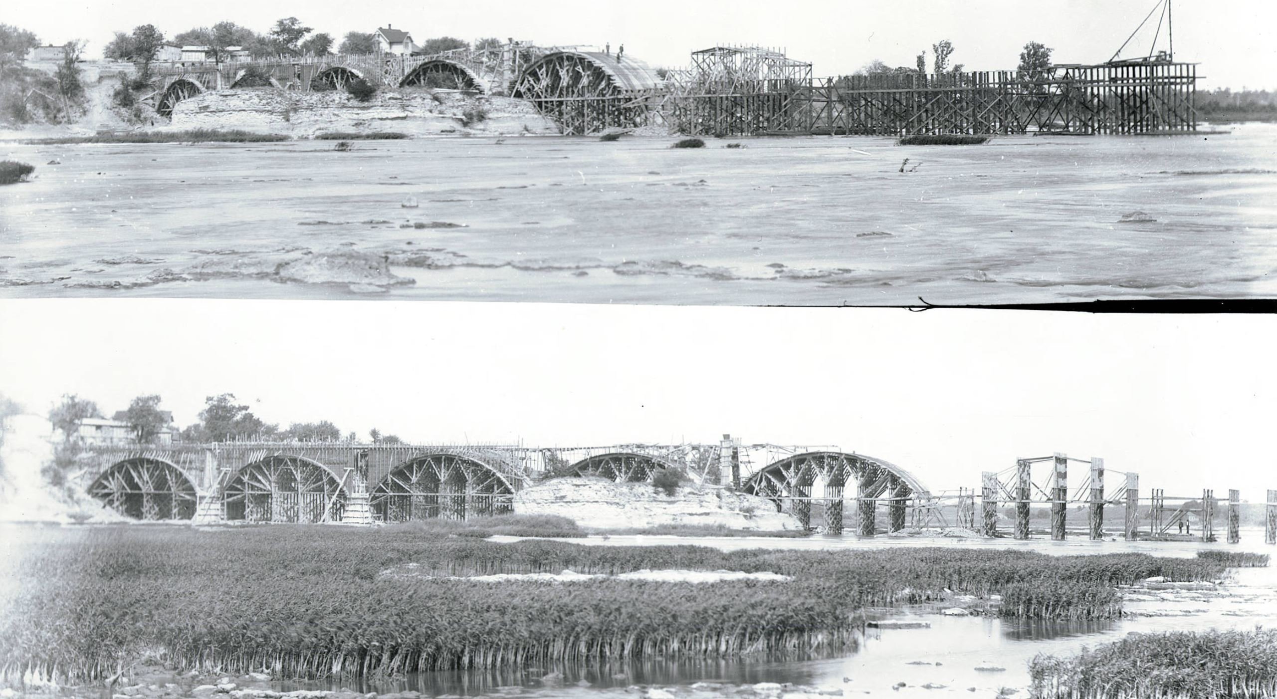
Above: Historical photo showing bridge construction.

Above: Historical photo showing bridge construction.
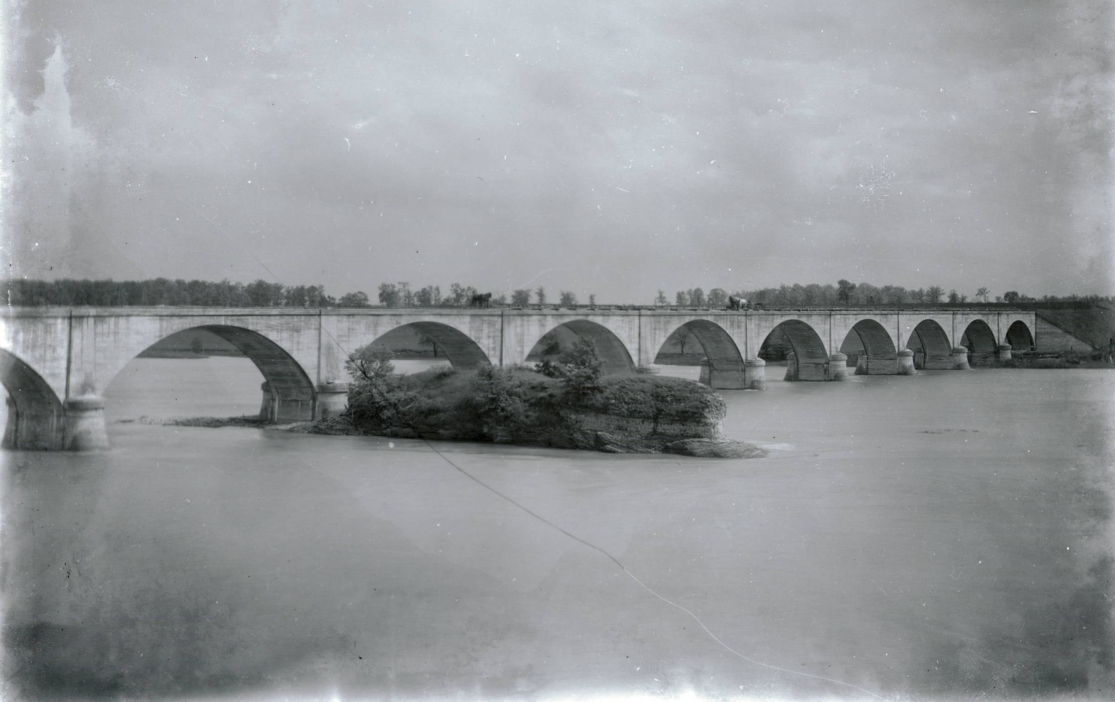
Above: Historical photo showing newly completed bridge.
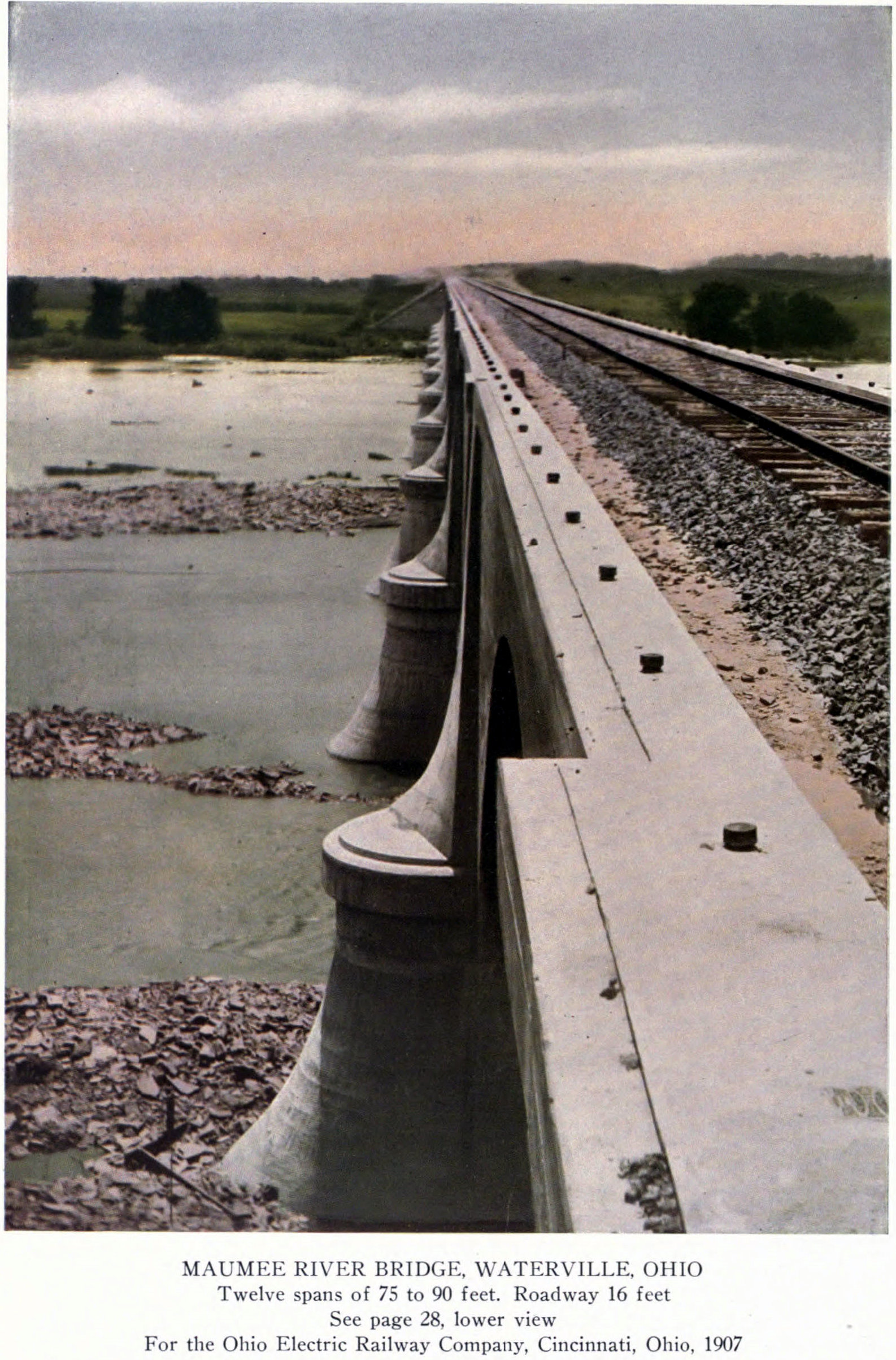
Above: Historical photo from Luten company publication showing newly completed bridge.

Above: Historical photo from Luten company publication showing newly completed bridge.

Above: Historical photo showing rock outcrop before bridge construction.
This bridge is tagged with the following special condition(s): Luten
![]()
![]()
![]()
Coordinates (Latitude, Longitude):
Search For Additional Bridge Listings:
Bridgehunter.com: View listed bridges within 0.5 miles (0.8 kilometers) of this bridge.
Bridgehunter.com: View listed bridges within 10 miles (16 kilometers) of this bridge.
Additional Maps:
Google Streetview (If Available)
GeoHack (Additional Links and Coordinates)
Apple Maps (Via DuckDuckGo Search)
Apple Maps (Apple devices only)
Android: Open Location In Your Map or GPS App
Flickr Gallery (Find Nearby Photos)
Wikimedia Commons (Find Nearby Photos)
Directions Via Sygic For Android
Directions Via Sygic For iOS and Android Dolphin Browser
USGS National Map (United States Only)
Historical USGS Topo Maps (United States Only)
Historic Aerials (United States Only)
CalTopo Maps (United States Only)

© Copyright 2003-2024, HistoricBridges.org. All Rights Reserved. Disclaimer: HistoricBridges.org is a volunteer group of private citizens. HistoricBridges.org is NOT a government agency, does not represent or work with any governmental agencies, nor is it in any way associated with any government agency or any non-profit organization. While we strive for accuracy in our factual content, HistoricBridges.org offers no guarantee of accuracy. Information is provided "as is" without warranty of any kind, either expressed or implied. Information could include technical inaccuracies or errors of omission. Opinions and commentary are the opinions of the respective HistoricBridges.org member who made them and do not necessarily represent the views of anyone else, including any outside photographers whose images may appear on the page in which the commentary appears. HistoricBridges.org does not bear any responsibility for any consequences resulting from the use of this or any other HistoricBridges.org information. Owners and users of bridges have the responsibility of correctly following all applicable laws, rules, and regulations, regardless of any HistoricBridges.org information.
![]()