

View Information About HSR Ratings
Please visit YouTube for a drone video showing this bridge after rehabilitation.

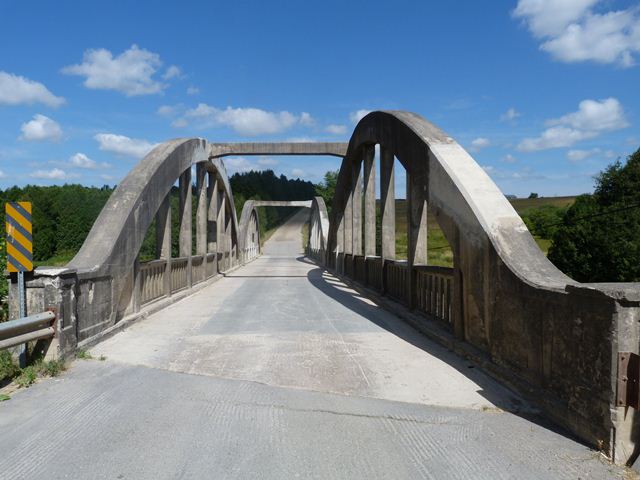
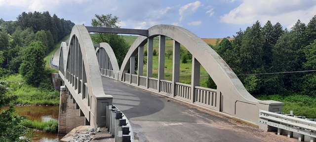
This bridge is an example of a concrete rainbow arch, also called a concrete bowstring bridge. It stands out as noteworthy for the length of its spans as well as its multi-span configuration. Perhaps the most striking feature of the bridge however is its heavy skew. Aside from the arches being offset from each other to accommodate this arch, the single overhead brace for each span does not follow the skew angle, so it does not meet at the same location on the arch at each end of the brace. The bridge is simple in appearance, with the arch's inherent graceful shape and appearance being the main form of aesthetic detail, although the railing does have some architectural embellishment. One interesting aspect of the bridge is it does not appear that the contractor put a large amount of effort into maintaining a perfect curve to the arch. Slight variances in the curve of the arch are discernable to the naked eye without too much difficulty. This is a contrast to some old concrete bridges where every curve and every detail was constructed to as close to perfection as possible.
This bridge is tagged with the following special condition(s): Unorganized Photos
![]()
![]()
![]()
![]()
![]()

![]()
![]()
Coordinates (Latitude, Longitude):
Search For Additional Bridge Listings:
Additional Maps:
Google Streetview (If Available)
GeoHack (Additional Links and Coordinates)
Apple Maps (Via DuckDuckGo Search)
Apple Maps (Apple devices only)
Android: Open Location In Your Map or GPS App
Flickr Gallery (Find Nearby Photos)
Wikimedia Commons (Find Nearby Photos)
Directions Via Sygic For Android
Directions Via Sygic For iOS and Android Dolphin Browser

© Copyright 2003-2024, HistoricBridges.org. All Rights Reserved. Disclaimer: HistoricBridges.org is a volunteer group of private citizens. HistoricBridges.org is NOT a government agency, does not represent or work with any governmental agencies, nor is it in any way associated with any government agency or any non-profit organization. While we strive for accuracy in our factual content, HistoricBridges.org offers no guarantee of accuracy. Information is provided "as is" without warranty of any kind, either expressed or implied. Information could include technical inaccuracies or errors of omission. Opinions and commentary are the opinions of the respective HistoricBridges.org member who made them and do not necessarily represent the views of anyone else, including any outside photographers whose images may appear on the page in which the commentary appears. HistoricBridges.org does not bear any responsibility for any consequences resulting from the use of this or any other HistoricBridges.org information. Owners and users of bridges have the responsibility of correctly following all applicable laws, rules, and regulations, regardless of any HistoricBridges.org information.
![]()