

View Information About HSR Ratings

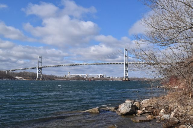
Originally known as the Cornwall-Massena International Bridge, this bridge is more recently known as the Seaway International Bridge. The border crossing this bridge provides was recently given the honorary name of Three Nations Crossing. The Seaway International Bridge is actually two distinct bridges that hop across an island in the St. Lawrence River. The bridges include the South Channel Bridge, and the North Channel Bridge. The two bridges are often referred to as a single bridge, but from an engineering standpoint they are clearly two bridges, and as such are represented by separate pages on HistoricBridges.org. The South Channel Bridge was also built a several years before the North Channel Bridge was completed.
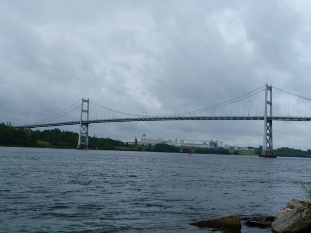
This bridge is a wire cable suspension bridge. The towers of the bridge have a heavy lattice design on the braces. The stiffening is a pony truss design, although a fair amount of the truss is actually below the deck like a deck truss. The stiffening truss follows a Warren truss configuration. The bridge has a traditional layout with three fully suspended spans. A cable bent is present where the orientation of the main cables change and are directed straight down into the anchorages. A series of deck plate girder spans provide an approach to the bridge.
This bridge is in a very unusual location. The bridge connects to a Canadian island south of the mainland. The island is Canadian soil, but is also part of an international Native American / First Nations reservation that extends south of the Canadian border into the United States. The residents of the island opposed the location of the Canadian customs in the traditional location on the island where the South Channel Bridge touches down on Canadian soil. Therefore, the customs were moved to north of the North Channel Bridge. This makes for an unusual situation. If someone is in the United States and goes to the island (Canadian soil) and then returns to the United States without crossing the North Channel Bridge, they will have visited Canada without going through Canadian customs! They will still have to go through American customs to get back in to the United States. This is a most unusual situation.
There is an interesting history of previous bridges at this location that is worth taking a look at.
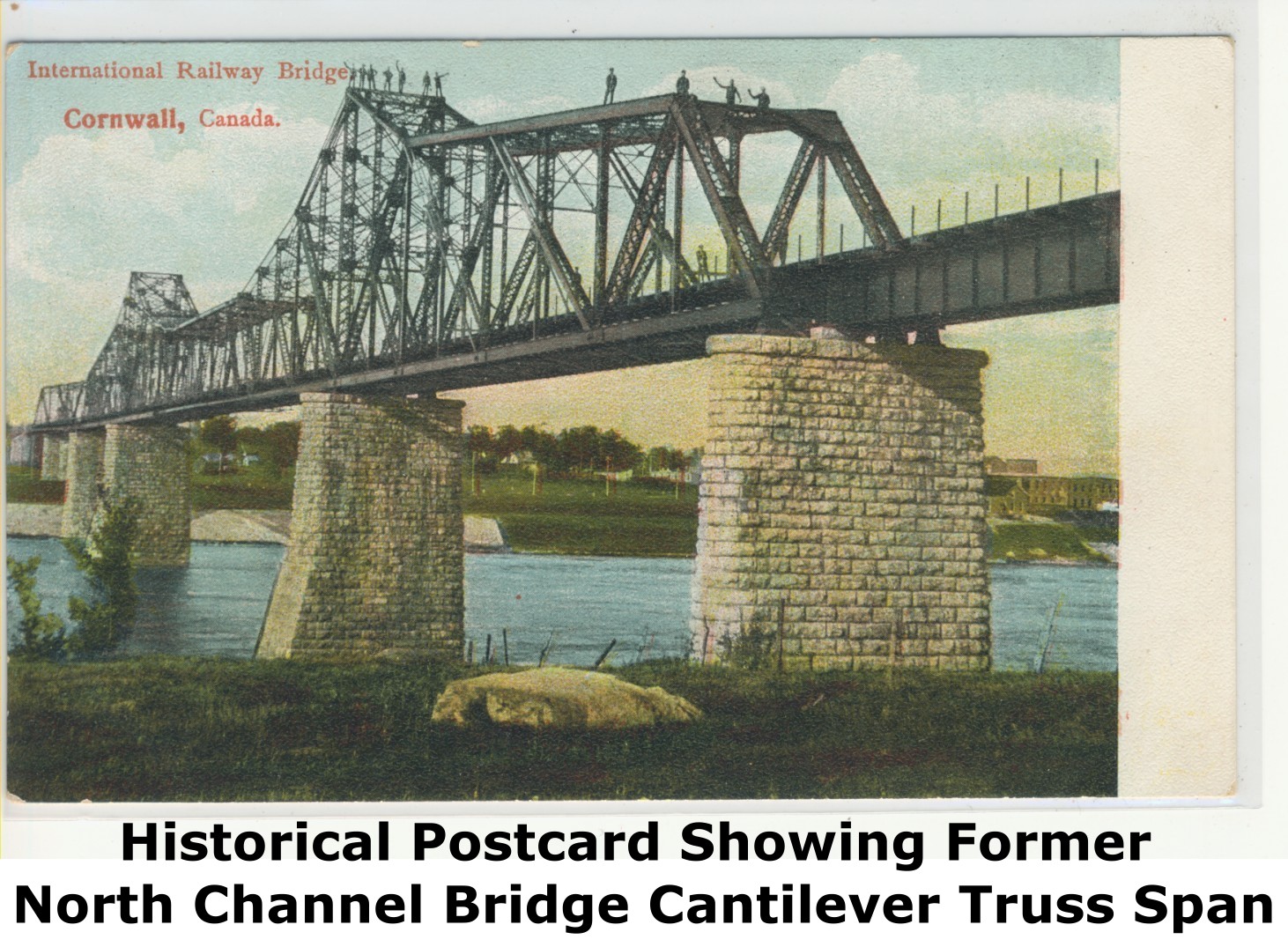
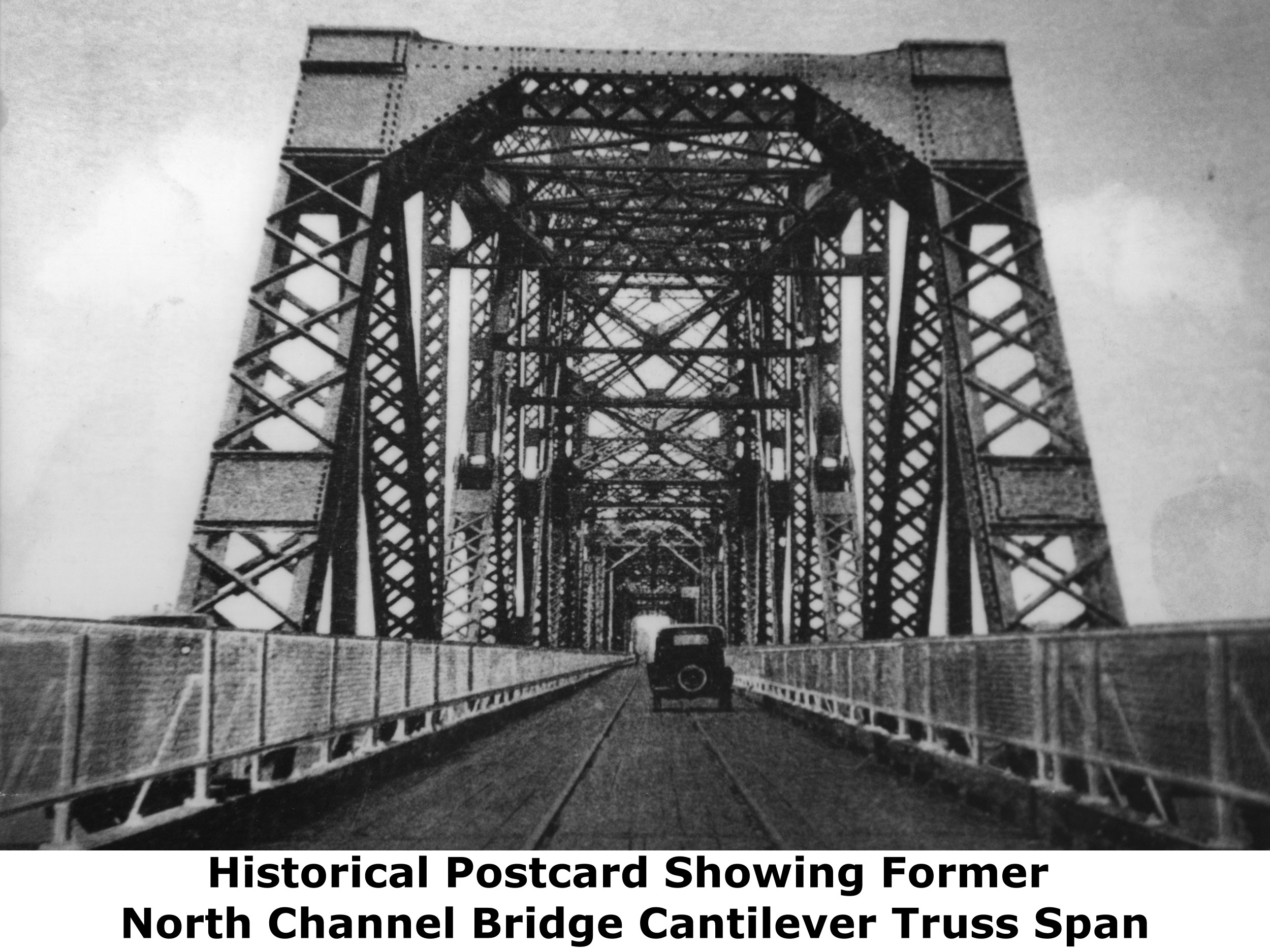

The previous North Channel Bridge was an impressive truss bridge that consisted of a large cantilever truss and also a pin-connected through truss swing span. The bridge was originally built as a railway bridge, but in 1933 it was converted to support vehicular traffic as well. The bridge was originally known as the Ottawa & New York Railway Bridge. The images above show this bridge.

In 1909, the swing span was destroyed when a problem with the locks caused a flood. The photo above shows the collapsed swing bridge. This was replaced following collapse.
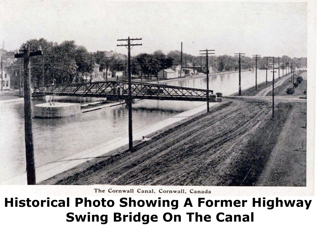
Separate of the main bridges, there was also a pony truss swing bridge that carried traffic over the canal only. This bridge is shown above.
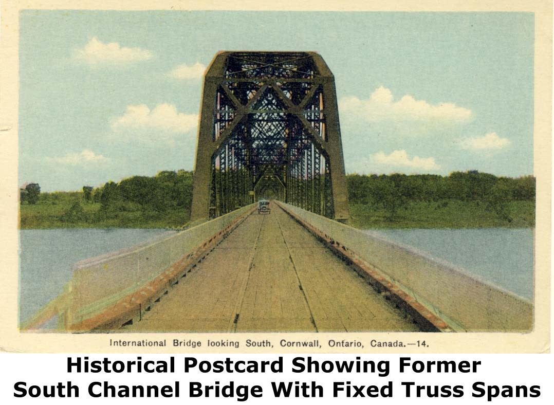

The former South Channel Bridge was opened to traffic in 1900. It was a three span pin-connected Parker truss bridge as shown in the images above. The stone piers of this bridge remain and can be seen east of the suspension bridge.
When both former bridges served vehicular traffic, they were called the Roosevelt International Bridges, a name given in 1934.
This bridge is tagged with the following special condition(s): Unorganized Photos
![]()
![]()
![]()
![]()
![]()
Coordinates (Latitude, Longitude):
Search For Additional Bridge Listings:
Additional Maps:
Google Streetview (If Available)
GeoHack (Additional Links and Coordinates)
Apple Maps (Via DuckDuckGo Search)
Apple Maps (Apple devices only)
Android: Open Location In Your Map or GPS App
Flickr Gallery (Find Nearby Photos)
Wikimedia Commons (Find Nearby Photos)
Directions Via Sygic For Android
Directions Via Sygic For iOS and Android Dolphin Browser

© Copyright 2003-2025, HistoricBridges.org. All Rights Reserved. Disclaimer: HistoricBridges.org is a volunteer group of private citizens. HistoricBridges.org is NOT a government agency, does not represent or work with any governmental agencies, nor is it in any way associated with any government agency or any non-profit organization. While we strive for accuracy in our factual content, HistoricBridges.org offers no guarantee of accuracy. Information is provided "as is" without warranty of any kind, either expressed or implied. Information could include technical inaccuracies or errors of omission. Opinions and commentary are the opinions of the respective HistoricBridges.org member who made them and do not necessarily represent the views of anyone else, including any outside photographers whose images may appear on the page in which the commentary appears. HistoricBridges.org does not bear any responsibility for any consequences resulting from the use of this or any other HistoricBridges.org information. Owners and users of bridges have the responsibility of correctly following all applicable laws, rules, and regulations, regardless of any HistoricBridges.org information.
![]()